Clyde in Wayne County, New York — The American Northeast (Mid-Atlantic)
Erie Canal
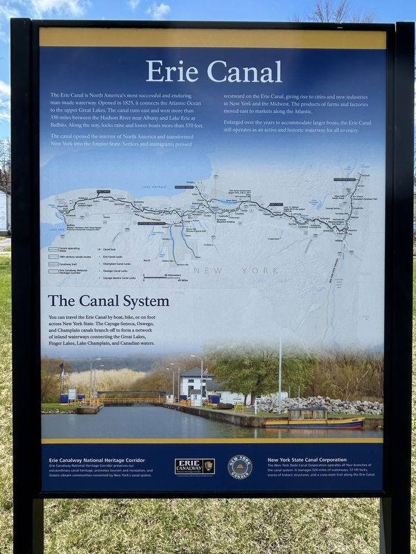
Photographed by Susan A. Dalaba, April 9, 2025
1. Erie Canal Marker
The canal opened the interior of North America and transformed New York into the Empire State. Settlers and immigrants pressed westward on the Erie Canal, giving rise to cities and new industries in New York and the Midwest. The products of farms and factories moved east to markets along the Atlantic.
Enlarged over the years to accommodate larger boats, the Erie Canal still operates as an active and historic waterway for all to enjoy.
Topics and series. This historical marker is listed in this topic list: Waterways & Vessels. In addition, it is included in the Erie Canal series list. A significant historical year for this entry is 1825.
Location. 43° 4.824′ N, 76° 52.236′ W. Marker is in Clyde, New York, in Wayne County. It is on Water Street, on the right when traveling west. Marker is located
this page online

Regionally, this marker is in Upstate New York, specifically in Western New York, in the Finger Lakes, and in the Rochester Metropolitan Area. It is also in the American Northeast and in the Mid-Atlantic. Globally, it is in North America, on the Great Lakes, in the Western Hemisphere, in the Western World, and in the Anglosphere. Historically, it finds itself in what was once the Haudenosaunee (Iroquois) Confederacy, New Netherland, and one of the original Thirteen Colonies.
Other nearby markers. At least 8 other markers are within walking distance of this marker: The Erie Canal in Clyde (here, next to this marker); Clyde Historical Highlights (within shouting distance of this marker); George Washington (within shouting distance of this marker); West Shore RR (within shouting distance of this marker); Town of Galen (about 500 feet away, measured in a direct line); Block House Road (about 600 feet away); Clyde River (about 700 feet away); Lincoln Inaugural Train Mural (about 700 feet away). Touch for a list and map of all markers in Clyde.
Credits. This page was last revised on April 19, 2025. It was originally submitted on April 10, 2025, by Susan A. Dalaba of Cortland, New York. This page has been viewed 155 times since then and 16 times this year. Photo 1. submitted on April 10, 2025, by Susan A. Dalaba of Cortland, New York. • Andrew Ruppenstein was the editor who published this page.
