Haute-Ville in Québec in Capitale-Nationale, — Central Canada (French-Canadian)
Une promenade pour le 350 ans de Québec
⎯⎯⎯
A walkway to commemorate Québec's 350 years
Photographed by Cosmos Mariner, August 3, 2019
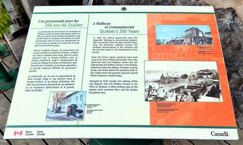
1. Une promenade pour le 350 ans de Québec / A walkway to commemorate Québec's 350 years Marker

Depuis le Régime français, les gouverneurs ont toujours habité à proximité de ce secteur : d'abord aux forts et châteaux Saint-Louis, dont les ruines subsistent sous la terrasse Dufferin; puis au château Haldimand, érigé à l'emplacement de l'actuel du Château Frontenac; et finalement, dans l'enceinte de la Citadelle, où se trouve aujourd'hui la seconde résidence officielle du gouverneur général.
La promenade, qui est sous la responsabilité de Parcs Canada, longe le cap Diamant entre la terrasse Dufferin et les plaines d'Abraham. Elle offre aux promeneurs des points de vue saisissants sur le majestueux Saint-Laurent et la grande région de Québec.
this page online
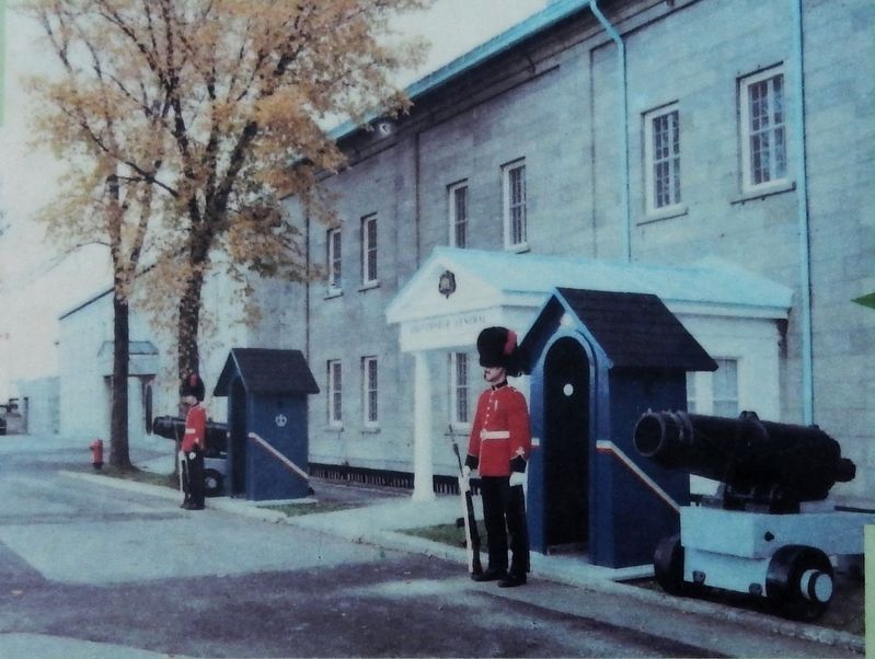
Since the French regime, governors have lived close to the site of today's promenade: first in the Saint-Louis forts and châteaux whose ruins still hide beneath the Dufferin Terrace; in the Château Haldimand where the Château Frontenac currently stands; and finally behind the protective walls of the Citadel where the governor general's second official residence is located today.
Managed by Parks Canada, the walkway climbs Cap Diamant from the Dufferin Terrace to the Plains of Abraham. It offers striking views of the majestic Saint Lawrence River and the Quebec City greater area.
Erected by Parcs Canada / Parks Canada.
Topics. This historical marker is listed in these topic lists: Architecture • Forts and Castles • Parks & Recreational Areas. A significant historical year for this entry is 1958.
Location. 46° 48.566′ N, 71° 12.248′ W. Marker is in Québec, in Capitale-Nationale. It is in Haute-Ville. It is on Governors’ Promenade close to Dufferin Terrace. The marker is located at the
Courtesy BSGG/OSGG
2. Marker detail: The Governor General's residence at the Citadel
La résidence du gouverneur général à la Citadelle.

Regionally, this marker is in Central Canada. Globally, it is in North America, the Western Hemisphere, and the Western World. Historically, it finds itself in what was once a British colony, the Viceroyalty of New France, the Haudenosaunee (Iroquois) Confederacy, and Rupert’s Land.
Other nearby markers. At least 8 other markers are within walking distance of this marker: Un site de choix pour fonder Québec / An Ideal Site to Found Québec (within shouting distance of this marker); Site du chantier naval Louis XV / Site of Louis XV Shipyard (about 120 meters away, measured in a direct line); Wolfe and Montcalm Monument (about 180 meters away); The Têtu House (about 210 meters away); Hommage à Gérard Paris et Jacques de Blois (about 210 meters away); Chief Warrant Officier Jean Couture, OMN, CD (about 210 meters away); Sir Frederick Haldimand (about 240 meters away); Stone Wind Mill (approx. 0.3 kilometers
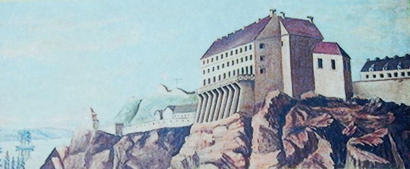
3. Marker detail: The Château Saint-Louis before the fire in 1834
Le château Saint-Louis peu avant l'incendie de 1834.
W. E. Seweil, Musée du Château Ramezay Museum
W. E. Seweil, Musée du Château Ramezay Museum
Also see . . . Promenade Des Gouverneurs / Governors' Promenade.
(By Stefan Mercier) Excerpt : Named after the Governor General of Canada from 1872 to 1878, Lord Dufferin. Dufferin played a key role in keeping Quebec City’s fortifications intact. He was a great admirer of the city’s architecture. He selected the “Citadelle” as the summer residence of the Governor General. It still is the official summer residence to this day.(Submitted on April 14, 2025, by Cosmos Mariner of Cape Canaveral, Florida.)
Library and Archives Canada
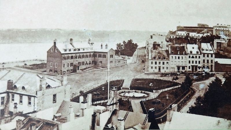
4. Marker detail: A breathtaking view over the Saint Lawrence, the Château Haldimand c.1885
Une vue imprenable sur le Saint-Laurent, le château Haldimand vers 1885.
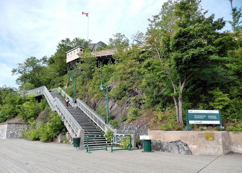
Photographed by Cosmos Mariner, August 3, 2019
5. Une promenade pour le 350 ans de Québec / A walkway to commemorate Québec's 350 years Marker
The marker is located at the at the base of the staircase.
Credits. This page was last revised on April 14, 2025. It was originally submitted on April 10, 2025, by Cosmos Mariner of Cape Canaveral, Florida. This page has been viewed 117 times since then and 22 times this year. Photos: 1, 2, 3, 4, 5. submitted on April 14, 2025, by Cosmos Mariner of Cape Canaveral, Florida.
