
Truckee in Nevada County, California — The American West (Pacific Coastal)
World War I Memorial
⎯⎯⎯
Victory Highway Monument Rededication
Photographed by Syd Whittle, October 21, 2009
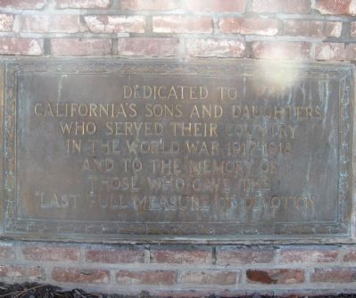
1. World War I Memorial Marker
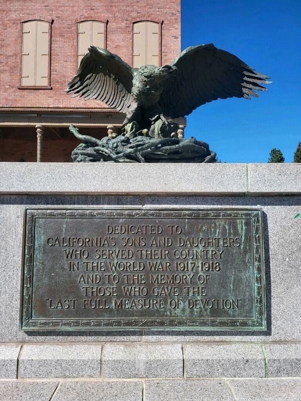
California’s sons and daughters
who served their country
in the World War 1917 -1918
and to the memory of
those who gave the
“last full measure of devotion”
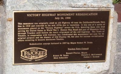
July 24, 1998
Truckee Town Council
Erected 1928 by California Department
this page online
Topics. This historical marker is listed in these topic lists: Roads & Vehicles • War, World I. A significant historical month for this entry is July 1939.
Location. 39° 19.651′ N, 120° 11.221′ W. Marker is in Truckee, California, in Nevada County. It is at the intersection of Donner Pass Road and Spring Street, on the right when traveling west on Donner Pass Road. Touch for map. Marker is at or near this postal address: 10154 Donner Pass Rd, Truckee CA 96161, United States of America. Touch for directions.

Regionally, this marker is in California’s Sierra Nevada. It is also in the American Mountain West. Globally, it is in North America, on the Ring of Fire, in the Pacific Rim, in the Western Hemisphere, in the Western World, and in the Anglosphere. Historically, it finds itself in what was once New Spain and also Mexico’s Alta California.
Other nearby markers. At least 8 other markers are within walking distance of this marker: Old Truckee Jail (within shouting distance of this marker); Truckee (about 300 feet away, measured in a direct line); Rocking Stone (about
Photographed by Syd Whittle, October 21, 2009
2. Victory Highway Monument Rededication Marker
Regarding World War I Memorial / Victory Highway Monument Rededication. The Victory Highway was a memorial to those who fought and died during World War One. It ran from Atlantic City to San Francisco.
Related marker. Click here for another marker that is related to this marker.
Also see . . . The “Victory Highway”. A Wikipedia article giving a short history of the “Victory Highway” (Submitted on October 22, 2009, by Syd Whittle of Mesa, Arizona.)
Additional commentary.
1. New Location
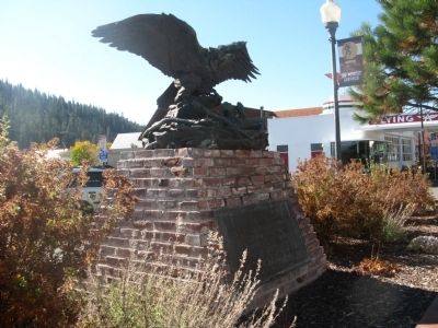
After a few years in storage and then at display in Town Hall, the Victory Highway Eagle Monument was unveiled at a new location in downtown Truckee in February 2015. As part of the Brickelltown Streetscape project, the monument is now located in a pedestrian plaza at the northwest
Photographed by Jeff Horan of Gustine California, October 19, 2022
3. World War I Memorial / Victory Highway Monument
— Submitted March 14, 2015, by Duane Hall of Abilene, Texas.
Additional keywords. Victory Highway
Photographed by Syd Whittle, October 21, 2009
4. World War I Memorial
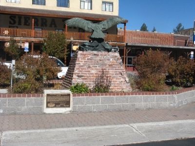
Photographed by Syd Whittle, October 21, 2009
5. Rear Side of Monument Displaying Victory Highway Rededication Marker
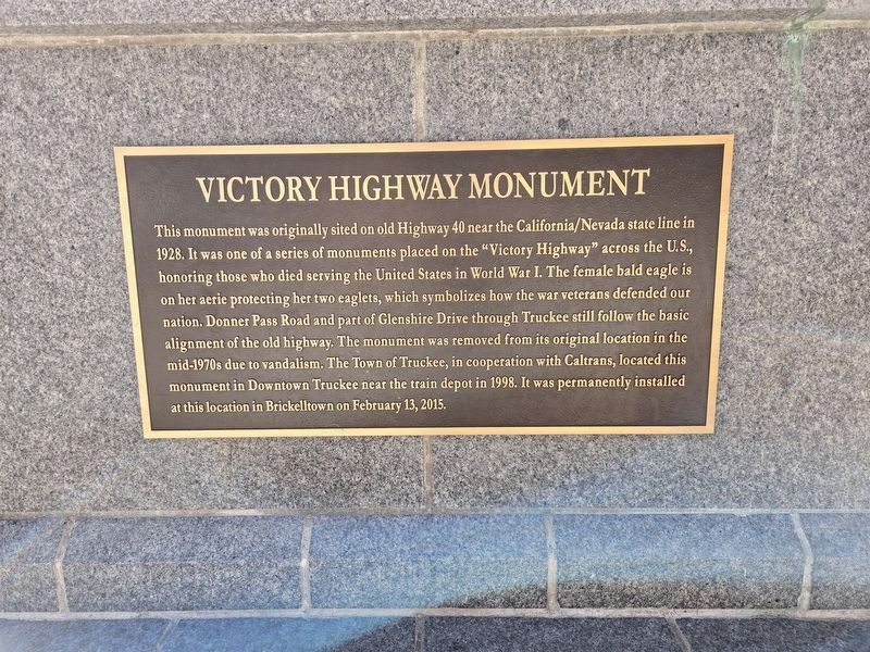
Photographed by E Gardner, April 11, 2025
6. World War I Memorial / Victory Highway Monument Rededication Marker
New rededication plaque
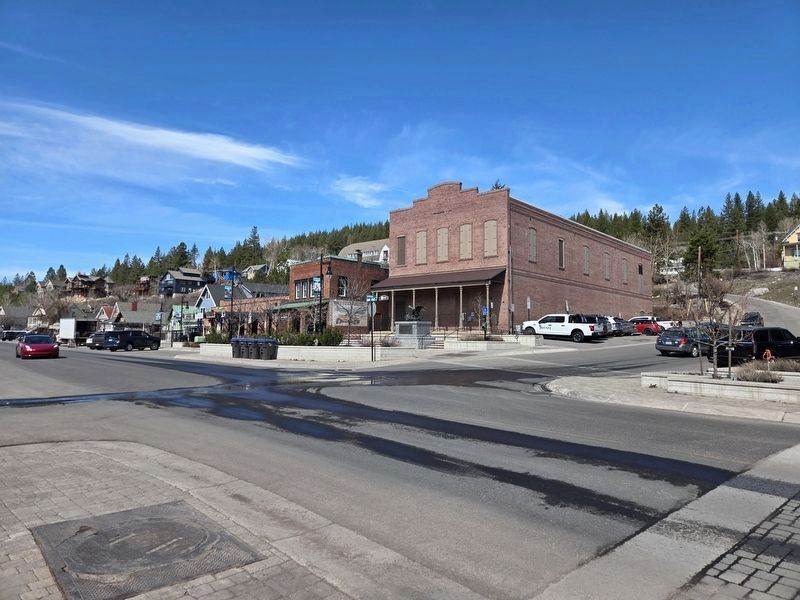
Photographed by E Gardner, April 11, 2025
7. World War I Memorial / Victory Highway Monument Rededication Marker
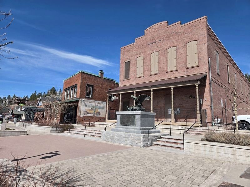
Photographed by E Gardner, April 11, 2025
8. Memorial in new location
Credits. This page was last revised on April 24, 2025. It was originally submitted on October 22, 2009, by Syd Whittle of Mesa, Arizona. This page has been viewed 2,561 times since then and 109 times this year. Last updated on April 11, 2025, by E Gardner of Reno, Nevada. Photos: 1, 2. submitted on October 22, 2009, by Syd Whittle of Mesa, Arizona. 3. submitted on October 23, 2022, by Joseph Alvarado of Livermore, California. 4, 5. submitted on October 22, 2009, by Syd Whittle of Mesa, Arizona. 6, 7, 8. submitted on April 11, 2025, by E Gardner of Reno, Nevada. • Devry Becker Jones was the editor who published this page.
Editor’s want-list for this marker. Photographs of the monument and surrounding area at its new location. • Can you help?
