
Bismarck in Burleigh County, North Dakota — The American Midwest (Upper Plains)
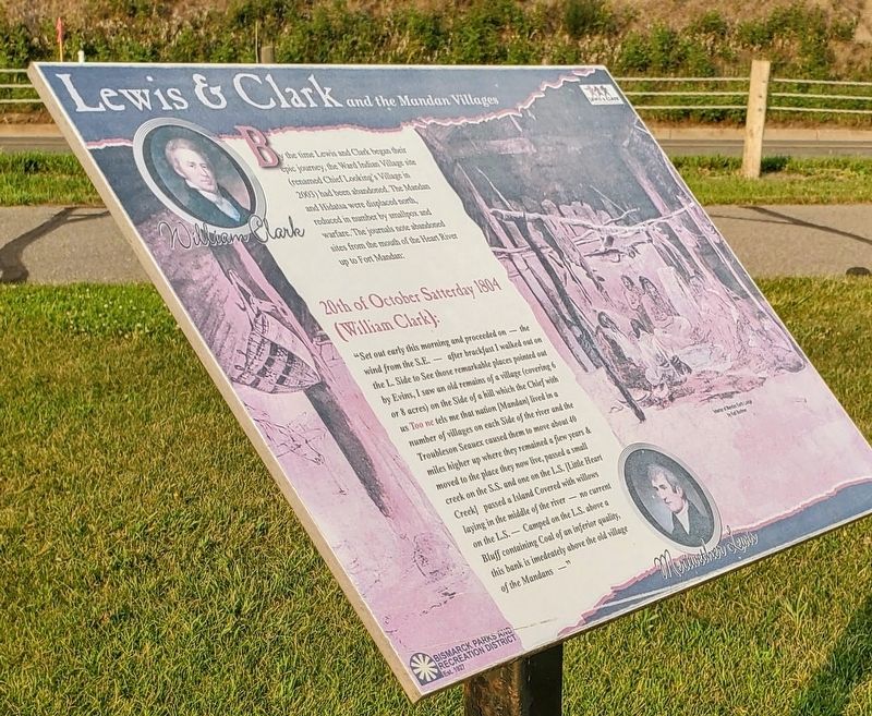
Lewis & Clark and the Mandan Villages
Photographed by Ian Lefkowitz, July 25, 2021
1. Lewis & Clark and the Mandan Villages Marker
20th of October Satterday 1804 (William Clark):
“Set out early this morning and proceeded on — the wind from the S.E. — after brackfast I walked out on the L. Side to See those remarkable places pointed out by Evins, I saw an old remains of a village (covering 6 or 8 acres) on the Side of a hill which the Chief with us Too ne tels me that nation [Mandan] lived in a number of villages on each Side of the river and the Troubleson Seauex caused them to move about 40 miles higher up where they remained a fiew years & moved to the place they now live, passed a small creek on the S.S. and one on the L.S. [Little Heart Creek] passed a Island Covered with willows laying in the middle of the river — no current on the L.S. — Camped on the L.S. above a Bluff containing Coal of an inferior quality, this bank is imedeately
this page online
Erected by Bismarck Parks and Recreation District.
Topics and series. This historical marker is listed in these topic lists: Exploration • Indigenous Peoples and Communities. In addition, it is included in the Lewis & Clark Expedition series list. A significant historical date for this entry is October 20, 1804.
Location. 46° 49.357′ N, 100° 49.663′ W. Marker is in Bismarck, North Dakota, in Burleigh County. It is on River Road. Touch for map. Marker is at or near this postal address: 2190 River Road, Bismarck ND 58504, United States of America. Touch for directions.

Regionally, this marker is on North Dakota’s Missouri Plateau. It is also in the American Lewis & Clark Corridor, on the prairies, and on the Northern Plains. Globally, it is in North America, the Western Hemisphere, the Western World, and the Anglosphere. Historically, it finds itself in what was once Rupert’s Land and also the Louisiana Purchase.
Other nearby markers. At least 8 other markers are within 3 miles of this marker, measured as the crow flies: Lewis & Clark near Bismarck-Mandan (within shouting distance
Photographed by Ian Lefkowitz, July 25, 2021
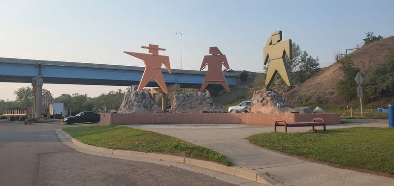
2. Lewis & Clark and the Mandan Villages Marker
This marker is located in Keelboat Park. The park's entrance has sculptural silhouettes of Lewis, Clark, and Sacagawea.
Photographed by Ian Lefkowitz, July 25, 2021
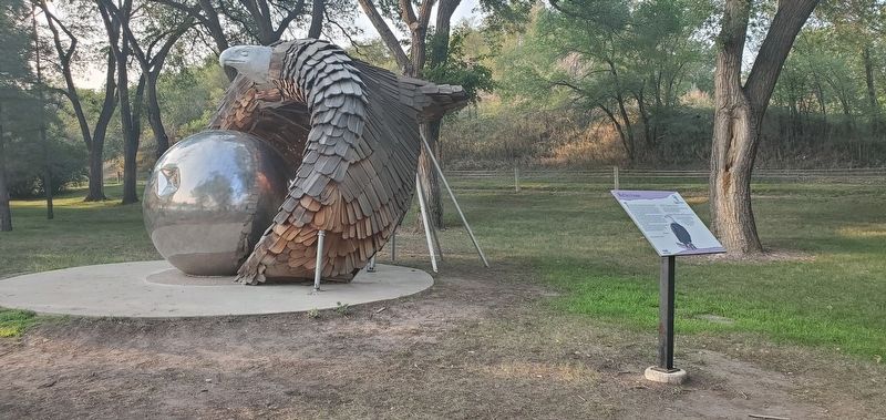
3. Reflections
Several works of art that symbolize the native cultures displaced by the results of the Expedition are on display in Keelboat Park, including Reflections, a work by artists from the United Tribes Technical College.
Credits. This page was last revised on April 12, 2025. It was originally submitted on April 12, 2025, by Ian Lefkowitz of New York, New York. This page has been viewed 236 times since then and 56 times this year. Photos: 1, 2, 3. submitted on April 12, 2025, by Ian Lefkowitz of New York, New York. • Andrew Ruppenstein was the editor who published this page.
