Moncks Corner in Berkeley County, South Carolina — The American South (South Atlantic)
Spring Grove Plantation
Photographed by J. J. Prats, March 25, 2025
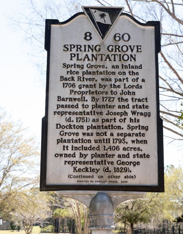
1. Spring Grove Plantation Marker, Side One
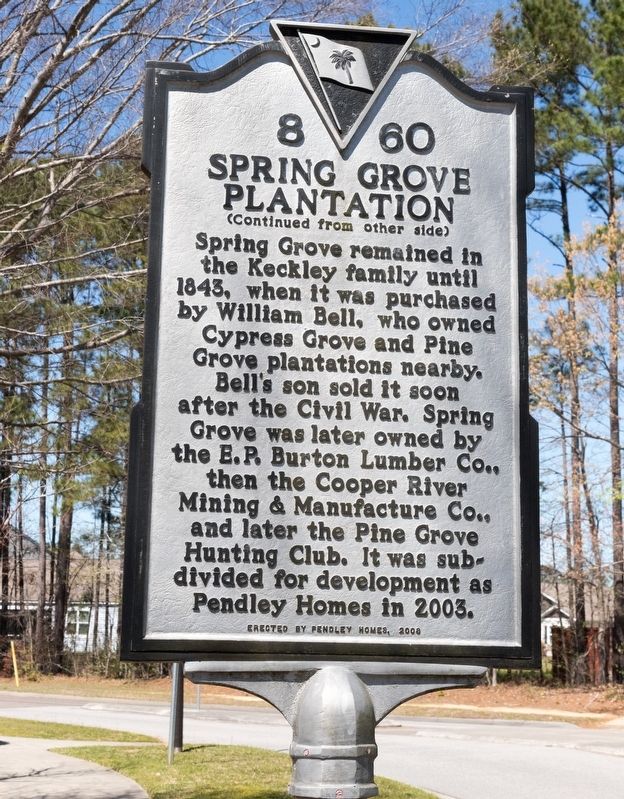
Spring Grove remained in the Keckley family until 1843, when it was purchased by William Bell, who owned Cypress Grove and Pine Grove plantations nearby. Bell’s son sold it soon after the Civil War. Spring Grove was later owned by the E.P. Burton Lumber Co., then the Cooper River Mining & Manufacture Co., and later the Pine Grove Hunting Club. It was subdivided for development as Pendley Homes in 2003.
Erected 2008 by Pendley Homes. (Marker Number 8-60.)
Topics. This historical marker is listed in these topic lists: Agriculture • Notable Places • Settlements & Settlers. A significant historical year for this entry is 1706.
Location. 33° 4.693′ N, 80° 0.64′ W. Marker is in Moncks Corner,
this page online

Regionally, this marker is in the Lowcountry and in Santee Cooper Country. It is also in the American South, specifically in the Deep South, and on the Eastern Seaboard. Globally, it is in the North Atlantic Region, North America, the Western Hemisphere, the Western World, and the Anglosphere. Historically, it finds itself in what was once the territory of the Mississippian Culture, one of the original Thirteen Colonies, one of the Confederate States of America, and the Antebellum South.
Other nearby markers. At least 8 other markers are within 5 miles of this marker, measured as the crow flies: St. James, Goose Creek Chapel of Ease / Bethlehem Baptist Church (approx. one mile away); Thorogood Plantation / Mount Holly Plantation
Photographed by J. J. Prats, March 25, 2025
2. Spring Grove Plantation Marker, Side Two

Photographed by J. J. Prats, March 25, 2025
3. Spring Grove Plantation Marker
Credits. This page was last revised on July 20, 2025. It was originally submitted on April 12, 2025, by J. J. Prats of Powell, Ohio. This page has been viewed 573 times since then and 167 times this year. Photos: 1, 2, 3. submitted on April 12, 2025, by J. J. Prats of Powell, Ohio.
