Urbanna in Middlesex County, Virginia — The American South (Mid-Atlantic)
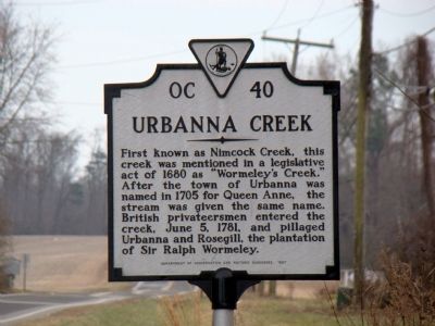
Urbanna Creek
Erected 1987 by Department of Conservation and Historic Resources. (Marker Number OC-40.)
Topics and series. This historical marker is listed in these topic lists: War, US Revolutionary • Waterways & Vessels. In addition, it is included in the Virginia Department of Historic Resources (DHR) series list. A significant historical date for this entry is June 5, 1894.
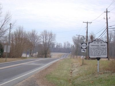
Location. 37° 37.746′ N, 76° 34.283′ W. Marker is in Urbanna, Virginia, in Middlesex County. Marker is on Urbanna Road (Virginia Route 227), on the left when traveling north. Marker is just before the bridge, at the entrance to the town. There is a pull-off on the left hand side of the road at the marker. Touch for map. Marker is in this post office area: Saluda VA 23149, United States of America. Touch for directions.
Other nearby markers. At least 8 other markers are within walking distance of this marker. Opiscopank (within shouting distance of this marker); Rosegill (approx. 0.2 miles away); Bridge Over the Creek (approx. 0.3 miles away); Steamboat Era (approx. 0.3 miles away); Overlook (approx. 0.3 miles away); Watling Street and Urbanna's Master Builder (approx. 0.4 miles away); Cross Street (approx. half a mile away); The Backyard Garden Was Essential (approx. half a mile away). Touch for a list and map of all markers in Urbanna.
More about this marker. This marker replaced an earlier marker dating to the 1930s with the same name and number that read, “This creek, mentioned in an act of 1680 as ‘Wormeley’s Creek,’ was earlier known as ‘Nimcock Creek.’ After Urbanna was named in 1705 for Queen Anne, the stream took the same name. British privateersmen entered the creek, June 5, 1781, and pillaged Urbanna and Rosegill.”
Credits. This page was last revised on June 16, 2016. It was originally submitted on January 30, 2010, by J. J. Prats of Powell, Ohio. This page has been viewed 1,096 times since then and 19 times this year. Photos: 1, 2, 3, 4. submitted on January 30, 2010, by J. J. Prats of Powell, Ohio.


