
Belle and Mayo Islands in Richmond, Virginia — The American South (Mid-Atlantic)
Old Dominion Iron & Steel Company
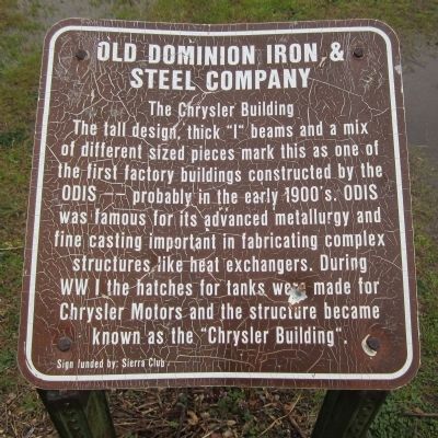
The Chrysler Building
Photographed by Bernard Fisher, March 31, 2013
1. Old Dominion Iron & Steel Company Marker
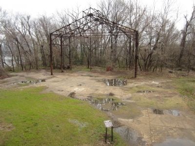
The tall design, thick "I" beams and a mix of different sized pieces mark this as one of the first factory buildings constructed by the ODIS -- probably in the early 1900's. OIDS was famous for is advanced metallurgy and fine casting important in fabricating complex structures like heat exchangers. During WW I the hatches for tanks were made for Chrysler Motors and the structure became known as the "Chrysler Building".
Sign funded by: Sierra Club
Erected by James River Park System.
Topics. This historical marker is listed in these topic lists: Industry & Commerce • War, World I.
Location. This marker has been replaced by another marker nearby. It was located near 37° 31.878′ N, 77° 26.983′ W. Marker was in Richmond, Virginia. It was in Belle and Mayo Islands. It could be reached from Tredegar Street 0.3 miles west of South 5th Street. Located on Belle Isle which can be reached via a pedestrian bridge from the north bank of the river. Touch for map. Marker was at or near this postal address: 470 Tredegar Street, Richmond VA 23219, United States of America.
this page online

Regionally, this marker was in Central Virginia. It was also in the American South and specifically in the Upper South. Globally, it was in North America, the Western Hemisphere, the Western World, and the Anglosphere. Historically, it found itself in what was once the territory of the Mississippian Culture, one of the original Thirteen Colonies, one of the Confederate States of America, and the Antebellum South.
Other nearby markers. At least 8 other markers are within walking distance of this location: Old Dominion Iron and Steel (here, next to this marker); Welcome to Belle Isle (within shouting distance of this marker); Belle Isle Prison Camp Monument (about 300 feet away); James River Fall Line (about 400 feet away); The Civil War at Belle Isle (about 500 feet away); Ironworks Oil House (approx. 0.2 miles away); Robert E. Lee Bridge (approx. 0.2 miles away); Water Power (approx. 0.2 miles away). Touch for a list and map of all markers in Richmond.
Other markers no longer nearby. Historic Belle Isle (was within shouting distance of this marker but has been replaced with another marker
Photographed by Bernard Fisher, March 31, 2013
2. Old Dominion Iron & Steel Company Marker
Photographed by Bernard Fisher, March 31, 2013
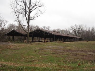
3. Old Dominion Iron & Steel Company Buildings
Credits. This page was last revised on April 14, 2025. It was originally submitted on April 1, 2013, by Bernard Fisher of Richmond, Virginia. This page has been viewed 2,237 times since then and 68 times this year. Last updated on April 13, 2025, by Evan Dwyer of Richmond, Virginia. Photos: 1, 2, 3. submitted on April 1, 2013, by Bernard Fisher of Richmond, Virginia. • Devry Becker Jones was the editor who published this page.
