Belle and Mayo Islands in Richmond, Virginia — The American South (Mid-Atlantic)
Headgate
Photographed by Bernard Fisher, March 31, 2013
1. Headgate Marker
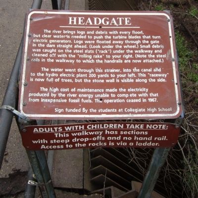
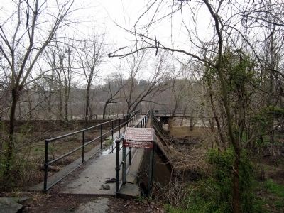
The river brings logs and debris with every flood, but clear water is needed to push the turbine blades that turn electric generators. Logs were floated away through the gate in the dam straight ahead. (Look under the wheel.) Small debris was caught on the steel slats ("rack") under the walkway and cleaned off with the "rolling rake" to your right. (Note the steel rails in the walkway to which the handrails are now attached.)
The water went through this strainer, into the canal and to the hydro electric plant 200 yards to your left. This "raceway" is now full of trees, but the stone wall is visible along the side.
The high cost of maintenance made the electricity produced by the river energy unable to compete with that from inexpensive fossil fuels. The operation ceased in 19767.
Sign funded by the students at Collegiate High School
Erected by James River Park System.
Topics. This historical marker is listed in this topic list: Industry & Commerce.
Location. This marker has been replaced by another marker nearby. It was located near 37° 31.628′ N, 77° 27.374′ W.
this page online

Regionally, this marker was in Central Virginia. It was also in the American South and specifically in the Upper South. Globally, it was in North America, the Western Hemisphere, the Western World, and the Anglosphere. Historically, it found itself in what was once the territory of the Mississippian Culture, one of the original Thirteen Colonies, one of the Confederate States of America, and the Antebellum South.
Other nearby markers. At least 6 other markers are within walking distance of this location: Headgate Cleaner and Hydro Plant (here, next to this marker); First Break Rapid (about 400 feet away, measured in a direct line); Belle Isle Hydro Plant (about 600 feet away); Quarrying Broad Rock Island (about 700 feet away); Hollywood Rapids (approx.
Photographed by Bernard Fisher, March 31, 2013
2. Headgate
Other markers no longer nearby. Headgate Cleaner (was a few steps from this marker but has been replaced with another marker now near it); Gun Emplacement (was within shouting distance of this marker but has been permanently removed); First Break Rapids (was about 400 feet away but has been replaced with another marker now near it); Quarry Pond (was about 600 feet away but has been replaced with another marker now near it); Quarry Equipment (was approx. 0.2 miles away but has been replaced with another marker now near it); a different marker also named Hollywood Rapids (was approx. ¼ mile away but has been replaced with another marker now near it); Belle Isle Rolling Milling and Slitting Manufactory (was approx. ¼ mile away but has been replaced with another marker now near it); Native American Fishing (was approx. 0.3 miles away but has been confirmed missing); Cannon over the Camp (was approx. 0.3 miles away but has been replaced with another marker now near it); Canons & Corpses (was approx. 0.3 miles away but has been permanently removed).
Related marker. Click here for another marker that is related to this marker. New Marker At This Location titled "Headgate Cleaner and Hydro Plant".
Credits. This page was last revised on April 27, 2025. It was originally submitted on April 1, 2013, by Bernard Fisher of Richmond, Virginia. This page has been viewed 674 times since then and 24 times this year. Last updated on April 13, 2025, by Evan Dwyer of Richmond, Virginia. Photos: 1, 2. submitted on April 1, 2013, by Bernard Fisher of Richmond, Virginia. • Devry Becker Jones was the editor who published this page.
