South of Broad in Charleston in Charleston County, South Carolina — The American South (South Atlantic)
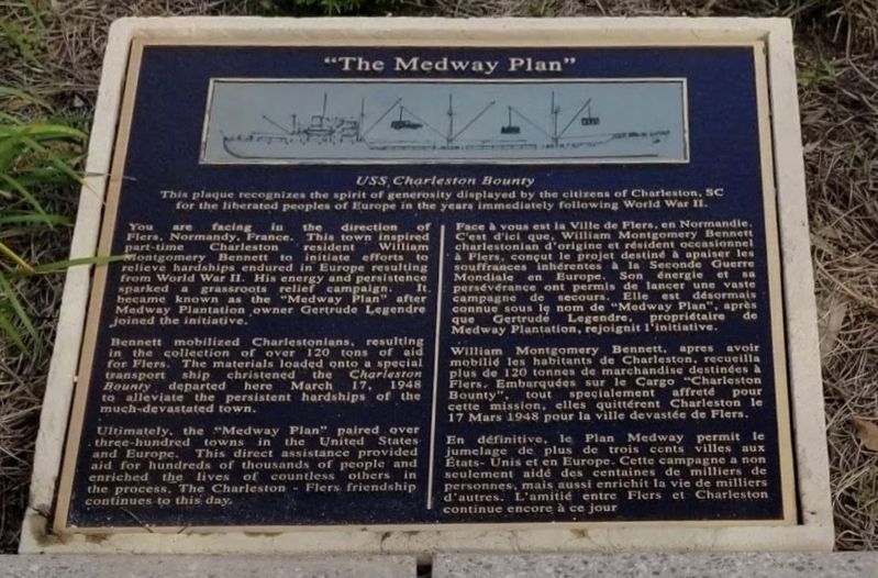
"The Medway Plan"
USS Charleston Bounty
Photographed by Ian Lefkowitz, October 27, 2018
1. "The Medway Plan" Marker

English text:
You are facing in the direction of Flers, Normandy, France. This town inspired part-time Charleston resident William Montgomery Bennett to initiate efforts to relieve hardships endured in Europe resulting from World War II. His energy and persistence sparked a grassroots relief campaign. It became known as the "Medway Plan" after Medway Plantation owner Gertrude Legendre joined the initiative.
Bennett mobilized Charlestonians, resulting in the collection of over 120 tons of materials for Flers. The materials loaded onto a special transport ship christened the Charleston Bounty departed here March 17, 1948 to alleviate the persistent hardships of the much-devastated town.
Ultimately, the "Medway Plan" paired over three-hundred towns in the United States with towns in Europe. This direct assistance provided aid for hundreds of thousands of people and enriched the lives of countless others in the process. The Charleston-Flers
this page online
French text:
William Montgomery Bennett, après avoir mobilisé les habitants de Charleston, recueilla plus de 120 tonnes de marchandise destinées à Flers. Embarquées sur le Cargo "Charleston Bounty", tout spécialement affrété pour cette mission, elles quittèrent Charleston le 17 Mars 1948 pour la ville dévastée de Flers.
En définitive, le Plan Medway permit le jumelage de plus de trois cents villes aux États-Unis et en Europe. Cette campagne a non seulement aidé des centaines de milliers de personnes, mais aussi enrichi la vie de milliers d'autres. L'amitié entre Flers et Charleston continue encore à ce jour.
Erected 2017
Photographed by Ian Lefkowitz, October 27, 2018
2. Waterfront Park
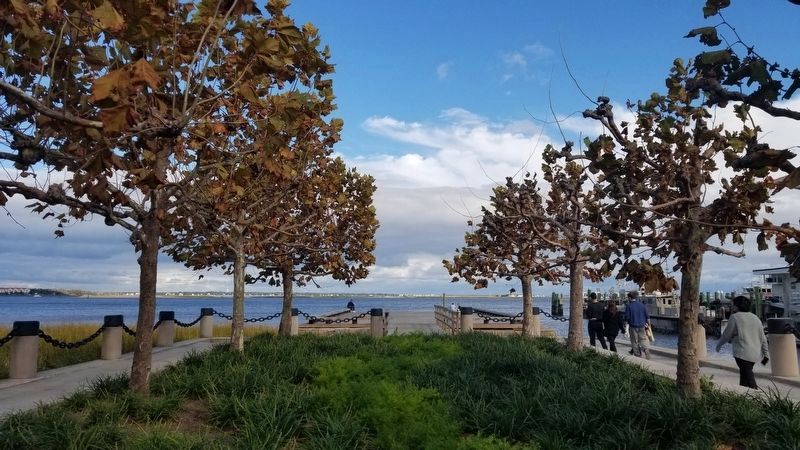
The historical marker is located at the base of this dock, from where the photo is taken.
Topics. This historical marker is listed in these topic lists: Charity & Public Work • War, World II • Waterways & Vessels. A significant historical date for this entry is March 17, 1948.
Location. 32° 46.54′ N, 79° 55.515′ W. Marker is in Charleston, South Carolina, in Charleston County. It is in South of Broad. It can be reached from Concord Street, on the right when traveling north. Touch for map. Marker is at or near this postal address: 6 Concord Street, Charleston SC 29401, United States of America. Touch for directions.

Regionally, this marker is in Historic Charleston and in the Lowcountry. It is also in the American South, specifically in the Deep South, and on the Eastern Seaboard. Globally, it is in the North Atlantic Region, North America, the Western Hemisphere, the Western World, and the Anglosphere. Historically, it finds itself in what was once the territory of the Mississippian Culture, one of the original Thirteen Colonies, one of the Confederate States of America, and the Antebellum South.
Other nearby markers. At least 8 other markers are within walking distance of this marker: Sir Nathaniel Johnson (within shouting distance of this marker); One North Adger's Wharf (about 300 feet away, measured in a direct line); As Old as Charleston (about 500 feet away); The Tavern (about 500 feet away); 90 East Bay Street Ancrum Wharf Building (about 600 feet away); 83-107 East Bay Street Rainbow Row (about 600 feet away); In Search of the Walled City (about 600 feet away); Inglis Arch House (about 600 feet away). Touch for a list and map of all markers in Charleston.
Also see . . . City of Charleston to Unveil Plaque Recognizing, “The Medway Plan”. In 1948, Charleston resident William Montgomery Bennett organized a grassroots movement and collected over 120 tons of materials to be shipped to Flers, located in the Normandy region, to help reinvigorate the town which had been devastated by the war. (Submitted on April 14, 2025, by Ian Lefkowitz of New York, New York.)
Credits. This page was last revised on April 18, 2025. It was originally submitted on April 14, 2025, by Ian Lefkowitz of New York, New York. This page has been viewed 290 times since then and 76 times this year. Photos: 1, 2. submitted on April 14, 2025, by Ian Lefkowitz of New York, New York. • Andrew Ruppenstein was the editor who published this page.
