Death Valley National Park in Inyo County, California — The American West (Pacific Coastal)
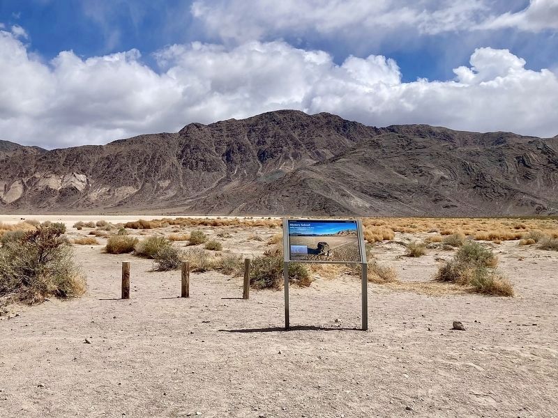
Mystery Solved!
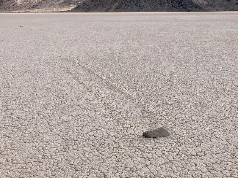
Sliding rocks leave tracks on the playa

Photographed by Craig Baker, April 2, 2025
1. Mystery Solved! Marker
For years, these moving rocks were a mystery. The tracks prove to everyone that rocks slide, and all believed that high desert winds must surely play a role. Many theories were proposed, but no one had ever seen a boulder slide across dirt or mud. Then in 2013 and 2014, a group of scientists led by cousins James and Richard Norris used scientific instruments to monitor the rocks and discovered the truth.
With enough rain, this end of the playa becomes a shallow lake. In winter, cold night temperatures freeze the surface of the lake into a sheet of floating ice, embedding the rocks. The morning sun causes the ice sheets to break up. Steady breezes catch the floating ice sheets, pushing them along with their embedded rocks. This explains why so many of the rocks leave parallel tracks. Eventually the ice melts and the water evaporates, leaving the rocks in new locations, and the next event, perhaps years later moves them again.
Many of the rocks leave parallel tracks, shopping and turning in unison.
Please do not alter or move the rocks so we can continue to watch their slow race across
this page online
Erected by Death Valley National Park.
Topics. This historical marker is listed in these topic lists: Natural Features • Notable Places. A significant historical year for this entry is 2013.
Location. 36° 39.941′ N, 117° 34.09′ W. Marker is in Death Valley National Park, California, in Inyo County. It is on Racetrack Valley Road 28 miles south of Ubehebe Crater, on the left when traveling south. Located at the Racetrack Moving Rocks trailhead. Touch for map. Marker is in this post office area: Death Valley CA 92328, United States of America. Touch for directions.

Regionally, this marker is in the Sierra Nevada. It is also in the American Mountain West. Globally, it is in North America, on the Ring of Fire, on the Pacific Rim, in the Western Hemisphere, in the Western World, and in the Anglosphere. Historically, it finds itself in what was once New Spain and also Mexico’s Alta California.
Other nearby markers. At least one other marker is within 2 miles of this marker, measured as the crow flies: The Racetrack (approx. 2 miles away).
Another marker is no longer nearby. The Racetrack (was approx.
Photographed by Craig Baker, April 2, 2025
2. Mystery Solved! Marker
The rocks come from the hillside in the distance.
More about this marker. The 28-mile-long dirt road might be impassible after rain or snow. High ground clearance vehicle recommended. Avoid traveling in remote areas during severe weather.
To see the moving rocks, walk ½-mile across the dry lake bed.
Also see . . .
1. The Racetrack. Death Valley National Park website has recommendations for visitors, road closure notices, and information about the moving rocks. (Submitted on April 14, 2025.)
2. 99 Years Later... We Solved It - YouTube video. 15-minute video with maybe 5 minutes of useful information. (Submitted on October 1, 2026, by Mark Hilton of Montgomery, Alabama.)
Photographed by Craig Baker, April 2, 2025
3. Mystery: Moving Rock

Photographed by Craig Baker, 2017
4. Original Marker
“The moving rocks are something of a mystery.”
Credits. This page was last revised on October 13, 2026. It was originally submitted on April 14, 2025, by Craig Baker of Sylmar, California. This page has been viewed 151 times since then and 30 times this year. Photos: 1, 2, 3. submitted on April 14, 2025, by Craig Baker of Sylmar, California. 4. submitted on November 4, 2023, by Craig Baker of Sylmar, California.
