Marker Logo HMdb.org THE HISTORICAL
MARKER DATABASE
“Bite-Size Bits of Local, National, and Global History”
Near Statenville in Echols County, Georgia — The American South (South Atlantic)
 

Skirmish at Cow Creek


Skirmish at Cow Creek Marker image. Click for full size.
Photographed By David Seibert, January 19, 2010
1. Skirmish at Cow Creek Marker
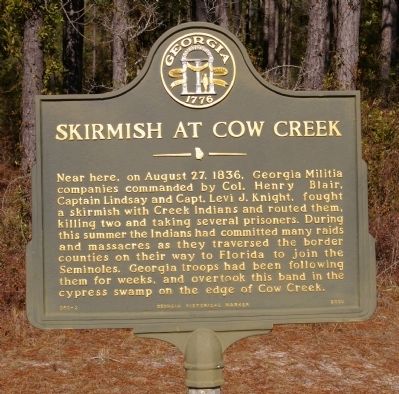
Inscription. Near here, on August 27, 1836, Georgia Militia companies commanded by Col. Henry Blair, Captain Lindsay and Capt. Levi J. Knight, fought a skirmish with Creek Indians and routed them, killing two and taking several prisoners. During this summer the Indians had committed many raids and massacres as they traversed the border counties on their way to Florida to join the Seminoles. Georgia troops had been following them for weeks, and overtook this band in the cypress swamp on the edge of Cow Creek.
 
Erected 2000 by Georgia Department of Natural Resources. (Marker Number 050-3.)
 
Topics and series. This historical marker is listed in these topic lists: Wars, US IndianWaterways & Vessels. In addition, it is included in the Georgia Historical Society series list. A significant historical year for this entry is 1836.
 
Location. 30° 51.37′ N, 83° 0.117′ W. Marker is near Statenville, Georgia, in Echols County. Marker is at the intersection of U.S. 129 at milepost 17 and Wayfare Road (County Route 1), on the right when traveling south on U.S. 129. Touch for map. Marker is in this post office area: Statenville GA 31648, United States of America. Touch for directions.
 
Other nearby markers. At least 8 other markers are within 14 miles of this marker, measured as the crow flies. Wayfare or Cow Creek Church (a few steps from this marker); Echols County (approx. 10.7 miles
Paid Advertisement
Click on the ad for more information.
Please report objectionable advertising to the Editor.
Click or scan to see
this page online
away); Burnt Church (approx. 12 miles away); Union Church Cemetery (approx. 12 miles away); Union Baptist Church (approx. 12.4 miles away); Fender Cemetery (approx. 13.4 miles away); The Milltown Air Line Locomotive (approx. 13˝ miles away); The Hotel Milltown (approx. 13˝ miles away). Touch for a list and map of all markers in Statenville.
 
More about this marker. This marker replaced an earlier marker of the same title and text on this location erected by the Georgia Historical Commission.
 
Skirmish at Cow Creek Marker image. Click for full size.
Photographed By David Seibert, January 19, 2010
2. Skirmish at Cow Creek Marker
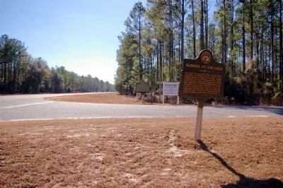
Looking north on US 129 toward Cow Creek
Skirmish at Cow Creek Marker image. Click for full size.
Photographed By David Seibert, January 19, 2010
3. Skirmish at Cow Creek Marker
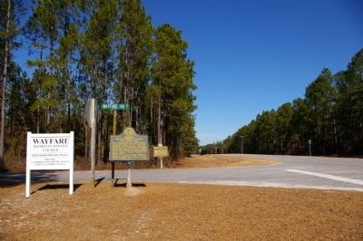
Two markers stand at Wayfare Road: "Wayfare or Cow Creek Church" in the foreground, and "Skirmish at Cow Creek" on the far side of the road.
Skirmish at Cow Creek Marker image. Click for full size.
Photographed By David Seibert, January 19, 2010
4. Skirmish at Cow Creek Marker
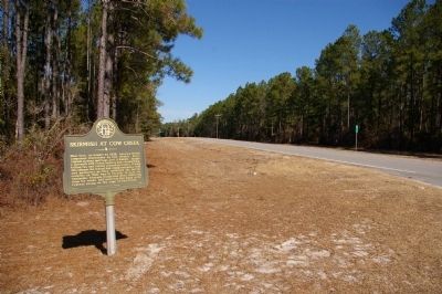
Looking south on US 129, toward Statenville
 
 
Credits. This page was last revised on October 20, 2020. It was originally submitted on January 31, 2010, by David Seibert of Sandy Springs, Georgia. This page has been viewed 1,971 times since then and 49 times this year. Photos:   1, 2, 3, 4. submitted on January 31, 2010, by David Seibert of Sandy Springs, Georgia. • Bill Pfingsten was the editor who published this page.
Share this page.  
Share on Tumblr
m=27036

CeraNet Cloud Computing sponsors the Historical Marker Database.
This website earns income from purchases you make after using our links to Amazon.com. We appreciate your support.
Paid Advertisement
Apr. 26, 2024