Athlone and Bigmeadow in County Westmeath, Leinster, Ireland — Mid-East (and Dublin)
The Great Siege of Athlone 1691
⎯⎯⎯
Remains of the Elizabethan Bridge
⎯⎯⎯
River Shannon and Navigation
Photographed by William Fischer, Jr., April 5, 2025
1. The Great Siege of Athlone 1691 Marker
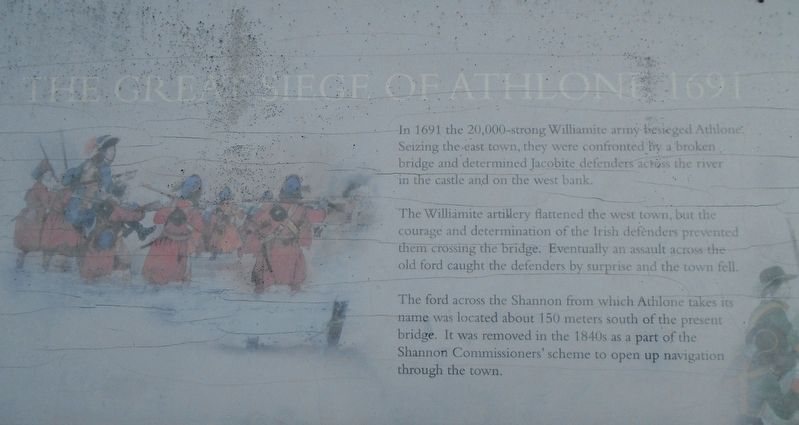
THE GREAT SIEGE OF ATHLONE 1691
In 1691 the 20,000-strong Williamite army besieged Athlone. Seizing the east town, they were confronted by a broken bridge and determined Jacobite defenders across the river in the castle and on the west bank.
The Williamite artillery flattened the west town, but the courage and determination of the Irish defenders prevented them crossing the bridge. Eventually an assault across the old ford caught the defenders by surprise and the town fell.
The ford across the Shannon from which Athlone takes its name was located about 150 meters south of the present bridge. It was removed in the 1840s as a part of the Shannon Commissioners' scheme to open up navigation through the town.
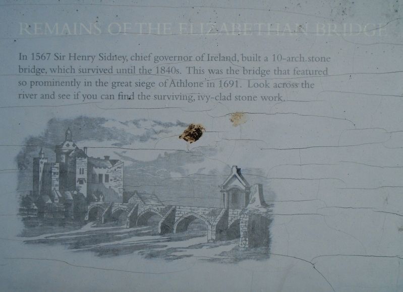
REMAINS OF THE ELIZABETHAN BRIDGE
In 1567 Sir Henry Sidney, chief governor of Ireland, built a 10-arch stone bridge, which survived until the 1840s. This was the bridge that featured so prominently in the great siege of Athlone in 1691. Look across the river and see if you can find the surviving, ivy-clad stone work.
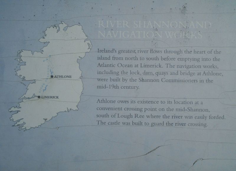
RIVER NAVIGATION AND NAVIGATION WORKS
Ireland's greatest river flows through the heart of the island
this page online
Athlone owes its existence to its location at a convenient crossing point on the mid-Shannon, south of Lough Ree where the river was easily forded. The castle was built to guard the river crossing.
Erected by Fáilte Ireland.
Topics. This historical marker is listed in these topic lists: Bridges & Viaducts • Forts and Castles • Settlements & Settlers • Waterways & Vessels. A significant historical year for this entry is 1691.
Location. 53° 25.404′ N, 7° 56.551′ W. Marker is in Athlone, Leinster, in County Westmeath. It is in Athlone and Bigmeadow. It can be reached from The Quay. Marker is on the Athlone Castle northeast upper battlement overlooking the River Shannon Bridge. Touch for map. Marker is in this post office area: Athlone, Leinster N37 A6D7, Ireland. Touch for directions.

Regionally, this marker is in the Hidden Heartlands. Globally, it is on the Atlantic Ocean, in the North Atlantic Region,
Photographed by William Fischer, Jr., April 5, 2025
2. Remains of the Elizabethan Bridge Marker
Other nearby markers. At least 8 other markers are within walking distance of this marker: Clonmacnoise (here, next to this marker); Athlone Woollen Mills/Town Bridge (here, next to this marker); Custume Barracks/Church of Saints Peter and Paul/Railway Bridge/Luan Gallery (here, next to this marker); Ireland's Hidden HEARTLANDS (here, next to this marker); Historical Garden at Athlone Castle (here, next to this marker); 24-Pounder Gun (a few steps from this marker); Athlone Castle (a few steps from this marker); Site of the President's House (within shouting distance of this marker). Touch for a list and map of all markers in Athlone.
More about this marker. Marker is heavily weathered; photos are enhanced.
Also see . . . The Sieges of Athlone 1690-1691. (Submitted on April 15, 2025, by William Fischer, Jr. of Reynoldsburg, Ohio.)
Photographed by William Fischer, Jr., April 5, 2025
3. River Shannon and Navigation Works Marker

Photographed by William Fischer, Jr., April 5, 2025
4. The Great Siege of Athlone 1691 / Remains of the Elizabethan Bridge / River Shannon and Navigation M

Photographed by William Fischer, Jr., April 5, 2025
5. The Great Siege of Athlone 1691 / Remains of the Elizabethan Bridge / River Shannon and Navigation M
Credits. This page was last revised on December 3, 2025. It was originally submitted on April 15, 2025, by William Fischer, Jr. of Reynoldsburg, Ohio. This page has been viewed 198 times since then and 39 times this year. Photos: 1, 2, 3, 4, 5. submitted on April 15, 2025, by William Fischer, Jr. of Reynoldsburg, Ohio.
