Shiloh in Hardin County, Tennessee — The American South (East South Central)
A Temporary Wall
Photographed by David Austin, April 13, 2025
1. A Temporary Wall Marker
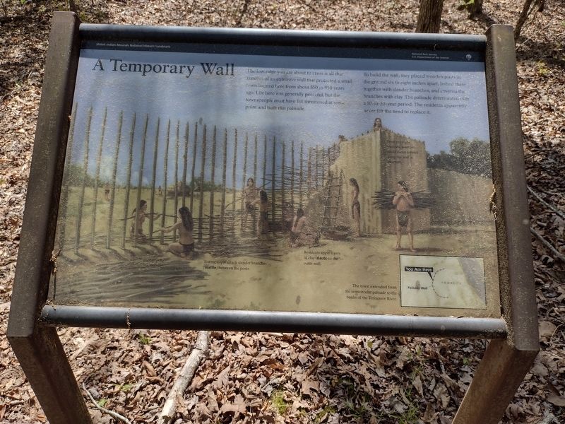
To build the wall, they placed wooden posts in the ground six to eight inches apart, lashed there together with slender branches, and covered the branches with clay. The palisade deteriorated over a 10-to-20-year period. The residents apparently never felt the need to replace it.
Captions
(Diagram #1) Townspeople attach slender branches (wattle) between the posts.
(Diagram #2) Residents apply layers of clay (daub) to the outer wall.
(Diagram #3) The town extended from the semicircular palisade to the banks of the Tennessee River.
(Diagram #4) From the eight bastions, warriors could shoot arrows along the wall at attackers.
Erected by Shiloh Indian Mounds National Landmark.
Topics. This historical marker is listed in these topic lists: Architecture • Indigenous Peoples and Communities • Settlements & Settlers. A significant historical year for this entry is 1075 CE.
Location. 35° 8.491′ N,
this page online

Regionally, this marker is in West Tennessee. It is also in the American South and specifically in the Upper South. Globally, it is in North America, the Western Hemisphere, the Western World, and the Anglosphere. Historically, it finds itself in what was once the territory of the Mississippian Culture, one of the Confederate States of America, and the Antebellum South.
Other nearby markers. At least 8 other markers are within walking distance of this marker: Kentucky Regiments at Battle of Shiloh (within shouting distance of this marker); Camp of 17th Kentucky Infantry (within shouting distance of this marker); Chickasaw Homeland (within shouting distance of this marker); Sifting the Evidence (within shouting distance of this marker); Mississippian Indians (within shouting distance of this marker); Shiloh Indian Mounds (about
Photographed by David Austin, April 13, 2025
2. A Temporary Wall Marker
Credits. This page was last revised on April 22, 2025. It was originally submitted on April 15, 2025, by David Austin of Scotts Hill, Tennessee. This page has been viewed 162 times since then and 19 times this year. Photos: 1, 2. submitted on April 15, 2025, by David Austin of Scotts Hill, Tennessee. • James Hulse was the editor who published this page.
