Alexandria in Fairfax County, Virginia — The American South (Mid-Atlantic)
People and the Land
George Washington Memorial Parkway
| — | National Park Service, U.S. Department of the Interior | — |
Photographed by Craig Swain, March 26, 2011
1. People and the Land Marker
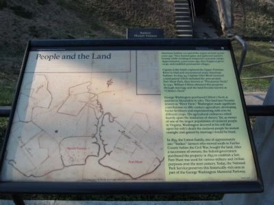
Captain John Smith explored the Upper Potomac River in 1608 and encountered many American Indians. In 1653-54, Captain Giles Brent received a land patent which included the area around Fort Hunt Park, then known as "Piscataway Neck." In 1730, William Clifton obtained this property through marriage and the land became known as "Clifton's Neck."
George Washington purchased Clifton's Neck at auction in Alexandria in 1760. This land later became known as "River Farm." Washington made significant contributions to 18th-century agriculture, developing better fertilizers and experimenting with over 60 different crops. His agricultural endeavors relied heavily upon the institution of slavery. Yet, as owner of one of the largest populations of enslaved people in Virginia, Washington decreed in his will that upon his wife's death the enslaved people he owned outright (not gained by marriage)
this page online
In 1855, the Linton Family, one of approximately 200 "Yankee" farmers who moved south to Fairfax County before the Civil War, bought the land. After a secession of owners, the federal government purchased the property in 1893 to establish a fort. Fort Hunt was used for various military and civilian purposes over the next century. Today, the National Park Service preserves this historically-rich area as part of the George Washington Memorial Parkway.
Erected by National Park Service, U.S. Department of the Interior.
Topics and series. This historical marker is listed in these topic lists: African Americans • Exploration • Indigenous Peoples and Communities • Settlements & Settlers. In addition, it is included in the Former U.S. Presidents: #01 George Washington series list. A significant historical year for this entry is 1608.
Location. 38° 42.912′ N, 77° 3.083′ W. Marker has been reported damaged. Marker is in Alexandria, Virginia, in Fairfax County. It is on Fort Hunt Park Loop 0.4 miles west of George Washington Memorial Parkway, on the left when traveling east. Located in Fort Hunt Park, a unit
Photographed by Craig Swain
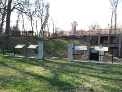
2. Markers in Front of Battery Mount Vernon

Regionally, this marker is in the Washington Metropolitan Area and in Northern Virginia. It is also in the American South, specifically in the Upper South, in the Mid-Atlantic, and on the Eastern Seaboard. Globally, it is in the North Atlantic Region, North America, the Western Hemisphere, the Western World, and the Anglosphere. Historically, it finds itself in what was once the territory of the Mississippian Culture, one of the original Thirteen Colonies, one of the Confederate States of America, and the Antebellum South.
Other nearby markers. At least 8 other markers are within walking distance of this location: Fort Hunt Park (here, next to this marker); Battery Mount Vernon (here, next to this marker); Civilian Conservation Corps (here, next to this marker); In Support of American Defense (here, next to this marker); Beyond What You See Today (within shouting distance of this marker); P.O. Box 1142
Photographed by Evan Dwyer, October 19, 2024
3. People and the Land Marker
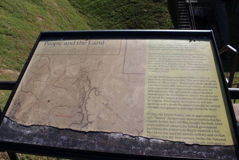
In 2024, the marker is damaged and deteriorating but not much of the text is missing.
Also see . . . Plan Your Visit - Fort Hunt Park. National Park Service (Submitted on June 5, 2011, by Craig Swain of Leesburg, Virginia.)
Credits. This page was last revised on April 24, 2025. It was originally submitted on March 27, 2011, by Craig Swain of Leesburg, Virginia. This page has been viewed 878 times since then and 25 times this year. Last updated on April 18, 2025, by Evan Dwyer of Richmond, Virginia. Photos: 1. submitted on March 27, 2011, by Craig Swain of Leesburg, Virginia. 2. submitted on June 5, 2011, by Craig Swain of Leesburg, Virginia. 3. submitted on April 18, 2025, by Evan Dwyer of Richmond, Virginia. • Bernard Fisher was the editor who published this page.
