Brookline near Wilsons Creek in Greene County, Missouri — The American Midwest (Upper Plains)
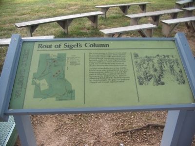
Rout of Sigel's Column
Wilson's Creek
Photographed by Craig Swain, August 29, 2010
1. Rout of Sigel's Column Marker
The Union strategy at Wilson's Creek called for a two-pronged surprise attack. General Lyon's main column with about 4,000 men would strike the Confederate camps from the north, while Col. Franz Sigel's brigade of about 1,200 men would attack from the south. The Confederate army would be crushed between the converging columns.
The plan seemed effective at first, but the Union forces were outnumbered, and poor communications between Lyon and Sigel made it difficult to coordinate the attack. Moving up the hill behind you, a line of advancing Rebels that the Federals mistook for reinforcements (the gray-clad 1st Iowa) charged and overran Sigel's position.
Topics. This historical marker is listed in this topic list: War, US Civil.
Location. 37° 5.735′ N, 93° 24.605′ W. Marker is near Wilsons Creek, Missouri, in Greene County. It is in Brookline. It is on Tour Road, on the left when traveling west. Located at stop 5, the Sigel's Final Position, of the Wilson's Creek battlefield driving tour. Touch for map. Marker is in this post office area: Brookline MO 65619, United
this page online

Regionally, this marker is in Greater Springfield. It is also in the American Ozarks, in the Lewis & Clark Corridor, and in the Corn Belt. Globally, it is in North America, the Western Hemisphere, the Western World, and the Anglosphere. Historically, it finds itself in what was once the territory of the Mississippian Culture, the Louisiana Purchase, and the Antebellum South.
Other nearby markers. At least 8 other markers are within walking distance of this marker: Sigel's Attack (approx. 0.3 miles away); The Eye of the Storm (approx. 0.4 miles away); Price's Headquarters (approx. half a mile away); Pulaski Arkansas Battery (approx. half a mile away); Guibor's Battery (approx. half a mile away); A Union Plan / The Broken Pincer (approx. half a mile away); a different marker also named Pulaski Arkansas Battery (approx. 0.6 miles away); What Would You Do? (approx. 0.6 miles away).
Also see . . . Wilson's Creek National Battlefield Park. (Submitted on September 2, 2010, by Craig Swain of Leesburg, Virginia.)
Photographed by Craig Swain, August 29, 2010
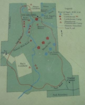
2. Battle Map
The map depicts the situation at around 8:30 A.M. on August 10, 1861. Note the north seeking arrow pointed to the bottom of the map.
Photographed by Craig Swain, August 29, 2010
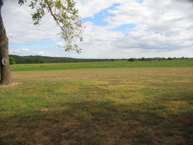
3. Movement from Second to Final Position
Sigel moved from the position in Sharp's cornfield to a position astride the Wire Road. The tour road parallels the axis of Sigel's advance across the valley.
Photographed by Craig Swain, August 29, 2010
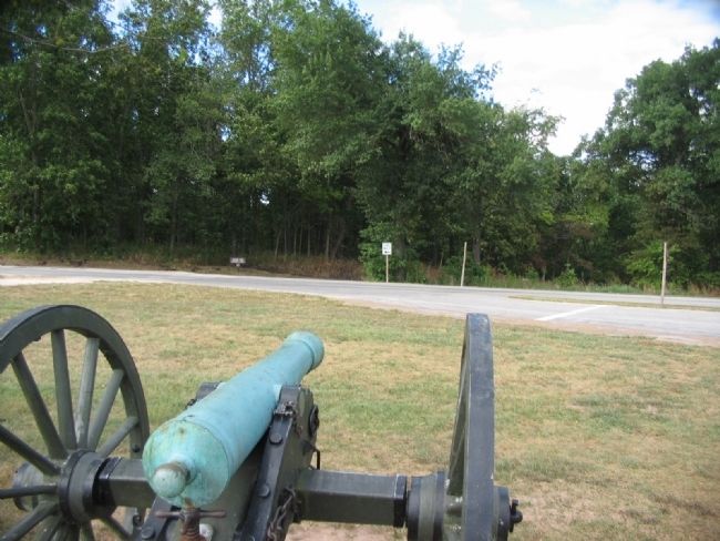
4. Misidentified Troops
Looking from one of the guns on display along the Wire Road. The tour road intersects the Wire Road at this point. When a Confederate force advanced up the Wire Road, Sigel's men held fire, assuming them to be Federals. At close range, the Confederates were able to overrun Sigel's position.
Photographed by Craig Swain, August 29, 2010
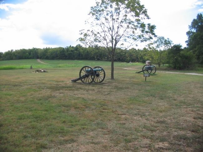
5. Sigel's Retreat
Two guns, representing Backof's Battery, sit astride the Wire Road. After the Confederate attack, Sigel's command fell back down the Wire Road. The road's trace continues into the woods in the distance. From there, Sigel moved back to the north to regain contact with Lyon's main force.
By Gregory William Wadley, April 4, 2025
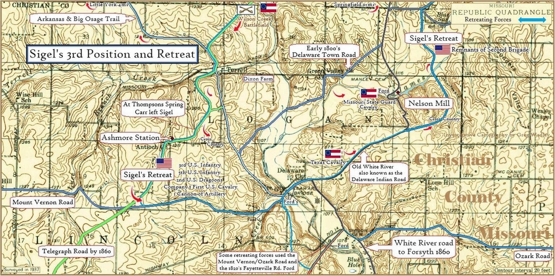
6. Sigel's third position and retreat from the Battlefield
Credits. This page was last revised on November 22, 2025. It was originally submitted on September 2, 2010, by Craig Swain of Leesburg, Virginia. This page has been viewed 1,650 times since then and 53 times this year. Last updated on April 18, 2025, by Gregory William Wadley of Fremont Hills, Missouri. Photos: 1, 2, 3, 4, 5. submitted on September 2, 2010, by Craig Swain of Leesburg, Virginia. 6. submitted on April 4, 2025, by Gregory William Wadley of Fremont Hills, Missouri. • Devry Becker Jones was the editor who published this page.
