Nelsonville in Athens County, Ohio — The American Midwest (Great Lakes)
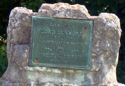
Camp Site of Lord Dunmore
1774
Photographed by J. J. Prats, July 14, 2008
1. Camp Site of Lord Dunmore Marker
Rock weights were in drawbridge at Harper Street crossing of Hocking Canal.
Erected 1938 by Elizabeth (illegible) Chapter, Daughters of the American Revolution.
Topics and series. This historical marker is listed in these topic lists: Colonial Era • Settlements & Settlers. In addition, it is included in the Daughters of the American Revolution (DAR) series list.
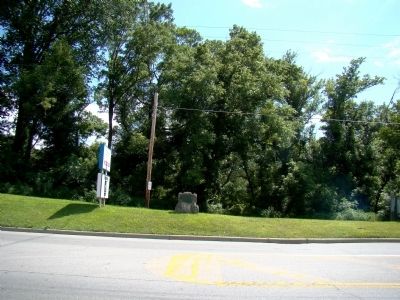
Location. Marker has been permanently removed. It was located near 39° 27.696′ N, 82° 14.526′ W. Marker was in Nelsonville, Ohio, in Athens County. It was at the intersection of Canal Street (U.S. 33) and Pine Grove Drive, on the right when traveling east on Canal Street. Touch for map. Marker was at or near this postal address: 558 Old U.S 33, Nelsonville OH 45764, United States of America.
We have been informed that this marker is no longer there and will not be replaced. This page is an archival view of what was.
Regionally, this marker was in the Hocking Hills. It was also in the American Midwest, in the Ohio River Valley, in Appalachia, and specifically in Northern Appalachia. Globally, it

this page online
Other nearby markers. At least 8 other markers are within walking distance of this location: A different marker also named Camp Site of Lord Dunmore (within shouting distance of this marker); Hocking Canal Site (about 500 feet away, measured in a direct line); Nelsonville (approx. ¼ mile away); Lockbourne Air Force Base Survival School (approx. 0.4 miles away); Veterans' Memorial (approx. 0.4 miles away); Nelsonville-York - Remember 9/11/01 (approx. half a mile away); Hocking Valley Railway (approx. half a mile away); a different marker also named Nelsonville (approx. half a mile away). Touch for a list and map of all markers in Nelsonville.
Also see . . . Lord Dunmore’s War: The Battle of Point Pleasant. Warfare History Network website entry:
Shawnee Indians and Virginians waged a thunderous and bloody battle at Point Pleasant during the conflict now known as Lord Dunmore's
Photographed by J. J. Prats, July 14, 2008
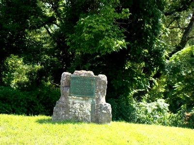
2. Camp Site of Lord Dunmore Monument
Monument is constructed from the rock counterweights of a nearby drawbridge over the Hocking Canal.
Photographed by J. J. Prats, July 14, 2008
3. Camp Site of Lord Dunmore D.A.R. Monument
Credits. This page was last revised on April 30, 2025. It was originally submitted on August 30, 2008, by J. J. Prats of Powell, Ohio. This page has been viewed 3,055 times since then and 48 times this year. Last updated on April 23, 2025, by Craig Doda of Napoleon, Ohio. Photos: 1, 2, 3. submitted on August 30, 2008, by J. J. Prats of Powell, Ohio. • Devry Becker Jones was the editor who published this page.
