Shelton in Naugatuck Valley Region, Connecticut — The American Northeast (New England)
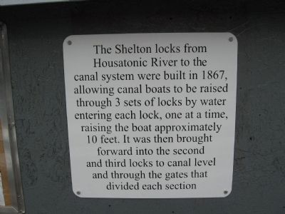
Shelton Locks
Photographed by Michael Herrick, February 2, 2010
1. Shelton Locks Marker
Topics. This historical marker is listed in these topic lists: Industry & Commerce • Waterways & Vessels. A significant historical year for this entry is 1867.
Location. 41° 19.34′ N, 73° 5.883′ W. Marker is in Shelton in Naugatuck Valley Region, Connecticut. It can be reached from Canal Street East 0.1 miles Bridge Street when traveling north. Touch for map. Marker is in this post office area: Shelton CT 06484, United States of America. Touch for directions.

Regionally, this marker is on the Connecticut Shoreline and in Greater Bridgeport. It is also in the American Northeast
this page online
Other nearby markers. At least 8 other markers are within walking distance of this marker: Fort Hill (about 300 feet away, measured in a direct line); Constitution Oak (about 600 feet away); To Honor the Men and Women of the City of Shelton (about 700 feet away); Shelton (approx. 0.2 miles away); Shelton World War II Memorial (approx. 0.2 miles away); Derby Korea – Vietnam Memorial (approx. half a mile away); Derby Veterans Monument (approx. half a mile away); Derby Firemen’s Memorial (approx. half a mile away). Touch for a list and map of all markers in Shelton.
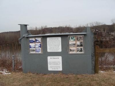
More about this marker. The marker is mounted on a lock gate.
Regarding Shelton Locks. The Ousatonic Dam and Shelton Canal were constructed
Photographed by Michael Herrick, February 2, 2010
2. Shelton Locks Marker
Old photographs of the dam, canal and locks are mounted on a steel lock gate.
McCallum Enterprises Owns and Operates the Dam and Power Station All Welcome
Derby Hydroelectric Plant
McCallum Enterprises I, LP
FERC License #6066-CT
Further information call
203-386-1745
McCallum Enterprises Owns and Operates the Dam and Power Station
Derby Hydroelectric Plant
McCallum Enterprises I, LP
FERC License #6066-CT
Further information call
203-386-1745
The canal was the power source for all downtown industries in an age before electricity. The dam was built in order to fill the canal with water at an elevation higher than the river.
Each factory tapped into the canal with a tunnel. The water fell to the river below, powering a turbine, connected to factory machinery through a series of shafts, pulleys, and belts. The canal and dam were so important that the town took its name after Edward Shelton, the primary mover and backer of the Ousatonic Dam Company.
Most of the canal has been filled in over the years, but a remnant still survives off the northwest end of Canal Street. The remaining canal is 1200 feet long and 80 feet wide, totaling 2.5 acres. It rests on a six-acre piece
Photographed by Michael Herrick, February 2, 2010
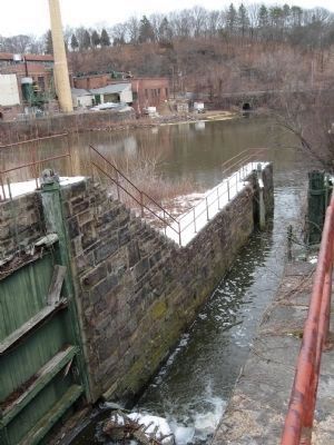
3. The Lowest Lock With Wooden Gates
The factory in the upper left is across the Housatonic River in Derby.
The canal and locks were last used by boats in 1973.
Also see . . . Ousatonic Dam and Canal. Page from a virtual tour of the Lower Naugatuck Valley. (Submitted on February 8, 2010, by Craig Swain of Leesburg, Virginia.)
Photographed by Michael Herrick, February 2, 2010
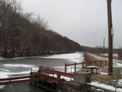
4. Looking North Up the Canal
The middle lock entrance is in the foreground. The upper lock at the far end of the canal has been filled in. The public access road is next to the canal, with the Housatonic River on the right.
Photographed by Michael Herrick, February 2, 2010
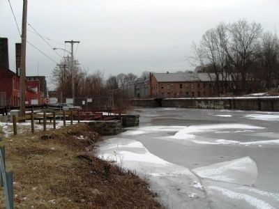
5. The Canal
Looking south. The stone works in the center are the entrance to the lower two locks, leading to the left down to the Housatonic River.
Photographed by Michael Herrick, February 2, 2010
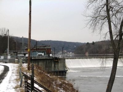
6. The Ousatonic Dam and Power Station
The dam across the Housatonic River. The concrete structure is the new station. Beyond are the ruins of the original station.
Photographed by Michael Herrick, February 2, 2010
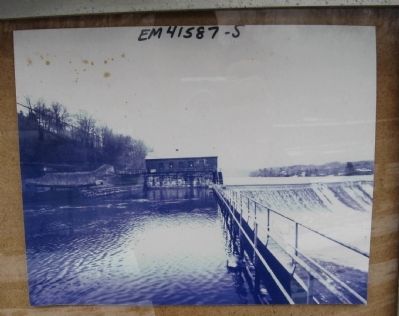
7. Old Photograph
One of the old photographs next to the marker. It shows the dam and original power station, with the upper lock to the left.
Photographed by Michael Herrick, February 2, 2010
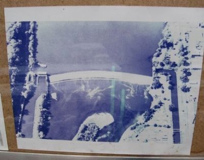
8. Old Photograph
One of the old photographs next to the marker. An aerial view of the dam. The power station, lock and canal are to the left of dam. On the right (east) side of the dam is a canal that delivered water power to factories in Derby.
Photographed by Michael Herrick, March 4, 2010
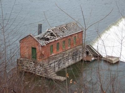
9. The Original Power Station
The uppermost lock was to the left of the building. It was dismantled when a new generating station was built just downstream.
Photographed by Michael Herrick, March 4, 2010
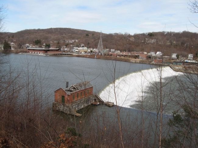
10. The Ousatonic Dam
View from the bluffs in Shelton, overlooking the Housatonic River. The building at center is the ogiginal power station. The building at the water's edge across the river is the Yale University rowing crews' boathouse.
Credits. This page was last revised on May 19, 2026. It was originally submitted on February 2, 2010, by Michael Herrick of Southbury, Connecticut. This page has been viewed 2,880 times since then and 134 times this year. Photos: 1, 2, 3, 4, 5, 6, 7, 8. submitted on February 2, 2010, by Michael Herrick of Southbury, Connecticut. 9, 10. submitted on March 7, 2010, by Michael Herrick of Southbury, Connecticut. • Craig Swain was the editor who published this page.
