
Powell in Delaware County, Ohio — The American Midwest (Great Lakes)
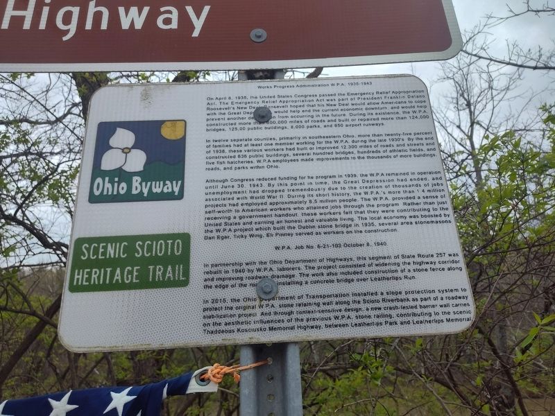
Works Progress Administration W.P.A. 1935-1943
Scenic Scioto Heritage Trail
| — | Ohio Byway | — |
Photographed by Craig Doda, April 19, 2025
1. Works Progress Administration W.P.A. 1935-1943 Marker
On April 8, 1935, the United States Congress passed the Emergency Relief Appropriation Act. The Emergency Relief Appropriation Act was part of President Franklin Delano Roosevelt's New Deal. Roosevelt hoped that his New Deal would allow Americans to cope with the Great Depression, would help end the current economic downturn, and would help prevent another depression from occurring in the future. During its existence, the W.P.A. prevent constructed more than 600,000 miles of roads and built or repaired more than 124,000 bridges, 125,00 public buildings, 8.000 parks, and 850 airport runways.
In twelve separate counties, primarily in southeastern Ohio, more than twenty-five percent of families had at least one member working for the W.P.A. during the late 1930's By the end of 1938, these various workers had built or improved 12.300 miles of roads and streets and construcled 636 public buildings, several hundred bridges, hundreds of athletic fields, and five fish hatcheries. W.P.A. employees made improvements to the thousands of more buildings. roads, and parks within Ohio.
Although Congress reduced funding for the program
this page online
WPA Job No 6-21-103 October 8, 1940
In partnership with the Ohio Department of Highways, this segment of State Route 257 was rebuilt in 1940 by W.P.A. laborers. The project consisted of widening the highway corridor and improving roadway drainage. The work also included construction of a stone fence along the edge of the road, and installing a concrete
Photographed by Craig Doda, April 19, 2025
2. Works Progress Administration W.P.A. 1935-1943 Marker
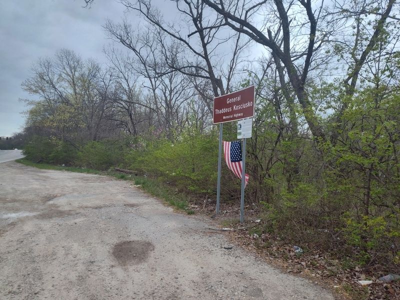
In 2015, the Ohio Department of Transportation installed a slope protection system lo protect the original W P.A stone retaining wall along the Scioto Riverbank as part of a roadway stabilization project And through context sensitive design a new crash-lesled barrier wall carries on the aesthetic influences of the previous WP.A. stone railing, contributing to the scenic Thaddeous Kosciusko Memorial Highway between Leatherlips Park and Leatherlips Memorial.
Topics and series. This historical marker is listed in these topic lists: Charity & Public Work • Roads & Vehicles. In addition, it is included in the Former U.S. Presidents: #32 Franklin D. Roosevelt, and the Works Progress Administration (WPA) projects series lists. A significant historical date for this entry is April 8, 1935.
Location. 40° 8.492′ N, 83° 7.177′ W. Marker is in Powell, Ohio, in Delaware County. It is on Buckingham Place 0.2 miles north of Stafford Avenue. Touch for map. Marker is at or near this postal address: 10848 Buckingham Pl, Powell OH 43065, United States of America. Touch for directions.

Regionally, this marker is in the Scioto Valley and in the Columbus Metropolitan Area. It is also in the American Midwest and in the Corn Belt. Globally, it is in North America, the Western Hemisphere, the Western World, and the Anglosphere. Historically, it finds itself in what was once the Haudenosaunee (Iroquois) Confederacy, the territory of the Mississippian Culture, and the Northwest Territory.
Other nearby markers. At least 8 other markers are within one mile of this marker, measured as the crow flies: Leatherlips (about 600 feet away, measured in a direct line); Polish Patriot Thaddeus Kosciusko (approx. 0.3 miles away); Habitat is Home (approx. 0.9 miles away); Unga (approx. 0.9 miles away); Colo (approx. one mile away); We Care! (approx. one mile away); Saving Bonobos (approx. one mile away); "Celebration of Giving Fountain" (approx. one mile away). Touch for a list and map of all markers in Powell.
Credits. This page was last revised on June 5, 2026. It was originally submitted on April 25, 2025, by Craig Doda of Napoleon, Ohio. This page has been viewed 252 times since then and 51 times this year. Photos: 1, 2. submitted on April 25, 2025, by Craig Doda of Napoleon, Ohio. • Devry Becker Jones was the editor who published this page.
