Carlinville in Macoupin County, Illinois — The American Midwest (Great Lakes)
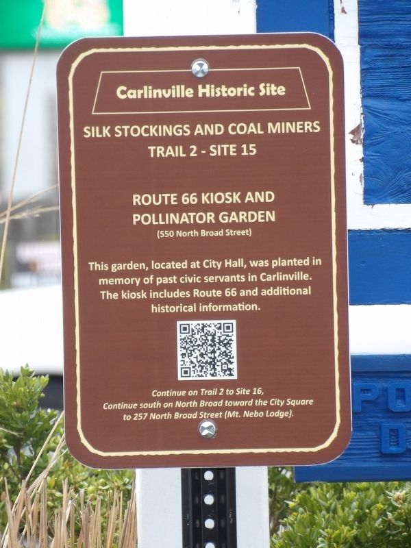
Route 66 Kiosk and Pollinator Garden
(550 North Broad Street)
| — | Silk Stockings and Coal Miners Trail 2 - Site 15 | — |
Photographed by Duane and Tracy Marsteller, April 5, 2025
1. Route 66 Kiosk and Pollinator Garden Marker
Continue on Trail 2 to Site 16, continue south on North Broad toward the city square to 257 North Broad Street (Mt. Nebo Lodge).
Topics. This historical marker is listed in these topic lists: Education • Horticulture & Forestry • Roads & Vehicles. A significant historical year for this entry is 1926.
Location. 39° 17.142′ N, 89° 52.905′ W. Marker is in Carlinville, Illinois, in Macoupin County. It is at the intersection of North Broad Street and West Nicholas Street, on the right when traveling south on North Broad Street. Touch for map. Marker is at or near this postal address: 500 N Broad St, Carlinville IL 62626, United States of America. Touch for directions.

Regionally, this marker is in the American Midwest and in the Corn Belt. Globally, it is in North America, the Western Hemisphere, the Western World, and the Anglosphere. Historically, it finds itself in what was once the territory of the Mississippian Culture and also the
this page online
Other nearby markers. At least 8 other markers are within walking distance of this marker: Carlinville, Illinois (here, next to this marker); Standard Oil Mine Office (approx. ¼ mile away); Standard Oil Company Store (approx. 0.4 miles away); Loomis House (approx. 0.4 miles away); Loomis House/Loehr's Drug Store (approx. 0.4 miles away); Circling The Square (approx. 0.4 miles away); Abraham Lincoln (approx. 0.4 miles away); Site of the Ariston Restaurant on the Original Route 66 (approx. 0.4 miles away). Touch for a list and map of all markers in Carlinville.
Also see . . . Rt. 66 Kiosk and Pollinator Garden at City Hall. From 1926-1930, the city of Carlinville was on the original alignment of Route 66. (Carlinville Public Library) (Submitted on April 25, 2025, by Duane and Tracy Marsteller of Murfreesboro, Tennessee.)
Photographed by Duane and Tracy Marsteller, April 6, 2025
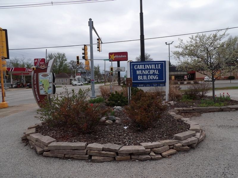
2. Route 66 Kiosk and Pollinator Garden Marker
The kiosk is visible on the left.
Credits. This page was last revised on April 25, 2025. It was originally submitted on April 25, 2025, by Duane and Tracy Marsteller of Murfreesboro, Tennessee. This page has been viewed 127 times since then and 17 times this year. Photos: 1, 2. submitted on April 25, 2025, by Duane and Tracy Marsteller of Murfreesboro, Tennessee.
