
Kew Gardens Hills in Queens in Queens County, New York — The American Northeast (Mid-Atlantic)
Freedom Square
.327 acre
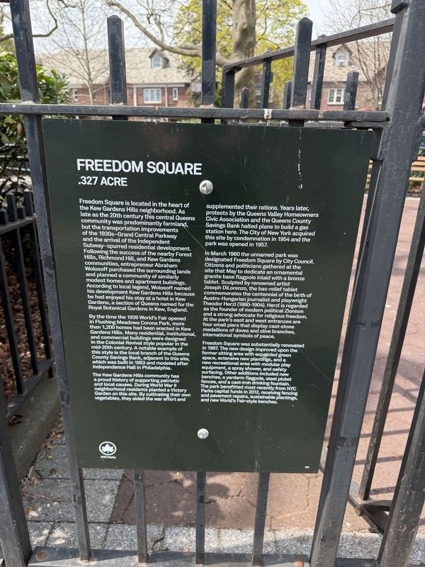
Freedom Square is located in the heart of the Kew Gardens Hills neighborhood. As late as the 20th century this central Queens community was predominantly farmland, but the transportation improvements of the 1930s—Grand Central Park way and the arrival of the Independent Subway—spurred residential development. Following the success of the nearby Forest Hills, Richmond Hill, and Kew Gardens communities, entrepreneur Abraham Wolosoff purchased the surrounding lands and planned a community of similarly modest homes and apartment buildings. According to local legend, Wolosoff named his development Kew Gardens Hills because he had enjoyed his stay at a hotel in Kew Gardens, a section of Queens named for the Royal Botanical Gardens in Kew, England.
By the time the 1939 World's Fair opened in Flushing Meadows Corona Park, more than 1,200 homes had been erected in Kew Gardens Hills. Many residential, institutional, and commercial buildings were designed in the Colonial Revival style popular in the mid-20th century. A notable example of this style is the local branch of the Queens County Savings Bank, adjacent to this site,
this page online
The Kew Gardens Hills community has a proud history of supporting patriotic and local causes. During World War II neighborhood residents planted a Victory Garden on this site. By cultivating their own vegetables, they aided the war effort and supplemented their rations. Years later, protests by the Queens Valley Homeowners Civic Association and the Queens County Savings Bank halted plans to build a gas station here. The City of New York acquired this site by condemnation in 1954 and the park was opened in 1957.
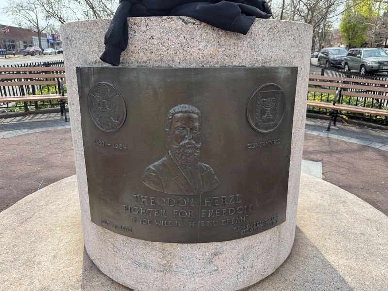
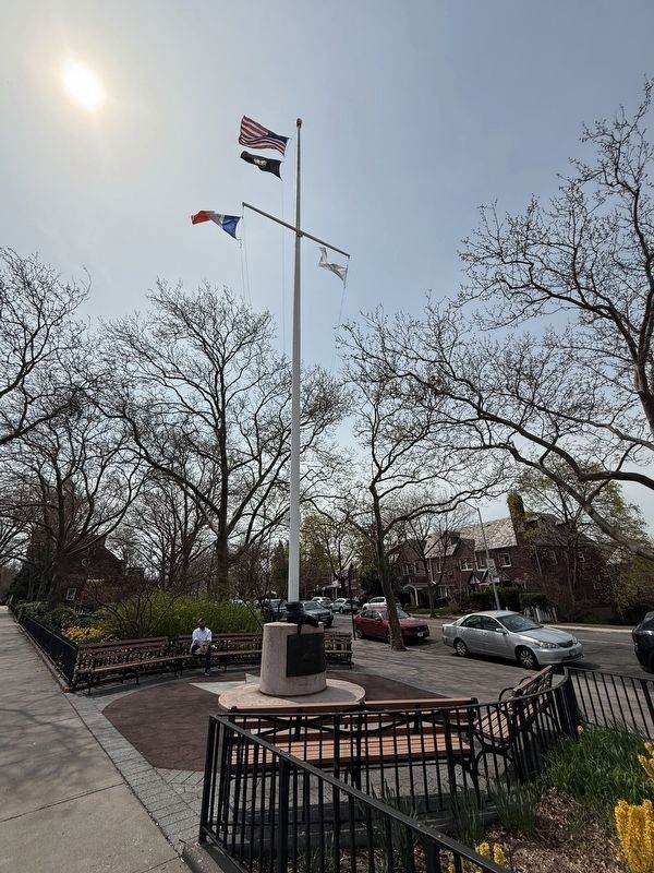
In March 1960 the unnamed park was designated Freedom Square by City Council. Citizens and politicians gathered at the site that may to dedicate an ornamental granite base flagpole inlaid with a bronze tablet. Sculpted by renowned artist Joseph DiLorenzo, the bas-relief tablet commemorates the centennial of the birth of Austro-Hungarian journalist and playwright Theodor Herzl (1860-1904). Herzl is regarded as the founder of modern political Zionism and a strong advocate for religious freedom. At the park's east and west entrances are four small
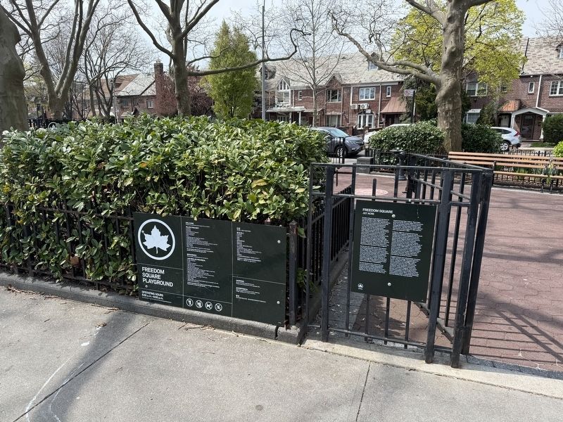
Freedom Square was substantially renovated in 1997. The new design improved upon the former sitting area with expanded green space, extensive new plantings, and a new recreational area with modular play equipment, a spray shower, and safety surfacing. Other additions included new benches, a yardarm flagpole, steel picket fences, and a cast-iron drinking fountain. The park benefitted most recently from NYC Parks capital funds in 2012, receiving fencing and pavement repairs, sustainable plantings, and New World's Fair-style benches.
Erected by NYC Parks. (Marker Number 300.)
Topics and series. This historical marker is listed in these topic lists: Architecture • Parks & Recreational Areas • Patriots & Patriotism • Settlements & Settlers. In addition, it is included in the NYC Parks series list. A significant historical month for this entry is March 1960.
Location. 40° 43.401′ N, 73° 49.213′ W. Marker is in Queens, New York, in Queens County. It is in Kew Gardens Hills. It is at the intersection of Main Street and 75th Road,

Regionally, this marker is in New York City. It is also in the American Northeast and on the Eastern Seaboard. Globally, it is in North America and the Western World. Historically, it finds itself in what was once one of the original Thirteen Colonies.
Other nearby markers. At least 8 other markers are within 2 miles of this marker, measured as the crow flies: Queens Valley Playground (approx. 0.2 miles away); Veterans Memorial (approx. 0.8 miles away); Queens Borough Hall Persian Gulf War Memorial (approx. 0.8 miles away); Willow Lake Playground (approx. 0.9 miles away); Emerald Playground (approx. 0.9 miles away); Maple Grove Cemetery (approx. one mile away); Forest Hills Beginnings (approx. 1.2 miles away); Great War Memorial (approx. 1.3 miles away). Touch for a list and map of all markers in Queens.
Credits. This page was last revised on April 25, 2025. It was originally submitted on April 25, 2025, by Devry Becker Jones of Washington, District of Columbia. This page has been viewed 137 times since then and 25 times this year. Photos: 1, 2, 3, 4. submitted on April 25, 2025, by Devry Becker Jones of Washington, District of Columbia.
