Richmond on Staten Island in Richmond County, New York — The American Northeast (Mid-Atlantic)
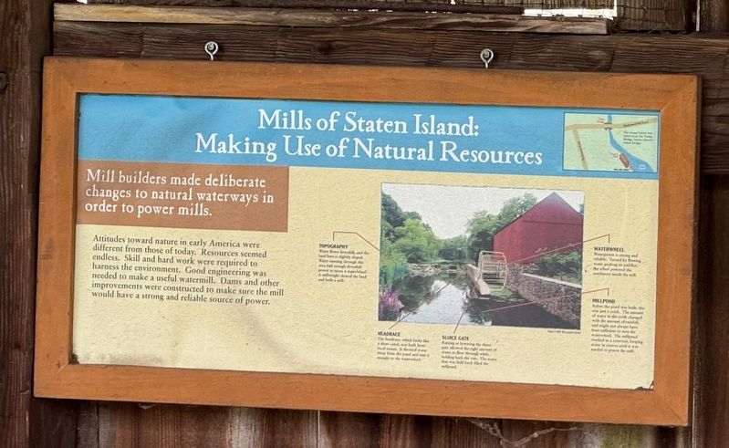
Mills of Staten Island: Making Use of Natural Resources
Photographed by Devry Becker Jones (CC0), April 19, 2025
1. Mills of Staten Island: Making Use of Natural Resources Marker
Mill builders made deliberate changes to natural waterways in order to power mills.
Attitudes toward nature in early America were different from those of today. Resources seemed endless. Skill and hard work were required to harness the environment. Good engineering was needed to make a useful watermill. Dams and other improvements were constructed to make sure the mill would have a strong and reliable source of power.
Erected by New York State Council on the Arts.
Topics. This historical marker is listed in these topic lists: Industry & Commerce • Waterways & Vessels.
Location. 40° 34.339′ N, 74° 8.784′ W. Marker is on Staten Island, New York, in Richmond County. It is in Richmond. It is at the intersection of Richmond Road and Richmond Hill Road, on the right when traveling west on Richmond Road. Touch for map. Marker is at or near this postal address: 3747 Richmond Rd, Staten Island NY 10306, United States of America. Touch for directions.

Regionally, this marker is in New York City. It is also in the American Northeast, in the Mid-Atlantic, and
this page online
Other nearby markers. At least 8 other markers are within walking distance of this marker: Staten Island Connections (here, next to this marker); "Grist" for the Mills (here, next to this marker); Where Does Your Grain Go? (here, next to this marker); Site of the Lighthouse Restaurant (within shouting distance of this marker); Site of the First County Courthouse (1729), Jail (1741), Jailer’s House (1751). (within shouting distance of this marker); St. Andrew’s Church (within shouting distance of this marker); Site of Richmond County Hall and the Parish House of St. Andrew's Church (within shouting distance of this marker); Treasure House (within shouting distance of this marker). Touch for a list and map of all markers in Staten Island.
Credits. This page was last revised on April 26, 2025. It was originally submitted on April 26, 2025, by Devry Becker Jones of Washington, District of Columbia. This page has been viewed 143 times since then and 34 times this year. Photo 1. submitted on April 26, 2025, by Devry Becker Jones of Washington, District of Columbia.
Editor’s want-list for this marker. A wide shot of the marker in context. • Transcription of the captions. • Can you help?
