
Richmond on Staten Island in Richmond County, New York — The American Northeast (Mid-Atlantic)
"Grist" for the Mills
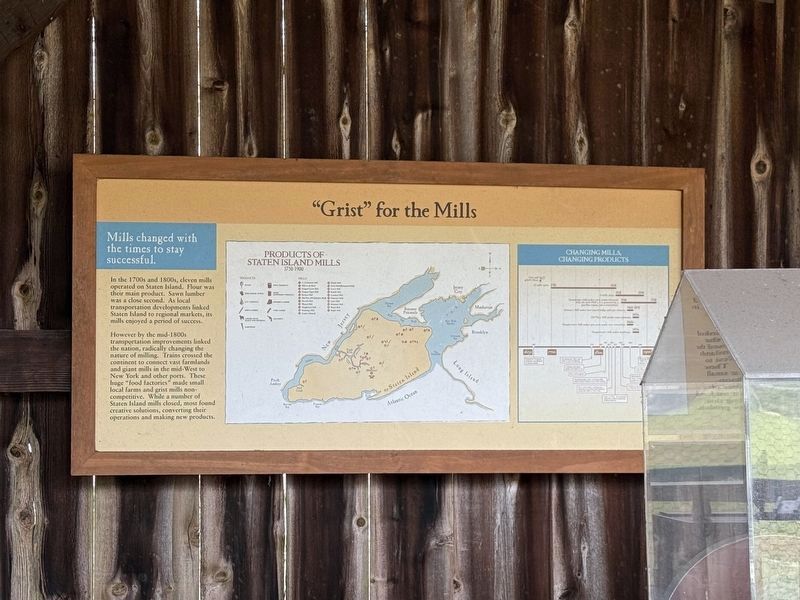
Mills changed with the times to stay successful.
In the 1700s and 1800s, eleven Mills operated on Staten Island. Flour was their main product. Sawn lumber was a close second. As local transportation developments linked Staten Island to regional markets, it's Mills enjoyed a period of success.
However by the mid-1800s transportation improvements linked the nation, radically changing the nature of milling. Trains crossed the continent to connect vast farmland and giant Mills in the mid-West to New York and other ports. These huge "food factories" made small local farms and grist mills non-competitive. While a number of Staten Island Mills closed, most found creative solutions, converting their operations and making new products.
Erected by New York State Council on the Arts.
Topics. This historical marker is listed in these topic lists: Agriculture • Industry & Commerce.
Location. 40° 34.339′ N, 74° 8.786′ W. Marker is on Staten Island, New York, in Richmond County. It is in Richmond. It is at the intersection of Richmond Road and Richmond Hill Road, on
this page online

Regionally, this marker is in New York City. It is also in the American Northeast, in the Mid-Atlantic, and on the Eastern Seaboard. Globally, it is in the North Atlantic Region, North America, the Western Hemisphere, the Western World, and the Anglosphere. Historically, it finds itself in what was once New Netherland and also one of the original Thirteen Colonies.
Other nearby markers. At least 8 other markers are within walking distance of this marker: Mills of Staten Island: Making Use of Natural Resources (here, next to this marker); Staten Island Connections (here, next to this marker); Where Does Your Grain Go? (here, next to this marker); Site of the Lighthouse Restaurant (within shouting distance of this marker); Site of 18th century structures (within shouting distance of this marker); St. Andrew’s Church (within shouting distance of this marker); Site of Richmond County Hall and the Parish House of St. Andrew's Church (within shouting distance of this marker); Treasure House (within shouting distance of this marker). Touch for a list and map of all markers in Staten Island.
Credits. This page was last revised on April 26, 2025. It was originally submitted on April 26, 2025, by Devry Becker Jones of Washington, District of Columbia. This page has been viewed 112 times since then and 10 times this year. Photo 1. submitted on April 26, 2025, by Devry Becker Jones of Washington, District of Columbia.
Editor’s want-list for this marker. A wide shot of the marker in context. • A transcription of the timeline on the right side of the marker. • Can you help?
