Latourette Park on Staten Island in Richmond County, New York — The American Northeast (Mid-Atlantic)
LaTourette Park in the Greenbelt
(859 acres)
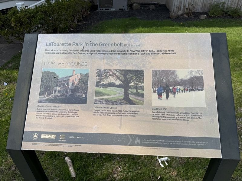
The LaTourette family farmed in this area until 1910, then sold the property to New York City in 1928. Today it is home to the popular LaTourette Golf Course, and provides easy access to Historic Richmond Town and the central Greenbelt.
Tour the Grounds
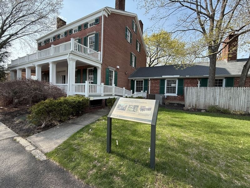
David LaTourette House
Built in 1836, this restored Greek revival manor house serves as the clubhouse for LaTourette Golf Course. Visitors can find an access point nearby for the Blue and Red Trails leading to Historic Richmond Town and the central Greenbelt.
LaTourette Golf Course
This golf course dates back to 1934. Rolling fairways and bucolic vistas attract golfers of all levels and make this one of New York City's most popular public golf courses.
Cold Feat 10K
Every February, the Greenbelt's annual Cold Feat 10K trail race starts and finishes on LaTourette Golf Course before heading into the surrounding Greenbelt trail system. The race takes place in all weather conditions.
🔥 A fire almost destroyed the David LaTourette House in July 2001. After an investigation, it was determined that the cause of the fire was a carelessly discarded cigarette.
Erected by NYC
this page online
Topics and series. This historical marker is listed in these topic lists: Architecture • Parks & Recreational Areas • Sports. In addition, it is included in the NYC Parks series list. A significant historical month for this entry is July 2001.
Location. 40° 34.565′ N, 74° 8.801′ W. Marker is on Staten Island, New York, in Richmond County. It is in Latourette Park. It is on Edinboro Road east of Richmond Hill Road, on the right when traveling west. Touch for map. Marker is at or near this postal address: 1001 Richmond Hill Rd, Staten Island NY 10306, United States of America. Touch for directions.

Regionally, this marker is in New York City. It is also in the American Northeast, in the Mid-Atlantic, and on the Eastern Seaboard. Globally, it is in the North Atlantic Region, North America, the Western Hemisphere, the Western World, and the Anglosphere. Historically, it finds itself in what was once New Netherland and also one of the original Thirteen Colonies.
Other nearby markers. At least 8 other markers are within walking distance of this marker: Church of Saint Andrew (approx.
Photographed by Devry Becker Jones (CC0), April 19, 2025
2. LaTourette Park in the Greenbelt Marker in front of the David LaTourette House
Credits. This page was last revised on April 26, 2025. It was originally submitted on April 26, 2025, by Devry Becker Jones of Washington, District of Columbia. This page has been viewed 190 times since then and 49 times this year. Photos: 1, 2. submitted on April 26, 2025, by Devry Becker Jones of Washington, District of Columbia.
