Mariners Harbor on Staten Island in Richmond County, New York — The American Northeast (Mid-Atlantic)
1776
⎯⎯⎯
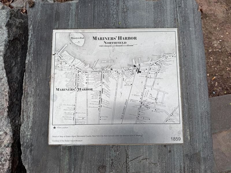
1859
⎯⎯⎯
1906

1776
Adapted detail of "A plan of New York Island, with part of Long Island, Staten Island & east New Jersey, with a particular description of the engagement on the Woody heights of Long Island, between Flatbush and Brooklyn, on the 27th of August 1776 between His Majesty's forces commanded by General Howe and the Americans under Major General Putnam, shewing [sic] also the landing of the British Army on New-York Island, and the taking of the city of New-York &c. on the 15th of September following, with the subsequent disposition of both the armies."
Courtesy of the Lionel Rincus and Princess Firyal Map Division, The New York Public Library
1859
Detail of "Map of Staten Island, Richmond County, New York City, from surveys under the direction of H. F. Walling."
Courtesy of the Staten Island Museum
1906
Adapted detail of "Borough of Richmond, Topographical Survey, Sheet No. 7 [Includes Shooter's Island and Mariner's Harbor.]"
Courtesy of the Staten Island Museum
Topics. This historical marker is listed in these topic lists: Notable Places • War, US Revolutionary • Waterways & Vessels. A significant historical date for this entry is August 27, 1776.
Location. 40° 38.222′ N,
this page online

Regionally, this marker is in New York City. It is also in the American Northeast, in the Mid-Atlantic, and on the Eastern Seaboard. Globally, it is in the North Atlantic Region, North America, the Western Hemisphere, the Western World, and the Anglosphere. Historically, it finds itself in what was once New Netherland and also one of the original Thirteen Colonies.
Other nearby markers. At least 8 other markers are within walking distance of this marker: Richmond Terrace Park (a few steps from this marker); Bobbie Lewis Jr. Playground (approx. 0.4 miles away); Recreation and Leisure (approx. half a mile away); Raising the Roadway (approx. half a mile away); Neighborhoods & People (approx. half a mile away); Designers and Engineers (approx. half a mile away); Port Richmond (approx.



Credits. This page was last revised on April 26, 2025. It was originally submitted on April 26, 2025, by Devry Becker Jones of Washington, District of Columbia. This page has been viewed 172 times since then and 44 times this year. Photos: 1, 2, 3, 4, 5, 6. submitted on April 26, 2025, by Devry Becker Jones of Washington, District of Columbia.
