Seminary Hill in Alexandria, Virginia — The American South (Mid-Atlantic)
Bombproof
Fort Ward Museum & Historic Site
| — | City of Alexandria, Virginia | — |

Two bombproofs, each measuring 200 feet long by 12.5 feet wide, were located in the center of Fort Ward. During normal operations, the bombproofs were used as meeting rooms, storage facilities, and sometimes as a prison. In the event of an attack, the structures provided temporary protection for the soldiers. Water was supplied by a well located between the bombproofs.
[Caption:]
The roof of a bombproof was constructed from logs that projected three feet over the entrance to the structure, forming a platform (banquette) on which infantrymen could stand to fire their muskets if the fort walls were scaled by an attacker.
Erected by City of Alexandria, Virginia.
Topics and series. This historical marker is listed in these topic lists: Forts and Castles • War, US Civil. In addition, it is included in the Defenses of Washington, and the Virginia, The City of Alexandria series lists.
Location. 38° 49.798′ N, 77° 6.129′ W. Marker is in Alexandria, Virginia. It is in Seminary Hill. It can be reached from West Braddock Road east of North Howard Street, on the right
this page online

Regionally, this marker is in the Washington Metropolitan Area and in Northern Virginia. It is also in the American South, specifically in the Upper South, in the Mid-Atlantic, and on the Eastern Seaboard. Globally, it is in the North Atlantic Region, North America, the Western Hemisphere, the Western World, and the Anglosphere. Historically, it finds itself in what was once the territory of the Mississippian Culture, one of the original Thirteen Colonies, one of the Confederate States of America, and the Antebellum South.
Other nearby markers. At least 8 other markers are within walking distance of this marker: From Fort to Community (a few steps from this marker); a different marker also named Fort Ward (within shouting distance of this marker); Jackson Cemetery Memorial (within shouting distance of this marker); Jackson Cemetery (within shouting distance of this marker); Welcome to Historic Fort Ward Park (within shouting distance of this marker);

Other markers no longer nearby. Bombproof (was a few steps from this marker but has been replaced with another marker now near it); Fort Ward (was within shouting distance of this marker but has been replaced with another marker now near it); a different marker also named Fort Ward (was within shouting distance of this marker but has been permanently removed); Entrance Gate to Fort Ward / Officers' Hut (was within shouting distance of this marker but has been replaced with another marker now near it); Powder Magazine and Filling Room (was within shouting distance of this marker but has been replaced with another marker now near it).
Related marker. Click here for another marker that is related to this marker. This marker has replaced the linked marker.
Photographed by Evan Dwyer, January 17, 2026
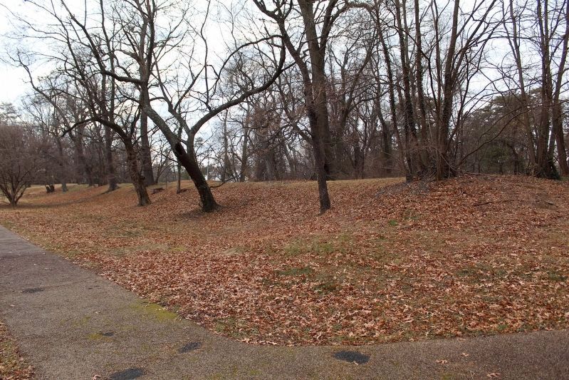
3. Bombproof No. 1
The long, low mound to the left of the marker is Bombproof No. 1. This view looks southwest from the marker's position.
Photographed by Evan Dwyer, January 17, 2026
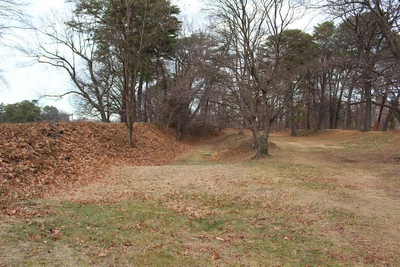
4. Bombproof No. 2
This view, facing due north, shows Bombproof No. 2. The ditch at center would have been the floor of the bombproof; once the logs that held up the earthen roof either collapsed from rot or were dismantled for lumber, the roof would have caved into the pit/depression dug to serve as the bombproof's interior. Reference the cross section on the marker. The remaining mound is the protective earthen berm on the face of the bombproof, intended to catch and stop incoming artillery projectiles. The roof collapse and decades of erosion created the slope that leads to the interior now.
Credits. This page was last revised on April 2, 2026. It was originally submitted on April 26, 2025, by Devry Becker Jones of Washington, District of Columbia. This page has been viewed 157 times since then and 23 times this year. Photos: 1, 2. submitted on April 26, 2025, by Devry Becker Jones of Washington, District of Columbia. 3, 4. submitted on March 30, 2026, by Evan Dwyer of Richmond, Virginia.
