Seminary Hill in Alexandria, Virginia — The American South (Mid-Atlantic)
Fort Ward
1861 - 1865
Fort Ward Museum & Historic Site
| — | City of Alexandria, Virginia | — |
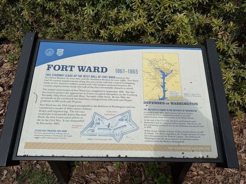
This stairway leads up the west wall of Fort War between the Northwest Bastion (to your left) and the Southwest Bastion (to your right). Fort Ward had 14 cannon emplacements along this area of the wall that created overlapping fields of fire. Infantry soldiers armed with rifle muskets stationed between the cannon emplacements made this will of the fort a formidable obstacle to attack.
The initial construction of Fort Ward was completed in September 1861. The fort was used to protect the approaches to Union occupied Alexandria via the Leesburg Turnpike (King Street) and Little River Turnpike (Duke Street). By late 1864, the perimeter of the earthwork fort had been enlarged from 540 yards and 24 gun positions to 818 yards and 36 guns.
Fort Ward was the fifth largest stronghold in the Defenses of Washington and was considered a model of 19th-century military design and engineering. The fort was named for Commander James Harmon Ward, the first Union naval officer to die in the Civil War. It was dismantled by December 1865.
Please help preserve Fort Ward for future generations by walking only on designated pathways. Climbing on the fragile earthen walls is detrimental to the fort.
[Sidebar:]
Defenses of Washington
The only battle fought in the Defenses of Washington
this page online
At the end of the Civil War, the forts and batteries were dismantled and the material sold at auction. Fort Foote, the last remaining earthwork fort in the Defenses, was deactivated in 1878.
Today, extant remains of many of these fortifications can still be found. The above map shows the 37-mile network of Union forts that protected the Federal Capital. The Defenses of Washington was the most extensive fortification system constructed in the Western Hemisphere.
Erected by City of Alexandria, Virginia.
Topics and series. This historical marker is listed in these topic lists: Forts and Castles • War, US Civil. In addition, it is included in the Defenses of Washington, and the Virginia, The City of Alexandria series lists. A significant historical month for this entry is July 1864.
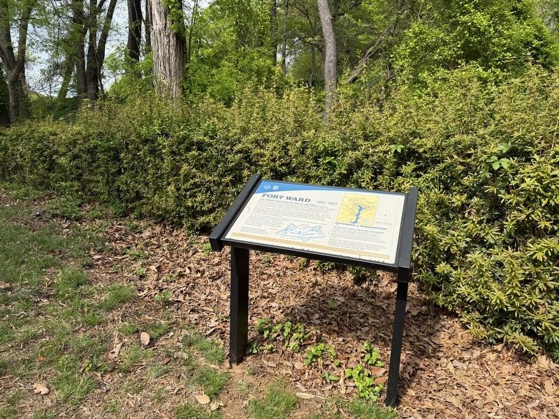
Location. 38° 49.809′ N, 77° 6.155′ W. Marker is in Alexandria, Virginia. It is in Seminary Hill. It can be reached from West Braddock Road east of North Howard Street, on the right when traveling

Regionally, this marker is in the Washington Metropolitan Area and in Northern Virginia. It is also in the American South, specifically in the Upper South, in the Mid-Atlantic, and on the Eastern Seaboard. Globally, it is in the North Atlantic Region, North America, the Western Hemisphere, the Western World, and the Anglosphere. Historically, it finds itself in what was once the territory of the Mississippian Culture, one of the original Thirteen Colonies, one of the Confederate States of America, and the Antebellum South.
Other nearby markers. At least 8 other markers are within walking distance of this marker: Jackson Cemetery Memorial (a few steps from this marker); Jackson Cemetery (within shouting distance of this marker); From Fort to Community (within shouting distance of this marker); a different marker also named Bombproof (within shouting distance of this marker); Powder Magazine and Filling Room (within shouting distance of this marker); Northwest Bastion
Photographed by Evan Dwyer, January 17, 2026
3. Fort Ward Marker
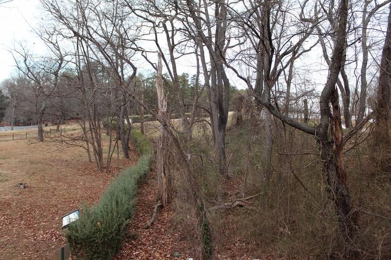
Marker is at lower left by the hedges. The Northwest bastion of Fort Ward is visible extending to the right.
Other markers no longer nearby. Fort Ward (has been replaced with this marker); Bombproof (was within shouting distance of this marker but has been replaced with another marker now near it); a different marker also named Powder Magazine and Filling Room (was within shouting distance of this marker but has been replaced with another marker now near it); a different marker also named Northwest Bastion (was within shouting distance of this marker but has been replaced with another marker now near it); a different marker also named Southwest Bastion (was about 300 feet away but has been permanently removed); Entrance Gate to Fort Ward / Officers' Hut (was about 300 feet away but has been replaced with another marker now near it); a different marker also named Fort Ward (was about 300 feet away but has been permanently removed).
Credits. This page was last revised on April 2, 2026. It was originally submitted on April 26, 2025, by Devry Becker Jones of Washington, District of Columbia. This page has been viewed 183 times since then and 21 times this year. Photos: 1, 2. submitted on April 26, 2025, by Devry Becker Jones of Washington, District of Columbia. 3. submitted on March 30, 2026, by Evan Dwyer of Richmond, Virginia.
