Dodge City in Ford County, Kansas — The American Midwest (Upper Plains)
Robert M. Wright
Photographed by Cosmos Mariner, August 20, 2022
1. Robert M. Wright Marker
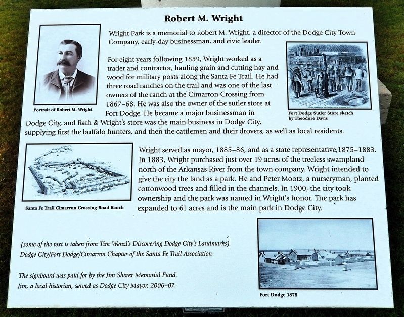
Wright Park is a memorial to Robert M. Wright, a director of the Dodge City Town Company, early-day businessman, and civic leader.
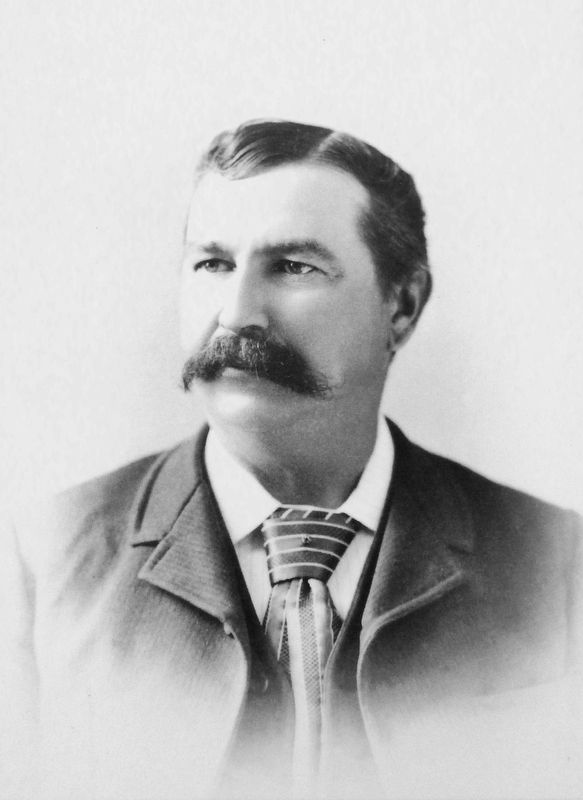
For eight years following 1859, Wright worked as a trader and contractor, hauling grain and cutting hay and wood for military posts along the Santa Fe Trail. He had three road ranches on the trail and was one of the last owners of the ranch at the Cimarron Crossing from 1867-68. He was also the owner of the sutler store at Fort Dodge. He became a major businessman in Dodge City, and Rath & Wright's store was the main business in Dodge City, supplying first the buffalo hunters, and then the cattlemen and their drovers, as well as local residents.
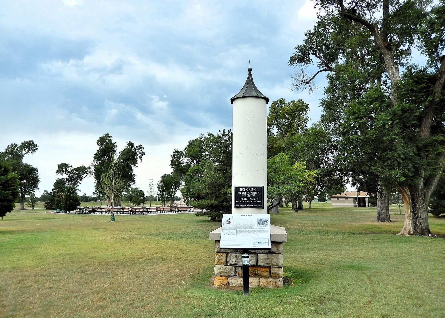
Wright served as mayor, 1885-86, and as a state representative, 1875-1883. In 1883, Wright purchased just over 19 acres of the treeless swampland north of the Arkansas River from the town company. Wright intended to give the city the land as a park. He and Peter Mootz, a nurseryman, planted cottonwood trees and filled in the channels. In 1900, the city took ownership and the park was named in Wright's honor. The park has expanded to 61 acres and is the
this page online
(some of the text is taken from Tim Wenzl's Discovering Dodge City's Landmarks)
Dodge City/Fort Dodge/Cimarron Chapter of the Santa Fe Trail Association
The signboard was paid for by the Jim Sherer Memorial Fund.
Jim, a local historian, served as Dodge City Mayor, 2006-07.
Topics and series. This historical marker is listed in these topic lists: Forts and Castles • Industry & Commerce • Parks & Recreational Areas • Settlements & Settlers. In addition, it is included in the Santa Fe Trail series list. A significant historical year for this entry is 1883.
Location. 37° 44.942′ N, 100° 1.238′ W. Marker is in Dodge City, Kansas, in Ford County. It can be reached from the intersection of North 2nd Avenue and Kerri Drive, on the right when traveling south. The marker is located in Wright Park, just inside the east entrance from North 2nd Avenue. Touch for map. Marker is at or near this postal address: 71 North 2nd Avenue, Dodge City KS 67801, United States of America. Touch for directions.

Regionally, this marker is in the American Midwest, in the Corn Belt, on the prairies, on the Great Plains, on
2. Marker detail: Robert M. Wright
Other nearby markers. At least 8 other markers are within walking distance of this marker: Liberty Garden (within shouting distance of this marker); Santa Fe Trail (within shouting distance of this marker); George M. Hoover (about 300 feet away, measured in a direct line); Dodge City Swimming Pool History (about 600 feet away); Boot Hill Cemetery (approx. ¼ mile away); El Capitan (approx. ¼ mile away); Rosemary & Lewis Mock (approx. ¼ mile away); Dodge City, a frontier legend (approx. 0.3 miles away). Touch for a list and map of all markers in Dodge City.
Related markers. Click here for a list of markers that are related to this marker. Robert M. Wright
Also see . . .
1. Robert M. Wright, 1840-1915.
(by George Laughead) Excerpt: Few cities were founded by a man with the background of Dodge(Submitted on April 27, 2025, by Cosmos Mariner of Cape Canaveral, Florida.)City's own Town President, Robert M. Wright. With a family that included a clerk of the U.S. Supreme Court, and a president of the Continental Congress, Wright came west at age 16 to make his mark on the world. He married his 13-year old first cousin, Alice, when he was 19. Wright rose from bullwhacker -- freight wagon driver -- to owner of the largest commercial empire in the area, making and losing a fortune on the cattle trade, starting trails and towns. By the time in 1872 that he owned a general store in Dodge City, Wright was making huge amounts of money from the Santa Fe Trail, buffalo hunter, and cattle trade.Sketch by Theodore R. Davis3. Marker detail: Sutler’s store at Fort Dodge

2. Wright Park — Santa Fe National Historic Trail (National Park Service).
Excerpt: Wright Park memorializes the name Robert M. Wright, a director of the Dodge City Town Company, early day businessman and civic leader.(Submitted on April 27, 2025, by Cosmos Mariner of Cape Canaveral, Florida.)
3. Early Ford County (Ford County Historical Society).
Excerpt: A plat of Dodge City was filed with the register of deeds(Submitted on April 27, 2025, by Cosmos Mariner of Cape Canaveral, Florida.)May 31, 1876, which showed the Wright Park area, divided into streets and lots. Water Street was along the River bank. The north-south streets were Second, Third, Fourth, and Fifth avenues as they are at this time. Now Water Street is to the east and north of its old location. Maple Street is still in the same location. Pine Street has become a part of Wright Park and Vandever Street has been changed to Mulberry Street. Today Wright Park brings many pleasure seekers for outings, especially family gatherings. 4. Marker detail: Cimarron Crossing Road Ranch
Santa Fe Trail

5. Marker detail: Fort Dodge, 1878

Photographed by Cosmos Mariner, August 20, 2022
6. Robert M. Wright & Peter Mootz Memorial Plaque
Photographed by Cosmos Mariner, August 20, 2022
7. Robert M. Wright Marker
The marker is located near the northeast corner of Wright Park.
Credits. This page was last revised on August 22, 2026. It was originally submitted on April 27, 2025, by Cosmos Mariner of Cape Canaveral, Florida. This page has been viewed 166 times since then and 46 times this year. Photos: 1, 2, 3, 4, 5, 6, 7. submitted on April 27, 2025, by Cosmos Mariner of Cape Canaveral, Florida.
