Lebanon in Laclede County, Missouri — The American Midwest (Upper Plains)
Lebanon
Drive in Our Town, Your Town
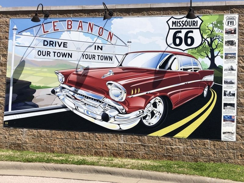
Photographed by Duane and Tracy Marsteller, April 7, 2025
1. Lebanon Marker
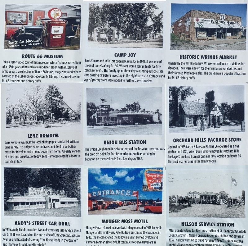
Route 66 Museum
Take a self-guided tour of this museum, which features recreations of a 1950s gas station and a classic diner, along with displays of antique cars, a collection of Route 66 books, magazines and videos. Located at the Lebanon-Laclede County Library. It's a must see for Rt. 66 travelers and history buffs.
Camp Joy
Emis Spears and wife Lois opened Camp Joy in 1927. It was one of the first motels along Rt. 66. Visitors would stay in tents for fifty cents per night. The family spent three days counting out-of-state cars passing by before investing in the eight-acre site. Cottages and a gas/grocery store were added to further serve travelers.
Historic Wrinks Market
Owned by the Wrinkle family. Wrinks served lunch to visitors for decades. They were known for their signature sandwiches and their famous fried apple pies. The building is a popular attraction for Rt. 66 history buffs.
Lenz Homotel
Lenz Homotel was built by local photographer and artist William Lenz in 1932. Its unique name indicates an intent to
this page online
Union Bus Station
The Union Greyhound bus station served the Lebanon area and was the drop off point for Fort Leonardwood soldiers coming to Lebanon on the weekends for a few days of R&R.
Orchard Hills Package Store
Opened in 1935 Carter & Lawson Phillips 66 operated as a gas station until 1971, when Dean Elmore moved his Orchard Hills Package Store here from its original 1946 location on Route 66. The business remains in the family today.
Andy's Street Car Grill
In 1946, Andy Liebl converted two old streetcars into Andy's Street Car Grill. It was located on the north side of Elm Street at Jackson Avenue and boasted of serving “the finest foods in the Ozarks” and “famous fried domestic rabbit.”
Munger Moss Motel
Munger Moss referred to a sandwich shop opened in 1936 by Nellie Munger and Emmit Moss. Pete Hudson purchased the business in 1945. The motel opened the following year. Owned by Bob and Ramona Lehman since 1971, it continues to serve travellers
Photographed by Duane and Tracy Marsteller, April 6, 2025
2. Lebanon Marker (detail)
Composite photograph of the text blocks down the right side of the mural. Click on photo for a larger view.
Nelson Service Station
After donating land for the construction of Rt. 66 through Laclede County, Arthur T. Nelson opened his service station and tavern in 1931. Nelson went on to build “Dream Village”, a stone cottage motel village popular with travellers from around the country.
Topics and series. This historical marker is listed in these topic lists: Education • Industry & Commerce • Roads & Vehicles. In addition, it is included in the U.S. Route 66 series list. A significant historical year for this entry is 1927.
Location. 37° 40.185′ N, 92° 39.922′ W. Marker is in Lebanon, Missouri, in Laclede County. It can be reached from Kent Drive east of West Elm Street (U.S. 66). Mural is in Boswell Park, on a parallel side street next to West Elm Street/U.S. Route 66. Touch for map. Marker is at or near this postal address: 679 W Elm St, Lebanon MO 65536, United States of America. Touch for directions.

Regionally, this marker is in South-Central Missouri. It is also in the American Ozarks, in the Lewis & Clark Corridor, and in the Corn Belt. Globally, it is in North America, the Western Hemisphere, the Western World, and the Anglosphere. Historically, it finds itself in what was once the territory of the Mississippian Culture, the Louisiana Purchase, and the Antebellum South.
Other nearby markers. At least 8 other markers are within walking distance of this marker: Nelson Family Legacy (within shouting distance of this marker); Laclede County (within shouting distance of this marker); Camp Joy (about 300 feet away, measured in a direct line); Ralph E. Burley House (approx. 0.7 miles away); “Stormin’ Norman Pipeline” (approx. 0.8 miles away); Veterans Memorial (approx. 0.8 miles away); War Memorial (approx. 0.8 miles away); Eleanor Briggans Ford 1920-1991 (approx. 0.9 miles away). Touch for a list and map of all markers in Lebanon.
Also see . . . Route 66: The Mother Road. Lebanon was an important stop on Route 66, and it provided the road services that tourists sought (City of Lebanon, Mo. Tourism Department) (Submitted on April 28, 2025, by Duane and Tracy Marsteller of Murfreesboro, Tennessee.)
Credits. This page was last revised on April 28, 2025. It was originally submitted on April 28, 2025, by Duane and Tracy Marsteller of Murfreesboro, Tennessee. This page has been viewed 182 times since then and 42 times this year. Photos: 1, 2. submitted on April 28, 2025, by Duane and Tracy Marsteller of Murfreesboro, Tennessee.
