Trevilians in Louisa in Louisa County, Virginia — The American South (Mid-Atlantic)
Battle of Trevilian Station
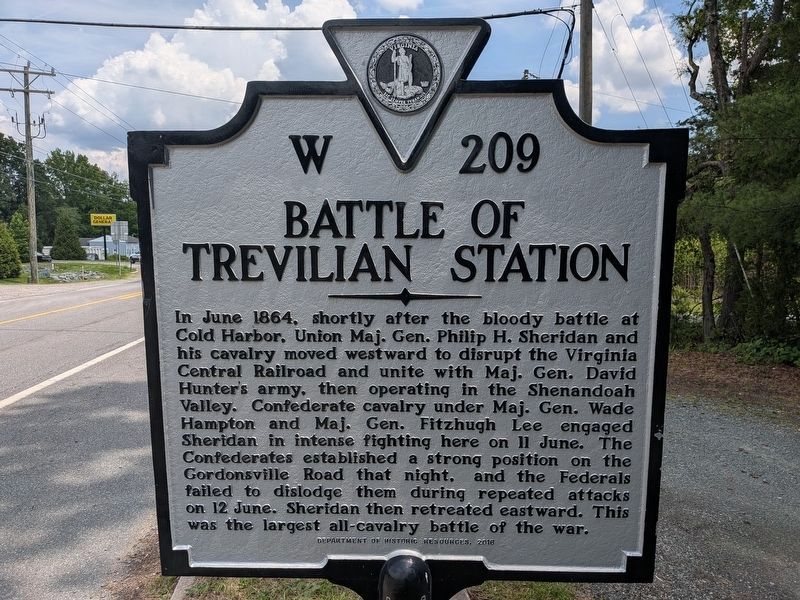
Photographed by Evan Dwyer, June 11, 2026
1. Battle of Trevilian Station Marker
Erected 2016 by Virginia Department of Historical Resources. (Marker Number W-209.)
Topics and series. This historical marker is listed in this topic list: War, US Civil. In addition, it is included in the Virginia Department of Historic Resources (DHR) series list. A significant historical date for this entry is June 11, 1864.
Location. 38° 3.084′ N, 78° 4.588′ W. Marker is in Louisa, Virginia, in Louisa County. It is in Trevilians. It is at the intersection of Louisa Road (U.S. 33) and Trevilians Square,
this page online

Regionally, this marker is in the Piedmont and in Central Virginia. It is also in the American South and specifically in the Upper South. Globally, it is in North America, the Western Hemisphere, the Western World, and the Anglosphere. Historically, it finds itself in what was once the territory of the Mississippian Culture, one of the original Thirteen Colonies, one of the Confederate States of America, and the Antebellum South.
Other nearby markers. At least 8 other markers are within 3 miles of this marker, measured as the crow flies: Battle of Trevillians (here, next to this marker); Custer's First Last Stand (about 700 feet away); Custer Rescued (about 800 feet away); Railroad Rails (approx. 0.2 miles away); The Netherland's Tavern (approx. 0.9 miles away); Netherland Tavern (approx. one mile away); Ogg Farm (approx. 1½ miles away); Bibb's Crossroads (approx. 2.9 miles away). Touch for a list and map of all markers in Louisa.
Other markers no

Photographed by Mike McKeown
2. Battle of Trevilian Station Marker
View northwest from the roadside pull-off.
Regarding Battle of Trevilian Station. This is one of several markers interpreting the Battle of Trevilian Station, June 11-12, 1864. See the Battle of Trevilian Station Virtual Tour by Markers linked below for additional related markers.
Related marker. Click here for another marker that is related to this marker. Old Marker At This Location titled "Battle of Trevilians"
Also see . . .
1. American Battlefield Trust - Trevilian Station. An authoritative source for information on the battle and battlefield preservation. (Submitted on August 15, 2026, by Evan Dwyer of Richmond, Virginia.)
2. Trevilian Station Battlefield Foundation. The TSBF has worked to preserve core areas of the Trevilian Station Battlefield, including the C.G. Trevilian House, which is open for tours seasonally, and a replica of the Netherland Tavern where an annual dinner is hosted. The website
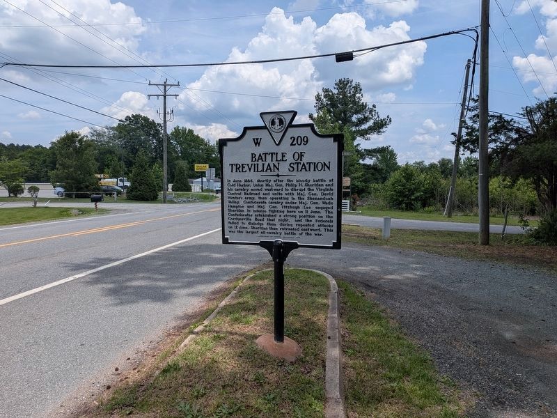
Photographed by Evan Dwyer, June 11, 2026
3. Battle of Trevilian Station Marker
View looking east
3. Original Trevilian Station Location. A summary of Eric J. Wittenberg's consideration on the depot's original site. (Submitted on August 12, 2026, by Evan Dwyer of Richmond, Virginia.)
4. Battle of Trevilian Station Virtual Tour by Markers. A set of markers that document the Battle of Trevilian Station, June 11-12, 1864. The order of appearance is generally aligned to the Trevilian Station Battlefield Foundation driving tour, with accommodations made for convenience both in the town of Louisa at the beginning of the tour, and on the eastbound side of Route 33 headed back towards the cemetery. Because the C.G. Trevilian House at the 'modern' station does not have its own marker, reviewing this database for accompanying information when reading about the railroad tracks there is recommended for added interpretive value. (Submitted on August 15, 2026, by Evan Dwyer of Richmond, Virginia.)
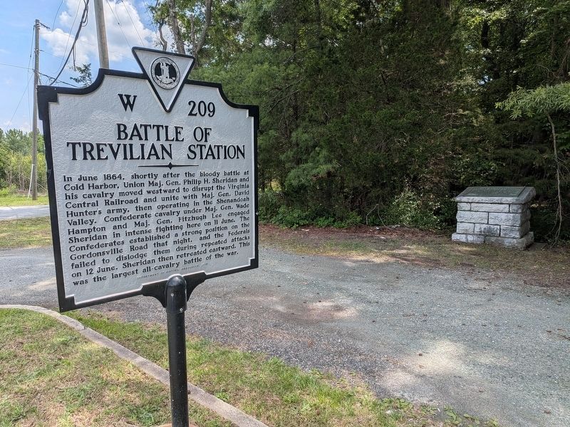
Photographed by Evan Dwyer, June 11, 2026
4. Battle of Trevilian Station Marker
The old United Daughters of the Confederacy marker mimicking Richmond's "Freeman" style pedestal-mounted roadside tablets is in the same pull-off.
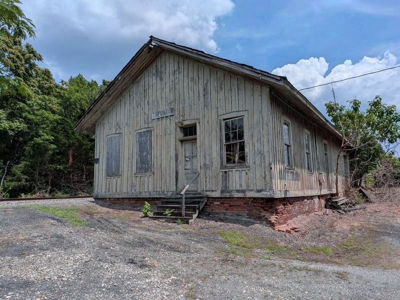
Photographed by Evan Dwyer, June 11, 2026
5. Trevilian Station
This old Chesapeake & Ohio Railroad Depot stands about 1,000 feet east of the marker, at the end of Danne Road. Built after the Civil War (1870, according to the Chesapeake & Ohio Historical Society - but remodeled in 1931), this building is at least the third - if not the fourth - "Trevilian Station." The modern hamlet of Trevilians formed around this particular station and the nearby Charles Goodall Trevilian House, itself a much earlier structure with a construction date of 1846. The original location of the depot - i.e., the Civil War location - is thought by the late historian Eric J. Wittenberg to have been a mile east, by Netherlands Tavern. It was destroyed twice, both in 1863 and 1864, and a late-war rebuild was likely on the north side of the tracks from the later depot seen here. A foundation of a station building similar in size to this one was still visible north of the tracks in aerial photographs from the late 1950s.
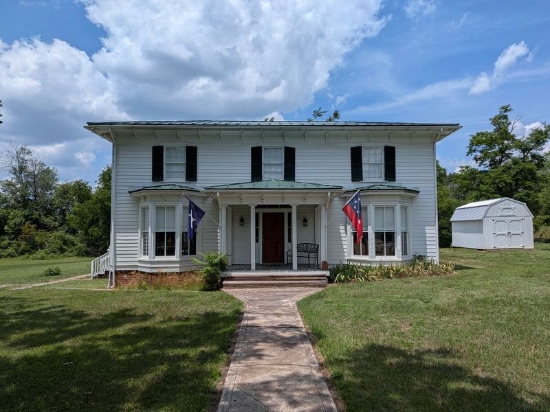
Photographed by Evan Dwyer, June 11, 2026
6. Charles Goodall Trevilian House
The Trevilian name comes from the Trevilian family - this 1846 house, where Custer slept on the porch between the 1st and 2nd days of the Battle of Trevilian's Station, is the oldest structure in Trevilians today. The old village post office, essentially a shack, is in the front yard out of sight to the right. The depot shown in the previous photograph is behind the photographer. The Trevilian House is open for tours seasonally by the Trevilian Station Battlefield Foundation, generally 10-2 every Thursday and the third Sunday of each month from April through October. The foundation's Facebook page is where hours are kept current.

Photographed by Evan Dwyer, June 11, 2026
7. Battle of Trevilian Station Exhibit
At the Louisa County History Museum, including a summary and artifacts recovered (legally) from the battlefield.
Credits. This page was last revised on August 18, 2026. It was originally submitted on April 28, 2025, by Mike McKeown of Baltimore, Maryland. This page has been viewed 380 times since then and 61 times this year. Photos: 1. submitted on August 12, 2026, by Evan Dwyer of Richmond, Virginia. 2. submitted on April 28, 2025, by Mike McKeown of Baltimore, Maryland. 3, 4, 5, 6, 7. submitted on August 12, 2026, by Evan Dwyer of Richmond, Virginia. • Bernard Fisher was the editor who published this page.
