
Church Ground in Figtree Parish, Nevis, Saint Kitts and Nevis — Caribbean Region of the Americas (Lesser Antilles in the West Indies)
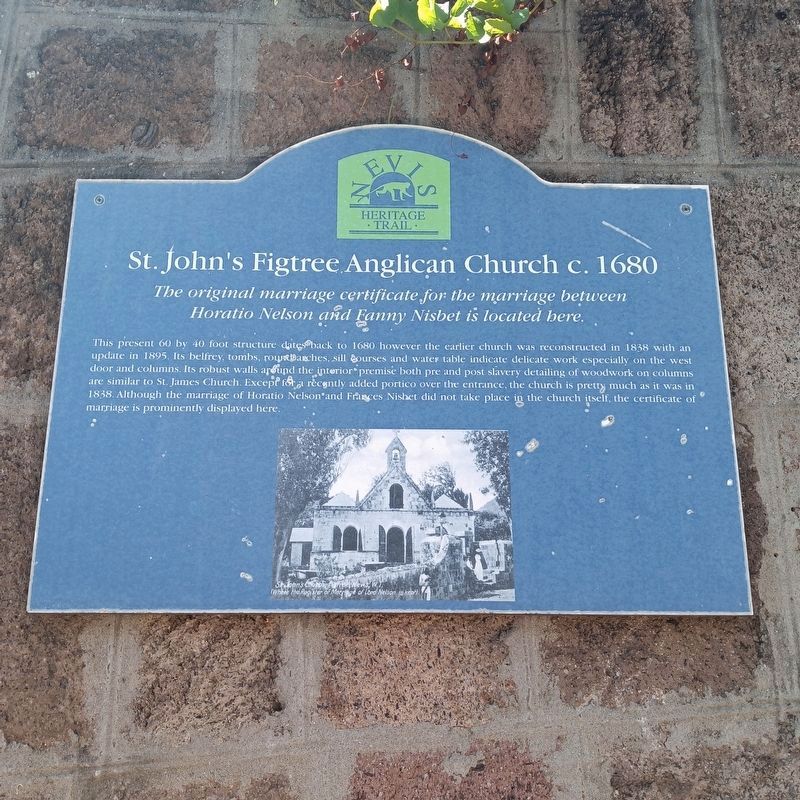
St. John's Figtree Anglican Church c.1680
Nevis Heritage Trail
Photographed by Judith Elizabeth Pearson, March 9, 2025
1. St.John's Figtree Anglican Church c.1680 Marker

The original marriage certificate for the marriage between Horatio Nelson and Fanny Nisbett is located here.
This present 40 by 60 foot structure dates back to 1680 however the earlier church was reconstructed in 1838 with an update in 1895. Its belfry, tombs, round arches, sill courses and water table indicate delicate work especially on the west door and columns. Its robust walls around the interior premise both pre and post slavery detailing of woodwork on columns are similar to St. James Church. Except for a recently added portico over the entrance, the church is pretty much as it was in 1838. Although the marriage of Horatio Nelson and Frances Nisbett did not take place in the church itself, the certificate of marriage is permanently displayed here.
Erected by Nevis Heritage Trail and the Nevis Historical and Conservation Society.
Topics. This historical marker is listed in these topic lists: Colonial Era • Religion & Religious Structures. A significant historical date for this entry is March 11, 1787.
Location. 17° 7.843′ N, 62° 36.056′ W. Marker is in Church Ground, Nevis, in Figtree Parish. It is on Main Island
this page online

Regionally, it is one of the Lesser Antilles on the Caribbean Sea, on in the Atlantic Ocean, in North America, in the Western Hemisphere, and in the Anglosphere. Historically, it finds itself in what was once a British colony.
Other nearby markers. At least 8 other markers are within 23 kilometers of this marker, measured as the crow flies: Alexander Hamilton (approx. 3.2 kilometers away); Landing of Virginia Settlers (approx. 3.2 kilometers away); Alexander Hamilton: Founding Father of the United States (approx. 3.2 kilometers away); The Alexander Hamilton Statue Project (approx. 3.2 kilometers away); Dedicated to the People of Nevis (approx. 3.2 kilometers away); Alexander Hamilton: Citizen of the Caribbean (approx. 3.2 kilometers away); Alexander Hamilton: Son of Nevis (approx. 3.2 kilometers away); The Judicial and Legal Complex (approx. 22.4 kilometers away in Saint Kitts).
More about this marker. The Nelson Nisbet "marriage certificate" is actually an entry in the historic church
From Wikipedia
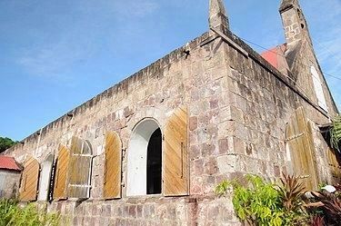
2. St. John's Figtree Anglican Church
Regarding St. John's Figtree Anglican Church c.1680. Nearby historical sites include the Museum of Nevis History and the early 19th century Bath Hotel. The nearby Nevis Maritime Museum is scheduled to open in 2025.
Photographed by Judith Elizabeth Pearson, January 9, 2024
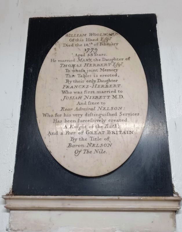
3. Memorial tablet ordered by Frances Nisbet Nelson in memory of her parents
This memorial tablet mentions William and Mary Woolward (her deceased parents), her deceased first husband (Josiah Nisbet, MD), and Horatio Nelson's status as a Knight of the Bath following his victory at the Battle of the Nile in 1798. This tablet is on an interior wall of the church, to the right of the altar.
Credits. This page was last revised on May 1, 2025. It was originally submitted on April 13, 2025, by Judith Elizabeth Pearson of Burke, Virginia. This page has been viewed 1,376 times since then and 87 times this year. Last updated on April 28, 2025, by Judith Elizabeth Pearson of Burke, Virginia. Photos: 1, 2, 3. submitted on April 13, 2025, by Judith Elizabeth Pearson of Burke, Virginia. • J. Makali Bruton was the editor who published this page.
