London in Laurel County, Kentucky — The American South (East South Central)
Wilderness Road Inn
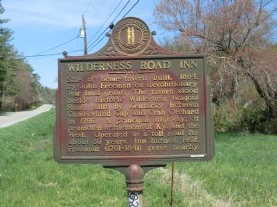
Photographed by Don Morfe, April 16, 2014
1. Wilderness Road Inn Marker
Erected 1966 by Kentucky Historical Society-Kentucky Department of Highways. (Marker Number 927.)
Topics and series. This historical marker is listed in these topic lists: Industry & Commerce • Roads & Vehicles • Settlements & Settlers. In addition, it is included in the Kentucky Historical Society series list. A significant historical year for this entry is 1804.
Location. 37° 4.368′ N, 84° 2.316′ W. Marker is in London, Kentucky, in Laurel County. It is on Barbourville Road (Kentucky Route 229). Touch for map. Marker is in this post office area: London KY 40744, United States of America. Touch for directions.

Regionally, this marker is in Eastern Kentucky and in the Cumberland Plateau. It is also in the American South, specifically in the
this page online
Other nearby markers. At least 8 other markers are within 2 miles of this marker, measured as the crow flies: CSA Returns to Tenn. (approx. 0.3 miles away); Levi Jackson Historic Stump (approx. 1.1 miles away); Laurel County (approx. 1.1 miles away); Defeated Camp Burial Ground (approx. 1.1 miles away); McNitt's Defeat (approx. 1.1 miles away); Daniel Boone's Trail (approx. 1.1 miles away); Where did Millstones Come From? (approx. 1.2 miles away); Dressing a Millstone (approx. 1.2 miles away). Touch for a list and map of all markers in London.
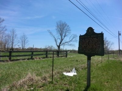
Photographed by Don Morfe, April 16, 2014
2. Wilderness Road Inn Marker
Credits. This page was last revised on April 30, 2025. It was originally submitted on May 23, 2014, by Don Morfe of Baltimore, Maryland. This page has been viewed 1,416 times since then and 86 times this year. Last updated on April 29, 2025, by Carl Gordon Moore Jr. of North East, Maryland. Photos: 1, 2. submitted on May 23, 2014, by Don Morfe of Baltimore, Maryland. • James Hulse was the editor who published this page.
