Near Moab in Grand County, Utah — The American Mountains (Southwest)
Camping at Courthouse Rock
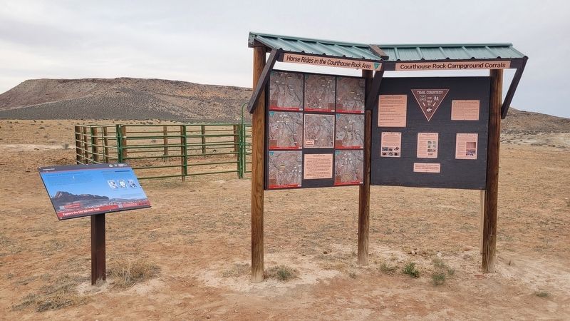
Explore the Old Spanish Trail

Photographed by James Hulse, March 31, 2025
1. Camping at Courthouse Rock Marker
The Elk Mountain Mission
In 1855, a hand-picked group of 53 men chosen by Latter-day Saint leader Brigham Young traveled through here on the Old Spanish Trail and camped at Courthouse Rock. Those who scouted for them earlier in the fall of 1854 hired a Ute guide and interpreter named Sun Cloud. This venture to settle Spanish Valley (present-day Moab) is the earliest record we have of wheeled vehicles being used on this portion of the Old Spanish Trail.
You are not the first to stay here. Native Americans and Old Spanish Trail traders camped here because of the water, fuel, and protection this place provided. Why did you choose this
this page online
Captions
(Photo #1) Levi Gregory Metcalf, Mission guide
(Photo #2) Alfred Billings, Mission president
(Photo #3) William Dresser Huntington, 1854 Expedition leader
Erected by Courthouse Rock, National Conservation Lands, National System of Public Lands, U.S. Department of the Interior, Bureau of Land Management.
Topics. This historical marker is listed in these topic lists: Exploration • Parks & Recreational Areas. A significant historical year for this entry is 1855.
Location. 38° 43.228′ N, 109° 44.106′ W. Marker is near Moab, Utah, in Grand County. It is on Cotter Mine Road (County Road BLM 215) 0.2 miles south of Mill Canyon Road, on the right when traveling south. The marker is located at the parking lot for the Mill Canyon Dinosaur Tracksite and Campsite. Touch for map. Marker is in this post office area: Moab UT 84532, United States of America. Touch for directions.

Regionally, this marker is in Canyon Country. It is also in the American Mountain West, on the Colorado Plateau, and at the Four Corners. Globally, it is in North America, the Western Hemisphere, the Western World, and the Anglosphere.

Photographed by James Hulse, March 31, 2025
2. Camping at Courthouse Rock Marker
Other nearby markers. At least 8 other markers are within walking distance of this marker: Crocodile Slide (approx. 0.2 miles away); Dromaeosaur Tracks (approx. 0.2 miles away); Medium-size Theropod Tracks (approx. 0.2 miles away); Large Theropod Tracks (approx. 0.2 miles away); Sauropod Tracks (approx. 0.2 miles away); Algae (approx. 0.2 miles away); Ornithopod Tracks (approx. 0.2 miles away); Sauropods or Ankylosaurs? (approx. 0.2 miles away). Touch for a list and map of all markers in Moab.

Photographed by James Hulse, March 31, 2025
3. The wide view of the Camping at Courthouse Rock area and Marker
Credits. This page was last revised on April 29, 2025. It was originally submitted on April 29, 2025, by James Hulse of Medina, Texas. This page has been viewed 108 times since then and 16 times this year. Photos: 1, 2, 3. submitted on April 29, 2025, by James Hulse of Medina, Texas.
