Near Moab in Grand County, Utah — The American Mountains (Southwest)
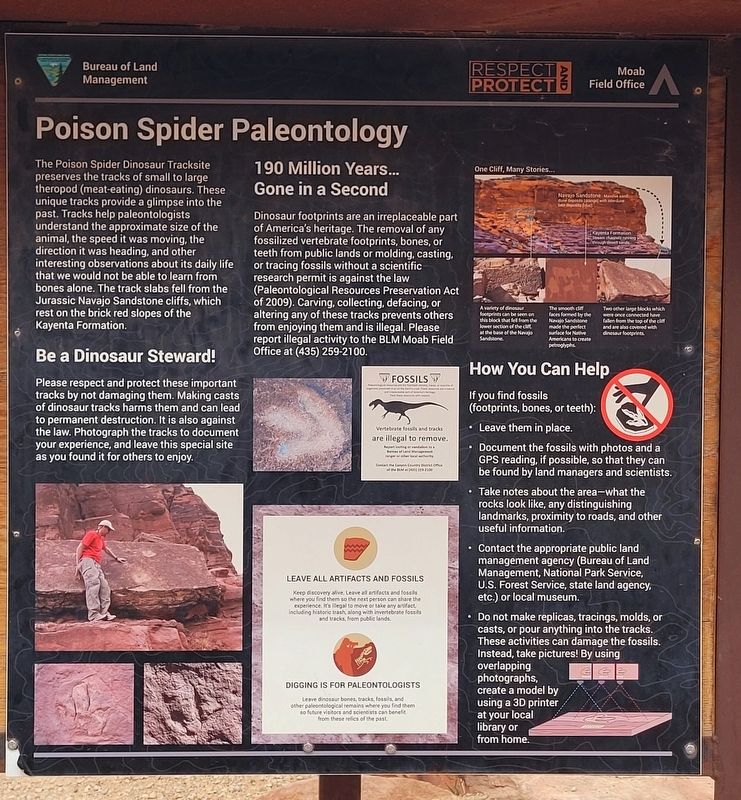
Poison Spider Paleontology
Photographed by James Hulse, March 31, 2025
1. Poison Spider Paleontology Marker
Be a Dinosaur Steward!
Please respect and protect these important tracks by not damaging them. Making casts of dinosaur tracks harms them and can lead to permanent destruction. It is also against the law. Photograph the tracks to document your experience, and leave this special site as you found it for others to enjoy.
190 Million Years... Gone in a Second
Dinosaur footprints are an irreplaceable part of America's heritage. The removal of any fossilized vertebrate footprints, bones, or teeth from public lands or molding, casting, or tracing fossils without a scientific research permit is against
this page online
Fossils
Vertebrate fossils and tracks are illegal to remove. Report looting or vandalium to a Bureau of Land Management ranger or other authority. Contact the Canyon Country District Office of the BLM at (435) 255-2100
Leave All Artifacts and Fossils
Keep discovery alive. Leave all artifacts and fossils where you find them so the next person can share the experience. It's illegal to move or take any artifact, including historic trash, along with invertebrate fossils and tracks, from public lands.
Digging Is for Paleontologists
Leave dinosaur bones, tracks, fossils, and other paleontological remains where you find them so future visitors and scientists can benefit from these relics of the past.
How You Can Help
If you find fossils (footprints, bones, or teeth):
• Leave them in place.
• Document the fossils with photos and a GPS reading, if possible, so that
Photographed by James Hulse, March 31, 2025
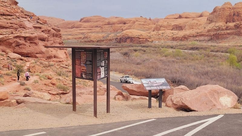
2. The view of the Poison Spider Paleontology Marker from the parking lot
• Take notes about the area-what the rocks look like, any distinguishing landmarks, proximity to roads, and other useful information.
• Contact the appropriate public land management agency (Bureau of Land Management, National Park Service, U.S. Forest Service, state land agency, etc.) or local museum.
• Do not make replicas, tracings, molds, or casts, or pour anything into the tracks. These activities can damage the fossils. Instead, take pictures! By using overlapping photographs, create a model by using a 3D printer at your local library or from home.
Captions
One Cliff, Many Stories
(Photo #1) Navajo Sandstone, Massive sand dune deposits (orange) with interdune lake deposita (blue).
Kayenta Formation, Stream channels running through desert sands.
(Photo #2) A variety of dinosaur footprints can be seen on this block that fell from the lower section of the cliff, at the base of the Navajo Sandstone.
(Photo #3) The smooth cliff faces formed by the Navajo Sandstone made the perfect surface for Native Americans to create petroglyphs.
(Photo #4) Two other large blocks which were once connected have fallen from the top of the cliff and are also covered with dinosaur footprints.
Erected by Bureau
Photographed by James Hulse, March 31, 2025
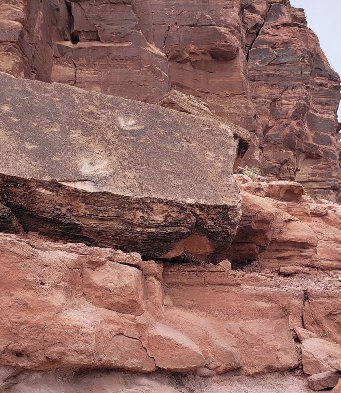
3. Poison Spider Dinosaur Tracksite
The marker is located along the hiking trail up the canyon.
Topics. This historical marker is listed in these topic lists: Paleontology • Parks & Recreational Areas.
Location. 38° 31.968′ N, 109° 36.523′ W. Marker is near Moab, Utah, in Grand County. It is on Potash ROad (State Road 279) 5 miles south of U.S. 191, on the right when traveling south. The marker is located at the Potash Road Dinosaur Tracks and Petroglyphs area. Touch for map. Marker is in this post office area: Moab UT 84532, United States of America. Touch for directions.

Regionally, this marker is in Canyon Country. It is also in the American Mountain West, on the Colorado Plateau, and at the Four Corners. Globally, it is in North America, the Western Hemisphere, the Western World, and the Anglosphere. Historically, it finds itself in what was once New Spain and also Mexico’s Alta California.

Other nearby markers. At least 8 other markers are within 4 miles of this marker, measured as the crow flies: Poison Spider Rock Art (here, next to this marker); Traces from an Ancient Desert Realm (here, next to this marker); Prowling Predators (about 300 feet away, measured in a direct line); Tracks and Traces (about 400 feet away); Base Jumping in Moab (approx. ¾ mile away); Birthing Panel (approx. 0.8 miles away); Utah Highway 279 Rock Art Site (approx. 0.9 miles away); The Moab Skyway - High Hopes and Big Risks (approx. 3.4 miles away). Touch for a list and map of all markers in Moab.
Additional keywords. Ichnology
Credits. This page was last revised on April 29, 2025. It was originally submitted on April 29, 2025, by James Hulse of Medina, Texas. This page has been viewed 151 times since then and 21 times this year. Photos: 1, 2, 3. submitted on April 29, 2025, by James Hulse of Medina, Texas.
