Penn Township near Jeannette in Westmoreland County, Pennsylvania — The American Northeast (Mid-Atlantic)
Bushy Run Station
Bushy Run Battlefield
Photographed by Bradley Owen, April 9, 2025
1. Bushy Run Station Marker
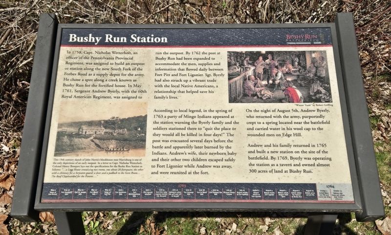
In 1758, Capt. Nicholas Wetterholt, an officer of the Pennsylvania Provincial Regiment, was assigned to build an outpost or station along the new South Fork of the Forbes Road as a supply depot for the army. He chose a spot along a creek known as Bushy Run for the fortified house. In May 1761, Sergeant Andrew Byerly, with the 60th Royal American Regiment, was assigned to run the outpost. By 1762 the post at Bushy Run had been expanded to accommodate the men, supplies and information that flowed daily between Fort Pitt and Fort Ligonier. Sgt. Byerly had also struck up a vibrant trade with the local Native Americans, a relationship that helped save his family's lives.
According to local legend, in the spring of 1763 a party of Mingo Indians appeared at the station warning the Byerly family and the soldiers stationed there to "quit the place or they would all be killed in four days!" The post was evacuated several days before the battle and apparently later burned by the Indians. Andrew's wife, their newborn baby and their other two children escaped safely to Fort Ligonier while Andrew was away, and were reunited at the
this page online
On the night of August 5th, Andrew Byerly, who returned with the army, purportedly crept to a spring located near the battlefield and carried water in his wool cap to the wounded men on Edge Hill. Andrew and his family returned in 1765 and built a new station on the site of the battlefield. By 1769, Byerly was operating the station as a tavern and owned almost 300 acres of land at Bushy Run.
(Captions):
This 19th century sketch of John Harris's blockhouse near Harrisburg is one of the only depictions of an early outpost. In a letter to Capt. Nicholas Wetterholt, Colonel Henry Bouquet lays out the specifications for the Bushy Run Station as follows: "...a Logg House containing two rooms, one about 20 feetsquare, the other with a chimney for a Serjeants guard: a door and a padlock to the Store Room... The Roof Clapboarded for the Present...."
"Winter Trade" by Robert Griffing
(Timeline at the bottom of the marker)
• May 16 Fort Sandusky falls
• May 25 Fort St. Joseph falls
• May 27 Fort Miami falls
• May 29 Siege of Fort Pitt
• June 1 Fort Ouiatenon falls
• June 2 Fort Michilimackinac falls
• June 2 Fort Ligonier attacked
• June 4 Fort Pitt’s help request reaches Col. Bouquet
• June 12 Amhearst orders the 42nd and 77th to Bouquet
• June 16 Fort Venango falls
• June 18 Fort Le Boeuf falls
• June 22 Fort Pesque Isle falls
• July 15 Bouquet leaves Carlisle
• July 25 Bouquet arrives at Fort Bedford
• August 2 Bouquet arrives at Fort Ligonier
• August 4 Bouquet leaves Fort Ligonier
• August 5 Natives attack Bouquet relief forces
• August 6 British defeat the Natives at Bushy Run
• August 10 British arrive at Fort Pitt
• October 25 Natives sign treaty and release their British prisoners
Topics.
Photographed by Bradley Owen, April 9, 2025
2. Bushy Run Station Marker
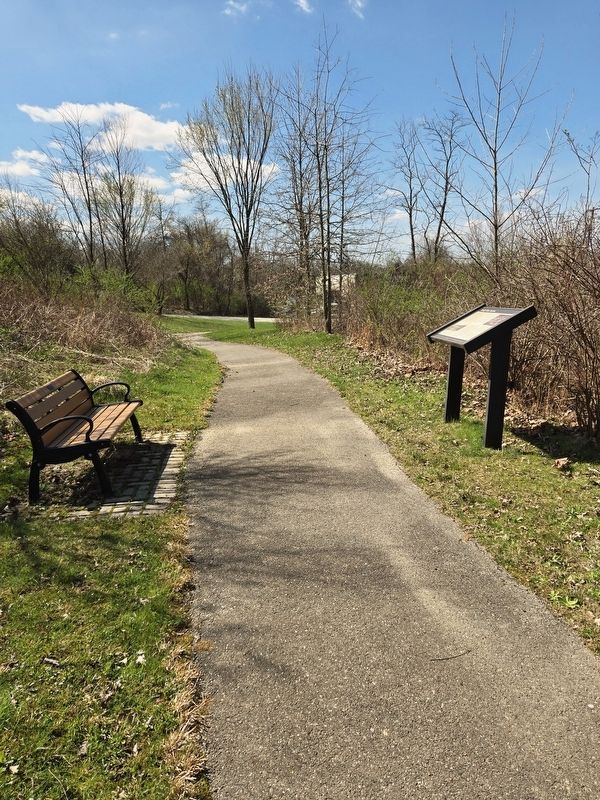
Location. 40° 21.401′ N, 79° 37.67′ W. Marker is near Jeannette, Pennsylvania, in Westmoreland County. It is in Penn Township. It can be reached from Bushy Run Road (Pennsylvania Route 993) 0.6 miles east of Gongaware Road, on the left when traveling east. Marker is located on the grounds of Bushy Run Battlefield. Touch for map. Marker is at or near this postal address: 1253 Bushy Run Road, Jeannette PA 15644, United States of America. Touch for directions.

Regionally, this marker is in the Laurel Highlands and in Greater Pittsburgh. It is also in the American Northeast, in the Mid-Atlantic, in Appalachia, and specifically in Northern Appalachia. Globally, it is in North America, the Western Hemisphere, the Western World, and the Anglosphere. Historically, it finds itself in what was once the Viceroyalty of New France, the Haudenosaunee (Iroquois) Confederacy, and one of the original Thirteen Colonies.
Other nearby markers. At least 8 other markers are within walking distance of this marker: After The Battle (within shouting distance of this marker); Bushy Run Battle 250th Anniversary Monument (within shouting distance of this marker); Ambushed (about 600 feet away, measured in a direct line); Welcome to Bushy Run Battlefield (about 600 feet away); Aftermath (about 700 feet away); Bushy Run Battlefield (about 700 feet away); Andrew Byerly's Spring (approx. 0.2 miles away); The Iroquois Nature Trail (approx. 0.2 miles away). Touch for a list and map of all markers in Jeannette.
Credits. This page was last revised on April 29, 2025. It was originally submitted on April 29, 2025, by Bradley Owen of Morgantown, West Virginia. This page has been viewed 836 times since then and 193 times this year. Photos: 1, 2. submitted on April 29, 2025, by Bradley Owen of Morgantown, West Virginia.
