Near Moab in Grand County, Utah — The American Mountains (Southwest)
Traces from an Ancient Desert Realm
Photographed by James Hulse, March 31, 2025
1. Traces from an Ancient Desert Realm Marker
Inscription.
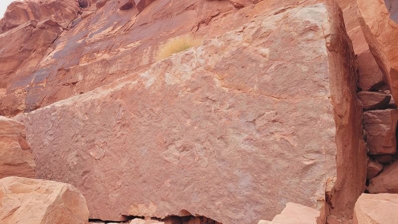
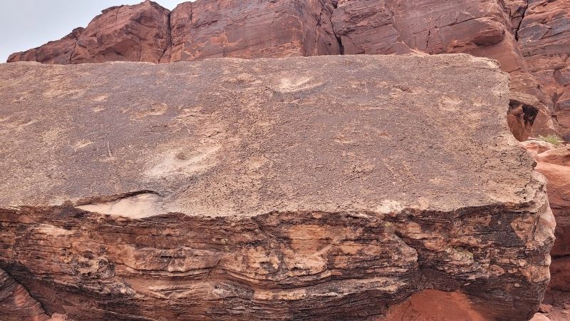
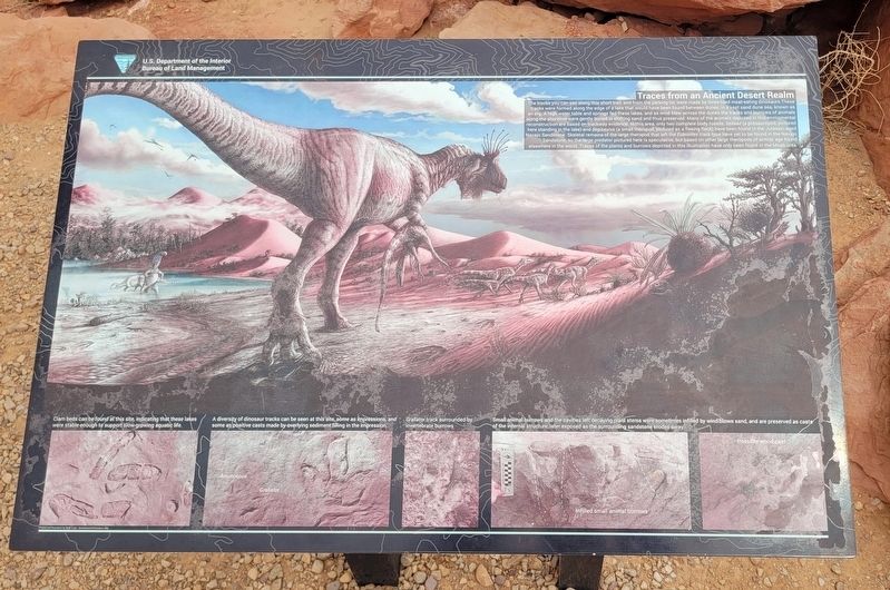
Traces from an Ancient Desert Realm. . The tracks you can see along this short trail, and from the parking lot, were made by three-toed meat-eating dinosaurs. These tracks were formed along the edge of a lake that would have been found between dunes, in a vast sand dune sea, known as an erg. A high water table and springs fed these lakes, and as wind blew across the dunes the tracks and burrows of animals along the shoreline were gently buried in shifting sand and thus preserved. Many of the animals depicted in this enviromental reconstruction are based on trackway evidence. In this area, only two complete body fossils, Seitaad (a prosauropod, pictured here standing in the lake) and Segisaurus (a small theropod, pictured as a fleeing flock) have been found in the Jurassic-aged Navajo Sandstone. Skeletal remains of the large theropod that left the Eubrontes track type have yet to be found in the Navajo Sandstone, so the large predator pictured here is speculative, but based on other large theropods of similar age found elsewhere in the world. Traces of the plants and burrows depicted in this illustration have only been found in the Moab area., Captions , (Photo #1) Clam beds can be found at this site, indicating that these lakes were stable enough to support slow-growing aquatic life. , (Photo #2) A diversity of dinosaur tracks can be seen at this site, some as impressions, and some as positive casts made by overlying sediment filling in the impression. , (Photo #3) Grallator track surrounded by invertebrate burrows. , (Photo #4) Small animal burrows and the cavities left decaying plant stems were sometimes infilled by wind-blown sand, and are preserved as casts of the internal structure, later exposed as the surrounding sandstone erodes away., Illustrations and Photos by Brian Engh - dontmesswithdinosaurs.com
The tracks you can see along this short trail, and from the parking lot, were made by three-toed meat-eating dinosaurs. These tracks were formed along the edge of a lake that would have been found between dunes, in a vast sand dune sea, known as an erg. A high water table and springs fed these lakes, and as wind blew across the dunes the tracks and burrows of animals along the shoreline were gently buried in shifting sand and thus preserved. Many of the animals depicted in this enviromental reconstruction are based on trackway evidence. In this area, only two complete body fossils, Seitaad (a prosauropod, pictured here standing in the lake) and Segisaurus (a small theropod, pictured as a fleeing flock) have been found in the Jurassic-aged Navajo Sandstone. Skeletal remains of the large theropod that left the Eubrontes track type have yet to be found in the Navajo Sandstone, so the large predator pictured here is speculative, but based on other large theropods of similar age found elsewhere in the world. Traces of the plants and burrows depicted in this illustration have only been found in the Moab area.
Captions (Photo #1) Clam beds can be found at this site, indicating that these lakes were stable enough to support slow-growing aquatic life. (Photo #2) A diversity of dinosaur tracks can be seen at this site, some as impressions, and some as positive casts made by overlying sediment filling in the impression. (Photo #3) Grallator track surrounded by invertebrate burrows. (Photo #4) Small animal burrows and the cavities left decaying plant stems were sometimes infilled by wind-blown sand, and are preserved as casts of the internal structure, later exposed as the surrounding sandstone erodes away.
Illustrations and Photos by Brian Engh - dontmesswithdinosaurs.com
Erected by U.S.
Click or scan to see this page online
Department of the Interior Bureau of Land Management.
Location. 38° 31.969′ N, 109° 36.519′ W. Marker is near Moab, Utah, in Grand County. It is on Potash Road (State Road 279) 5 miles south of U.S. 191, on the right when traveling south. The marker is located at the Potash Road Dinosaur Tracks and Petroglyphs area. Touch for map. Marker is in this post office area: Moab UT 84532, United States of America. Touch for directions.

Regionally, this marker is in Canyon Country. It is also in the American Mountain West, in Colorado Plateau, and at the Four Corners. Globally, it is in North America, the Western Hemisphere, the Western World, and the Anglosphere. Historically, it finds itself in what was once New Spain and also Mexicos Alta California.
Other nearby markers. At least 8 other markers are within 4 miles of this marker, measured as the crow flies: Poison Spider Rock Art (here, next to this marker); Poison Spider Paleontology (here, next to this marker);
Photographed by James Hulse, March 31, 2025
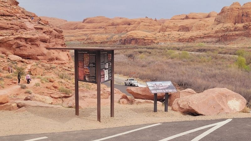
2. The view of the Traces from an Ancient Desert Realm Marker from the parking area
Credits. This page was last revised on April 30, 2025. It was originally submitted on April 29, 2025, by James Hulse of Medina, Texas. This page has been viewed 159 times since then and 14 times this year. Photos:1, 2. submitted on April 29, 2025, by James Hulse of Medina, Texas. 3, 4. submitted on April 30, 2025, by James Hulse of Medina, Texas.