Near Rice in Amelia County, Virginia — The American South (Mid-Atlantic)
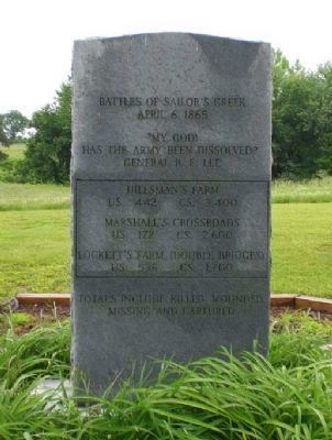
Battles of Sailor's Creek
Photographed by Linda Walcroft, May 17, 2009
1. Front of Monument
April 6, 1865
"My God! Has the army been dissolved?"
General R. E. Lee
Hillsman's Farm
US 442 CS 3.400
Marshall's Crossroads
US 172 CS 2,600
Lockett's Farm (Double Bridges)
US 536 CS 1,700
Totals include killed, wounded, missing and captured.
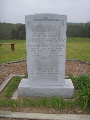
(Back)
Confederate and Union
Soldiers who fought in
the surrounding hills with
great honor and perseverance
on April 6, 1865.
During the three engagements
each regiment participated
with valor and fraternity,
in what was the last
major battle of the Civil War
in Virginia.
Dedicated by the
Sayler’s Creek Reenactment
and Preservation Committee
April 2000
Erected 2000 by Sayler’s Creek Reenactment and Preservation Committee.
Topics. This memorial is listed in this topic list: War, US Civil. A significant historical date for this entry is April 6, 1865.
Location. 37° 17.901′ N, 78° 13.742′ W. Memorial is near Rice, Virginia, in Amelia County. It is on Saylers Creek Road (Virginia Route 617) 0.2 miles north of Scuffletown Road ( Route 620), on the left when traveling south. Located next to the Sailor’s
this page online

Regionally, this memorial is in the Piedmont and in Central Virginia. It is also in the American South and specifically in the Upper South. Globally, it is in North America, the Western Hemisphere, the Western World, and the Anglosphere. Historically, it finds itself in what was once the territory of the Mississippian Culture, one of the original Thirteen Colonies, one of the Confederate States of America, and the Antebellum South.
Other nearby markers. At least 8 other markers are within 2 miles of this marker, measured as the crow flies: Marshall’s Crossroads (approx. 0.2 miles away); General Wheaton's First Division Assault (approx. 0.7 miles away); Rock Formations At Sailor's Creek (approx. ¾ mile away); The Federal Artillery Barrage (approx. 0.9 miles away); Battle of Sailor's (Sayler's) Creek (approx. 0.9 miles away); a different marker also named Overton/Hillsman House (approx. one mile away); Prince Edward County / Nottoway County
Photographed by Bill Coughlin, April 26, 2007
2. Back of Memorial
Marker is in Sailor’s Creek Battlefield State Park.
Other markers no longer nearby. Victory or Death (was approx. 0.3 miles away but has been permanently removed); Ewell’s Line of Defense (was approx. 0.4 miles away but has been permanently removed); The Final Clash: With Fate Against Them (was approx. 0.4 miles away but has been permanently removed); Assaulting the Confederate Battle Line (was approx. half a mile away but has been permanently removed); Crossing Little Sailor's Creek (was approx. 0.6 miles away but has been permanently removed); Overton/Hillsman House (was approx. 0.9 miles away but has been replaced with another marker now near it); Hillsman House (was approx. 0.9 miles away but has been permanently removed).
Also see . . . Sailor's Creek Battlefield State Park. Virginia State Parks website. (Submitted on September 26, 2008, by Bill Coughlin of Woodland Park, New Jersey.)
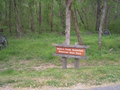
Photographed by Bill Coughlin, April 26, 2007
3. Sailor’s Creek Battlefield State Park
This park preserves the site of the last major battle of Gen. Robert E. Lee's Army of Northern Virginia.
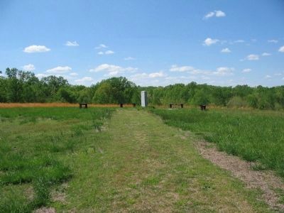
Photographed by Craig Swain, April 18, 2010
4. Battle of Sailors Creek Monument
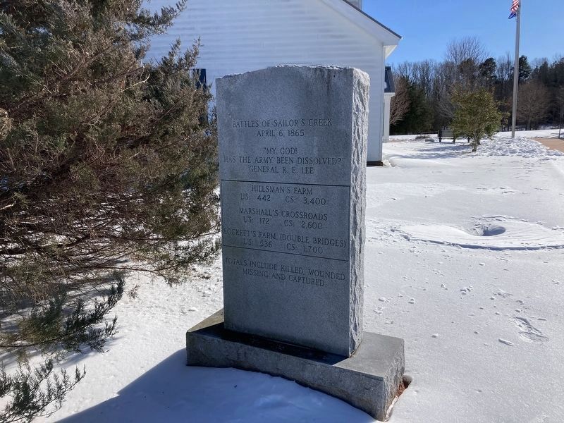
Photographed by Evan Dwyer, February 7, 2026
5. Battles of Sailor's Creek Marker
The park visitor center, a line of trees, and some utility installations have surrounded the marker in the years since it was first photographed for this database.
Credits. This page was last revised on February 28, 2026. It was originally submitted on September 26, 2008, by Bill Coughlin of Woodland Park, New Jersey. This page has been viewed 3,221 times since then and 93 times this year. Last updated on April 29, 2025, by Mike McKeown of Baltimore, Maryland. Photos: 1. submitted on June 6, 2009, by Linda Walcroft of Woodstock, Virginia. 2, 3. submitted on September 26, 2008, by Bill Coughlin of Woodland Park, New Jersey. 4. submitted on June 12, 2010, by Craig Swain of Leesburg, Virginia. 5. submitted on February 19, 2026, by Evan Dwyer of Richmond, Virginia. • Bernard Fisher was the editor who published this page.
