Dew in Freestone County, Texas — The American South (West South Central)
Dew Cemetery

Photographed by James Hulse, April 30, 2025
1. Dew Cemetery Marker
In 1869 W.S. Compton; one of the early settlers, and D.A Self, local merchant and dentist, donated land for this community cemetery. First burial was that of a young girl, Missouri A.E. Humphrey (1869-1871). Other early graves date from the yellow fever epidemic of 1873.
The town was renamed in 1885 when Dew Post Office opened. The name "Drew" was requested to honor a local resident, but postal officials misread the application. A market center for cotton farmers of the area, Dew had a cotton gin and several stores. Rural delivery replaced the Dew Post Office in 1909.
A land donation by Wiley Black in 1901 enlarged the graveyard, which lies adjacent to Dew Methodist Church where funeral services are held. About 1912-13 a cemetery association was organized. Descendants and community residents gather at annual Memorial Day observances to tend the 11 and 1/3 acre site. The 1000 graves here include many from the 1918-19 Influenza Epidemic.
Erected 1977 by Texas Historical Commission. (Marker Number 9871.)
Topics. This historical marker is listed in this topic list: Cemeteries & Burial Sites. A significant historical year for this entry is 1870.
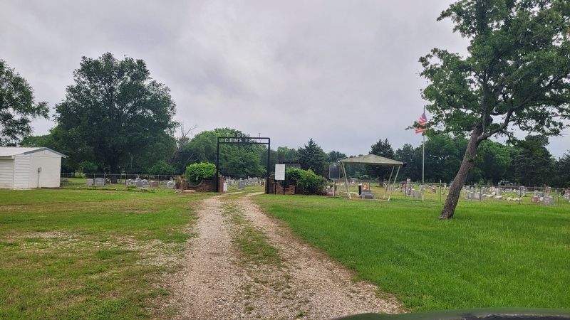
Location. 31° 35.629′ N, 96° 8.453′ W. Marker is in Dew, Texas, in Freestone County. It is at the intersection of Farm to Market Road 489 and U.S. 75 on Road 489. The marker is located at the front of the cemetery. Touch for map. Marker is in this post office area: Teague TX 75860, United States of America. Touch for directions.

Regionally, this marker is in the Prairies & Lakes Region. It is also in the American South. Globally, it
this page online
Other nearby markers. At least 8 other markers are within 9 miles of this marker, measured as the crow flies: Dew Veterans Memorial (here, next to this marker); Harrison Chapel (approx. 3.1 miles away); Captain Richard B. Haley (approx. 7½ miles away); Salem Predestinarian Baptist Church and Cemetery (approx. 7½ miles away); The Dr. Emmet Headlee House (approx. 8.3 miles away); Dogan High School (approx. 8.3 miles away); John F. Wallace House (approx. 8.4 miles away); Mt. Zion Methodist Church and Cemetery (approx. 8½ miles away). Touch for a list and map of all markers in Dew.

Photographed by James Hulse, April 30, 2025
2. Dew Cemetery Marker
Photographed by James Hulse, April 30, 2025
3. The view of the entrance of the Dew Cemetery and Marker from the cemetery road
Credits. This page was last revised on April 30, 2025. It was originally submitted on April 30, 2025, by James Hulse of Medina, Texas. This page has been viewed 117 times since then and 18 times this year. Photos: 1, 2, 3. submitted on April 30, 2025, by James Hulse of Medina, Texas.
