Seaport (South Boston) in Suffolk County, Massachusetts — The American Northeast (New England)
Anthony's Pier 4: Boston Icon
Photographed by Conrad Ward, November 17, 2024
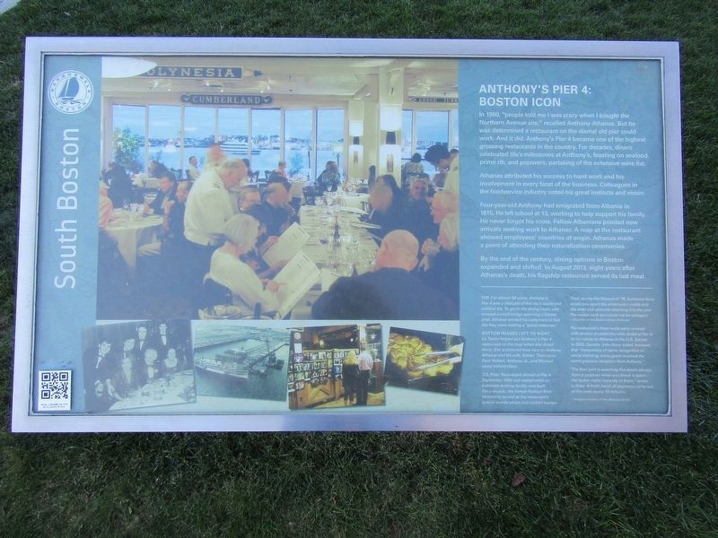
1. Anthony's Pier 4: Boston Icon Marker
In 1960, "people told me I was crazy when I bought the Northam Avenue site," recalled Anthony Athanas. But he was determined a restaurant on the dismal old pier could work. And it did. Anthony's Pier 4 became one of the highest grossing restaurants in the country. For decades, diners celebrated life's milestones at Anthony's, feasting on seafood, prime rib, and popovers, partaking of the extensive wine list.
Athanas attributed his success to hard work and his involvement in every facet of the business. Colleagues in the foodservice industry rated his great instincts and vision.
Four-year-old Anthony had emigrated from Albania in 1915. He left school at 13, working to help support his family. He never forgot his roots. Fellow Albanians pointed new arrivals seeking work to Athanas. A map at the restaurant showed employees' countries of origin. Athanas made a point of attending their naturalization ceremonies.
By the end of the century, dining options in Boston expanded and shifted. In August 2013, eight years after Athanas's death, his flagship restaurant served its last meal.
(photo captions)
Top For
this page online
Bottom images left to right
Liz Taylor helped put Anthony's Pier 4 restaurant on the map when she dined there. She is pictured here next to Anthony Athanas and his wife, Esther. Their sons Paul, Robert, Anthony Jr., and Michael stand behind them.
S.S. Peter Stuyvesant arrived at Pier 4 September 1968 and waited while and elaborate docking facility was built. For a decade, the former Hudson River steamship served as the restaurant's special events venue and cocktail lounge.
Then, during the Blizzard of '78, hurricane-force winds tore apart the underwater cradle and the steel and concrete attaching it to the pier. The vessel sank and could not be salvaged.
~Courtesy of the Boston Globe Archives.
The restaurants foyer walls were covered with photos of celebreties who dined at Pier 4. In his tribute to Athanas in the U.S. Senate in 2005, Senator John Kerry noted, however, that "irrespective

Photographed by Conrad Ward, November 17, 2024
2. Anthony's Pier 4: Boston Icon Marker
"The best part is watching the steam escape from a popover when you break it apart—the butter melts instantly in them," wrote a diner. A fresh batch of popovers came out of the oven every 15 minutes.
~Images courtesy of the Athanas family
Erected by Boston Harborwalk.
Topics. This historical marker is listed in these topic lists: Immigration • Industry & Commerce. A significant historical month for this entry is August 2013.
Location. 42° 21.198′ N, 71° 2.49′ W. Marker is in Boston, Massachusetts, in Suffolk County. It is in Seaport (South Boston). It can be reached from Pier 4 Boulevard north of Northern Avenue, on the right when traveling north. Touch for map. Marker is at or near this postal address: 300 Pier 4 Boulevard, Boston MA 02210, United States of America. Touch for directions.

Regionally, this marker is in Massachusetts’ Historic Boston. It is also in the American Northeast, in New England, and on the Eastern Seaboard. Globally, it is in the North Atlantic Region, North America, the Western Hemisphere, the Western World, and the Anglosphere. Historically, it finds itself in what was once one of the original Thirteen Colonies.
Other nearby markers. At least 8 other markers are within walking distance of this marker: Transformed Tidal Flats (about 800 feet away, measured in a direct line); The Way to a Cleaner Harbor (approx. ¼ mile away); Fan Pier. (approx. ¼ mile away); a different marker also named Fan Pier. (approx. 0.3 miles away); a different marker also named Fan Pier. (approx. 0.3 miles away); Boston Harbor Islands (approx. 0.3 miles away); Captain John Foster Williams (approx. half a mile away); Four Point Channel (approx. half a mile away). Touch for a list and map of all markers in Boston.
Also see . . . Anthony's Pier 4 (Wikipedia). (Submitted on April 30, 2025.)
Credits. This page was last revised on July 8, 2025. It was originally submitted on April 30, 2025, by Conrad Ward of Guilford, Connecticut. This page has been viewed 336 times since then and 79 times this year. Photos: 1, 2. submitted on April 30, 2025, by Conrad Ward of Guilford, Connecticut. • Michael Herrick was the editor who published this page.
