Jacksonville in Calhoun County, Alabama — The American South (East South Central)
Sulphur Springs
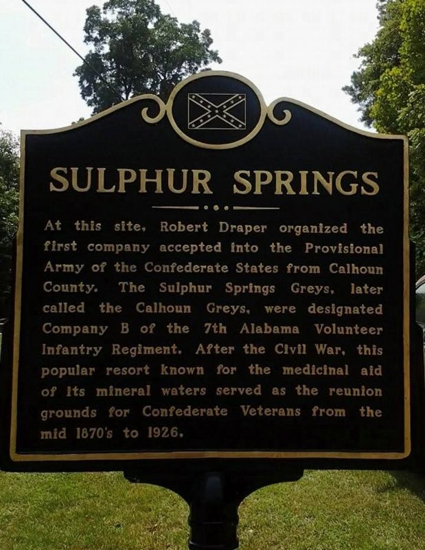
Photographed by Quinton Reid Kirk
1. Sulphur Springs Marker
Topics. This historical marker is listed in this topic list: War, US Civil.
Location. 33° 50.63′ N, 85° 51.772′ W. Marker is in Jacksonville, Alabama, in Calhoun County. It is on Ranch Road 0.1 miles east of Old Sulphur Springs Road, on the left when traveling south. Touch for map. Marker is in this post office area: Jacksonville AL 36265, United States of America. Touch for directions.

Regionally, this marker is in East Alabama. It is also in the American South and specifically in the Deep South. Globally, it is in North America, a Gulf of Mexico state, the Western Hemisphere, the Western World, and the Anglosphere. Historically,
this page online
Other nearby markers. At least 8 other markers are within 6 miles of this marker, measured as the crow flies: Tallasseehatchee (approx. 3.3 miles away); Jacksonville, Alabama (approx. 5.4 miles away); The Depot (approx. 5.4 miles away); Chief Ladiga Trail - Jacksonville (approx. 5½ miles away); Lincoyer (approx. 5½ miles away); The Tallasahatchie Battle Field (approx. 5½ miles away); Profile Cotton Mills Historic District (approx. 5.7 miles away); Joseph William Burke (approx. 5.8 miles away). Touch for a list and map of all markers in Jacksonville.
Credits. This page was last revised on May 1, 2025. It was originally submitted on April 30, 2025, by Quinton Reid Kirk of Piedmont, Alabama. This page has been viewed 553 times since then and 91 times this year. Photo 1. submitted on April 30, 2025, by Quinton Reid Kirk of Piedmont, Alabama. • Bernard Fisher was the editor who published this page.
