Wilmington in New Hanover County, North Carolina — The American South (South Atlantic)
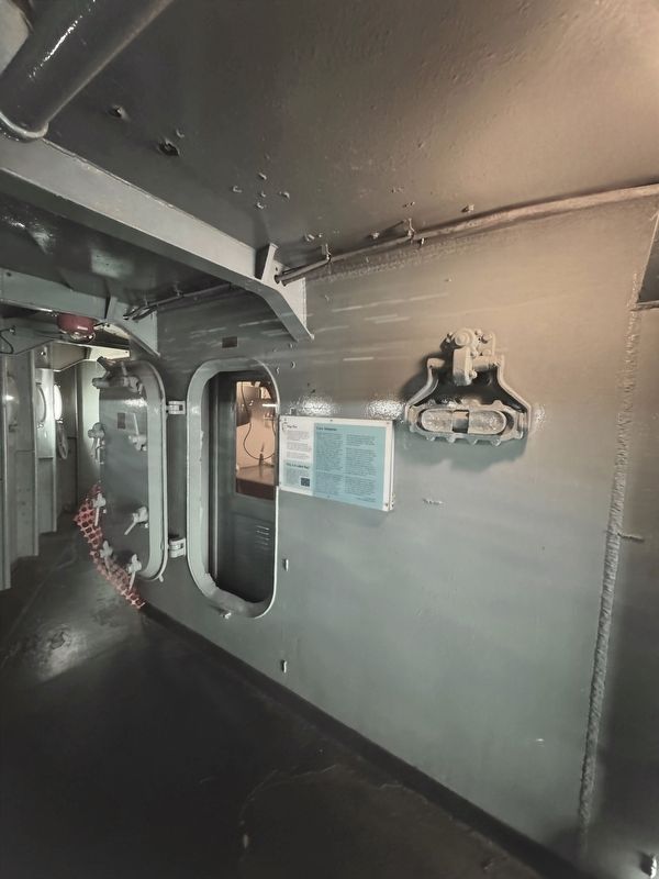
Flag Plot
| — | U.S.S. North Carolina | — |

Photographed by Brandon D Cross
1. Flag Plot Marker
Flag Plot was his tactical and operational center. The admiral and his staff had their own radio circuits, radar repeaters, and plotting board to coordinate movements of ships and aircraft.
North Carolina was not often a flagship, so the Combat Intelligence Officer used it as his office and briefing room.
Why is it called flag?
Flag or flag officer is the general term for an admiral. Admirals are referred to as flag officers because they can fly their personal flag from the ship's mast when onboard. Whenever an admiral is onboard a ship, that ship is referred to as his flagship.
Crew Memories
The place assigned to me for my work was Flag Plot. It was intended to be used by an embarked admiral, but since the “North Carolina” did not ordinarily carry one, the space was available and admirably suited to serve as my intelligence plot. For security reasons, the room was kept locked at all times, with keys in the possession of only four persons: the Captain, Executive Officer; Gunnery Officer, and myself. Because I was so often awakened at night to plot new information, I managed to obtain a canvas cot, with the Exec's permission, so I could sleep in that space at times when a major operation was going on. The setup was especially advantageous for me because Flag Plot was one of the few places on the Ship that were air-conditioned.
Each day the Ship received by encrypted radio message a secret intelligence summary from Pacific Fleet Headquarters at Pearl Harbor. These gave the best known or estimated positions of all major units of the Imperial Japanese Navy, including submarines. Also received regularly were updates of the positions of our own naval forces in the combat area. It was my duty to maintain on a large map of the western Pacific an up-to-the-minute plot of the locations of all those ships, both enemy and friendly. The work was demanding of my time that I was assigned no watches. Most unusual and quite welcomed.
Because I was the person responsible for the secret intelligence plot and perhaps best informed of what was going on in the combat area, I was given custody of all operation plans and orders received by the “North Carolina” preceding each operation. These plans, explaining what we were to accomplish during an impending period at sea, usually did not arrive on board until the very day of our sortie from port. This was for security reasons, as the plans and orders were invariably classified Top Secret.
My role was to take custody of the plans in my secret hideaway and digest them as rapidly as possible before giving an oral presentation to key officers of the Ship, spelling out where we were headed and what we were about to do. My briefing, which usually lasted at least a couple of hours, was conducted in the unoccupied Admiral Quarters.
this page online
— Lt (jog) Ben Blee,
Combat Intelligence Officer
Erected by Friends of the Battleship North Carolina.
Topics. This historical marker is listed in these topic lists: War, World II • Waterways & Vessels.
Location. 34° 14.185′ N, 77° 57.263′ W. Marker is in Wilmington, North Carolina, in New Hanover County. It is on Battleship Road NE 0.2 miles south of U.S.S. North Carolina Road, on the left when traveling north. Touch for map. Marker is at or near this postal address: 1 Battleship Rd NE, Wilmington NC 28401, United States of America. Touch for directions.

Regionally, this marker is in North Carolina’s Coastal Plain and on the Cape Fear Coast. It is also in the American South, specifically in the Upper South, in the Tidewater, and on the Eastern Seaboard. Globally, it is in the North Atlantic Region, North America, the Western Hemisphere, the Western World, and the Anglosphere. Historically, it finds itself in what was once the territory of the Mississippian Culture, one of the original Thirteen Colonies, one of the Confederate States of America,
Photographed by Brandon D Cross
2. Flag Plot Marker
Other nearby markers. At least 8 other markers are within walking distance of this marker: Friendly Fire (here, next to this marker); Sky II (here, next to this marker); Magnetic Compass (a few steps from this marker); Battle Ribbons and Kill Board (a few steps from this marker); U.S.S. North Carolina Battleship Memorial (a few steps from this marker); In the Beginning: 15 Boats (a few steps from this marker); Admiral’s Cabin (a few steps from this marker); The Navigators (a few steps from this marker). Touch for a list and map of all markers in Wilmington.

via Naval History and Heritage Command, 1944
3. USS North Carolina (BB-55), 1941-1961
Naval History and Heritage Command website entry
Click for more information.
Click for more information.
Credits. This page was last revised on May 12, 2025. It was originally submitted on May 1, 2025, by Brandon D Cross of Flagler Beach, Florida. This page has been viewed 230 times since then and 110 times this year. Photos: 1, 2. submitted on May 1, 2025, by Brandon D Cross of Flagler Beach, Florida. 3. submitted on May 12, 2025, by Larry Gertner of New York, New York. • J. J. Prats was the editor who published this page.
