Near Stuart in Patrick County, Virginia — The American South (Mid-Atlantic)
The Story Behind Stuart's Knob
Photographed by Mark Parker, April 29, 2025
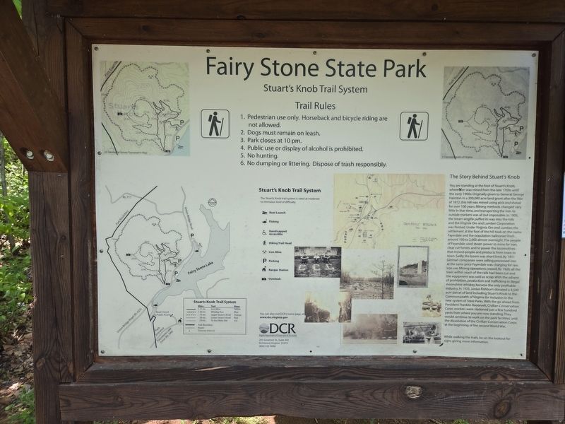
1. Full information kiosk and map containing The Story Behind Stuart's Knob Marker
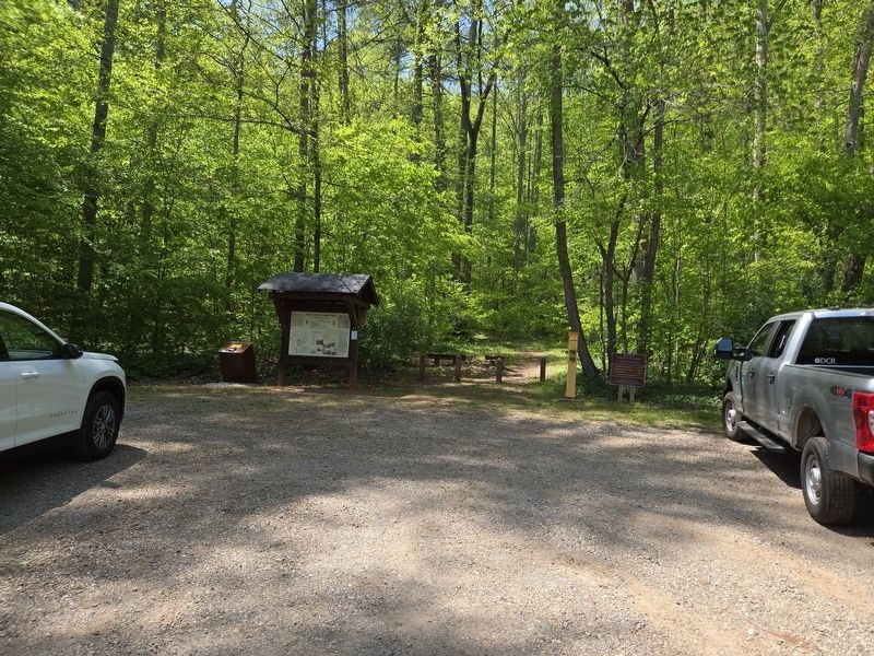
Location is in the parking lot at the Stuart's Knob Trailhead.
You are standing at the foot of Stuart's Knob, where iron was mined from the late 1700s until the early 1900s. Originally given to General George Hairston in a 300,000 acre land grant after the War of 1812, this hill was mined using pick and shovel for over 100 years. Mining methods changed very little in that time, and transporting the iron to outside markets was all but impossible. In 1905, the steam engine puffed its way into the hills and the Virginia Ore and Lumber Corporation was formed. Under Virginia Ore and Lumber, the settlement at the foot of the hill took on the name Fayerdale and the population ballooned from around 100 to 2,000 almost overnight. The people of Fayerdale used steam power to mine for iron, clear cut forests and to power the locomotives that moved people and products from town to town. Sadly, the boom was short lived. By 1911 German companies were selling processed iron at the same price Fayerdale was charging for raw iron ore. Mining operations ceased. By 1920, all the trees within reach of the rails had been cut and the equipment was sold as scrap. With the advent of prohibition, production
this page online
While walking the trails, be on the lookout for signs giving more information.
Erected by Virginia Department of Conservation and Recreation.
Topics. This historical marker is listed in these topic lists: Charity & Public Work • Industry & Commerce • Parks & Recreational Areas • Railroads & Streetcars. A significant historical year for this entry is 1905.
Location. 36° 47.91′ N, 80° 7.027′ W. Marker is near Stuart, Virginia, in Patrick County. It is on Union Bridge Road (Virginia Route 623) one mile south of Fayer Dale Drive, on the right when traveling south. The
Photographed by Mark Parker, April 29, 2025
2. Stuart's Knob Trailhead parking lot

Regionally, this marker is in Southern Virginia and in the Blue Ridge Highlands. It is also in the American South, specifically in the Upper South, in Appalachia, and specifically in Southern Appalachia. Globally, it is in North America, the Western Hemisphere, the Western World, and the Anglosphere. Historically, it finds itself in what was once the territory of the Mississippian Culture, one of the original Thirteen Colonies, one of the Confederate States of America, and the Antebellum South.
Other nearby markers. At least 8 other markers are within 9 miles of this marker, measured as the crow flies: Fairy Stone State Park (within shouting distance of this marker); The Historic John D. Bassett High School (approx. 7.2 miles away); Dehart Homeplace (approx. 7.8 miles away); Col. Abram Penn (approx. 8.2 miles away); Blue Ridge Mission School (approx. 8.4 miles away); Jack's Creek Covered Bridge (approx. 9 miles away); a different marker also named Jacks Creek Covered Bridge (approx. 9 miles away); Our Historic Covered Bridges (approx. 9 miles away).
Another marker is no longer nearby. Colonel Abram Penn (was approx. 8.2 miles away but has been replaced with another marker now near it).
More about this marker. The marker is a part of the larger map at the information kiosk at the trailhead.
Credits. This page was last revised on May 15, 2025. It was originally submitted on May 1, 2025, by Mark Parker of Hickory, North Carolina. This page has been viewed 163 times since then and 25 times this year. Photos: 1, 2. submitted on May 1, 2025, by Mark Parker of Hickory, North Carolina. • Devry Becker Jones was the editor who published this page.
