
Fruita in Wayne County, Utah — The American Mountains (Southwest)
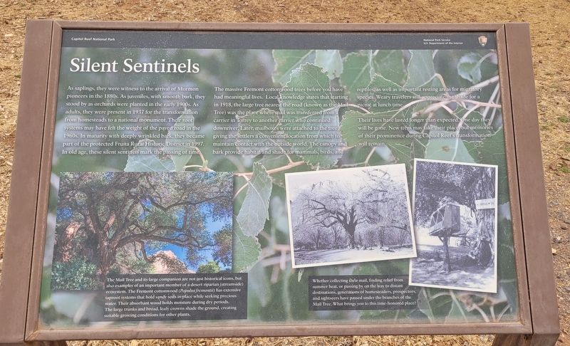
Silent Sentinels
Photographed by James Hulse, April 2, 2025
1. Silent Sentinels Marker
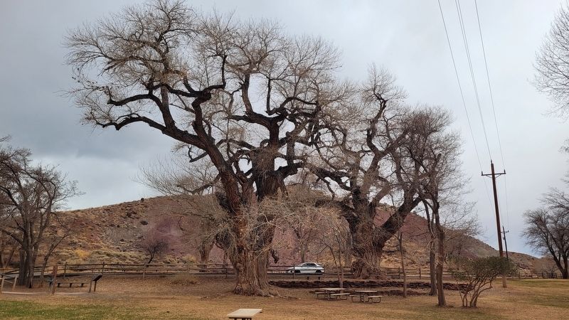
The massive Fremont cottonwood trees before you have had meaningful lives. Local knowledge states that starting in 1918, the large tree nearest the road (known as the Mail Tree) was the place where mail was transferred from a carrier in Torrey to another carrier who continued downriver. Later, mailboxes were attached to the tree, giving the settlers a convenient location from which to maintain contact with the outside world. The canopy and bark provide habitat and shade for mammals, birds, and reptiles, as well as important resting areas for migratory species. Weary travelers still appreciate the shade for
this page online
Their lives have lasted longer than expected. One day they will be gone. New trees may take their place, but memories of their prominence during Capitol Reef's transformation will remain.
Captions
(Photo #1) The Mail Tree and its large companion are not just historical icons, but also examples of an important member of a desert riparian (streamside) ecosystem. The Fremont cottonwood (Populus fremontii) has extensive taproot systems that hold sandy soils in place while seeking precious water. Their absorbant wood holds moisture during dry periods. The large trunks and broad, leafy crowns shade the ground, creating suitable growing conditions for other plants.
(Photo #2) Whether collecting their mail, finding relief from summer heat, or passing by on the way to distant destinations, generations of homesteaders, prospectors, and sightseers have passed under the branches of the Mail Tree. What brings you to this time-honored place?
Erected by Capital Reef National Park, National Park Service, U.S. Department of the Interior.
Topics. This historical marker is listed in these topic lists: Horticulture & Forestry

Photographed by James Hulse, April 2, 2025
2. The Marker and the Cottonwood trees
Location. 38° 17.134′ N, 111° 14.787′ W. Marker is in Fruita, Utah, in Wayne County. It is on Scenic Drive 1.1 miles south of Utah Road 24, on the left when traveling south. The marker is located at the small park along the road. Touch for map. Marker is at or near this postal address: 388 Scenic Dr, Torrey UT 84775, United States of America. Touch for directions.

Regionally, this marker is in Canyon Country. It is also in the American Mountain West, on the Colorado Plateau, and at the Four Corners. Globally, it is in North America, the Western Hemisphere, the Western World, and the Anglosphere. Historically, it finds itself in what was once New Spain and also Mexico’s Alta California.

Other nearby markers. At least 8 other markers are within walking distance of this marker: It's Alive! (within shouting distance of this marker); The Giving Groves (about 400 feet away, measured in a direct line); Living Off the Land (about 600 feet away); Pendleton-Jorgenson-Gifford Barn Story (approx. 0.2 miles away); A Community's Cornerstone (approx. 0.2
Photographed by James Hulse, April 2, 2025
3. The view of the cottonwood trees and marker from the park
Credits. This page was last revised on May 2, 2025. It was originally submitted on May 1, 2025, by James Hulse of Medina, Texas. This page has been viewed 156 times since then and 25 times this year. Photos: 1, 2, 3. submitted on May 2, 2025, by James Hulse of Medina, Texas.
