
Near Fredericksburg in Spotsylvania County, Virginia — The American South (Mid-Atlantic)
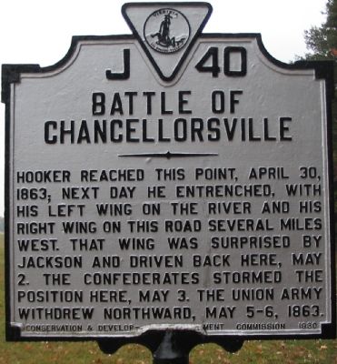
Battle of Chancellorsville
Photographed by Craig Swain, November 10, 2007
1. Battle of Chancellorsville Marker
Erected 1930 by Conservation & Development Commission. (Marker Number J-40.)
Topics and series. This historical marker is listed in this topic list: War, US Civil. In addition, it is included in the Virginia Department of Historic Resources (DHR) series list. A significant historical date for this entry is April 30, 1863.
Location. This marker has been replaced by another marker nearby. It was located near 38° 18.58′ N, 77° 38.087′ W. Marker was near Fredericksburg, Virginia, in Spotsylvania County. It was at the intersection of Elys Ford Road (County Route 610) and Plank Raod (Virginia Highway 3), on the right when traveling south on Elys Ford Road. Located in the parking lot for Chancellor House tour stop on the driving tour of the Chancellorsville Battlefield. Within the Fredericksburg and Spotsylvania National Military
this page online

Regionally, this marker was in the Washington Metropolitan Area, in Northern Virginia, and in the Piedmont. It was also in the American South, specifically in the Upper South, in the Mid-Atlantic, and on the Eastern Seaboard. Globally, it was in the North Atlantic Region, North America, the Western Hemisphere, the Western World, and the Anglosphere. Historically, it found itself in what was once the territory of the Mississippian Culture, one of the original Thirteen Colonies, one of the Confederate States of America, and the Antebellum South.
Other nearby markers. At least 8 other markers are within walking distance of this location: A different marker also named Battle of Chancellorsville (a few steps from this marker); The Chancellorsville Intersection (within shouting distance of this marker); Climactic Struggle (within shouting distance of this marker); Lee's Greatest Triumph (within shouting distance of this marker); The Chancellor Slaves (about 300 feet
Photographed by Craig Swain, November 10, 2007
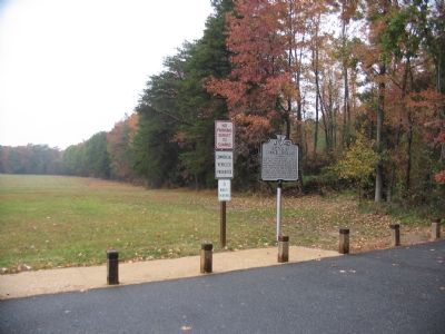
2. Marker in the Chancellor House Parking Lot
Other markers no longer nearby. Chancellorsville (was within shouting distance of this marker but has been permanently removed); Chancellorsville Home of Mrs. Sanford Chancellor (was about 300 feet away but has been permanently removed); a different marker also named Battle of Chancellorsville (was about 400 feet away but has been permanently removed).
More about this marker. This marker was located closer to the intersection, but relocated several years ago to the parking area for the tour stop.
Regarding Battle of Chancellorsville. This is one of several markers for the Battle of Chancellorsville at the Chancellorsville Intersection, scene of considerable fighting in the battle. See the Chancellorsville Intersection Virtual Tour by Markers in the links section for a listing of related markers on the tour.
Related marker. Click here for another marker that is related
Photographed by Craig Swain, November 10, 2007
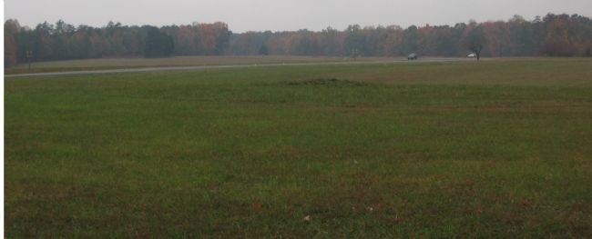
3. From Chancellor House Looking towards Fairview
When Jackson's flank attack struck from the west, Federals were driven back to fortified line based on a ridge at Fairview. Later they withdrew further back beyond the Chancellor House and Inn.
Also see . . . Chancellorsville Intersection Virtual Tour by Markers. The Chancellorsville Intersection portion of the battlefield (stop three on the driving tour of the battlefield) includes markers at the intersection of the historic Plank and Ely's Ford Roads. Considerable fighting occurred here on May 3, 1863. (Submitted on December 8, 2007, by Craig Swain of Leesburg, Virginia.)
Credits. This page was last revised on May 4, 2025. It was originally submitted on November 12, 2007, by Craig Swain of Leesburg, Virginia. This page has been viewed 5,488 times since then and 45 times this year. Last updated on May 2, 2025, by Mike McKeown of Baltimore, Maryland. Photos: 1, 2, 3. submitted on November 12, 2007, by Craig Swain of Leesburg, Virginia. • Bill Pfingsten was the editor who published this page.
