Conway in Horry County, South Carolina — The American South (South Atlantic)
The Steamboat Era on the Waccamaw River
Photographed by Brandon D Cross
1. The Steamboat Era on the Waccamaw River Marker
[ Timeline ]
1860
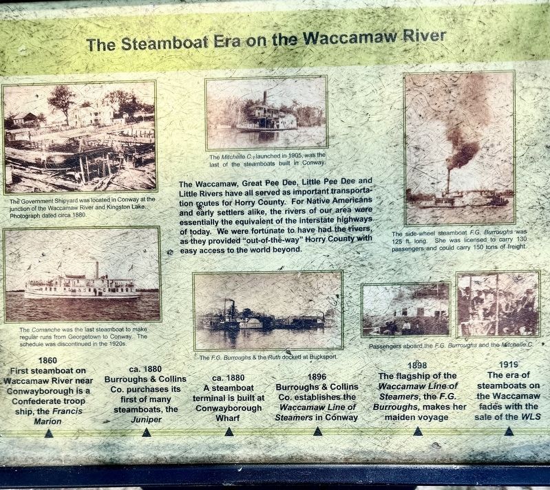
First steamboat on Waccamaw River near Conwayborough is a Confederate troop ship, the Francis Marion
ca. 1880
Burroughs & Collins Co. purchases its first of many steamboats, the Juniper
ca. 1880
A steamboat terminal is built at Conwayborough Wharf
ca. 1896
Burroughs & Collins Co. establishes the Waccamaw Line of Steamers in Conway
ca. 1898
The flagship of the Waccamaw Line of Steamers, the F.G. Burroughs, makes her maiden voyage
ca. 1919
The era of steamboats on the Waccamaw fades with the sale of the WLS
(captions)
The Government Shipyard was located in Conway at the junction of the Waccamaw River and Kingston Lake. Photograph dated circa 1880.
The Comanche was the last steamboat to make regular runs from Georgetown to Conway. The schedule was discontinued in the 1920s.
The Mitchelle C. launched in 1905, was the last of the steamboats built in Conway.
The F.G. Burroughs & the Ruth docked at Bucksport.
The side-wheel steamboat F.G. Burroughs was 125 ft. long. She was licensed to carry 130 passengers and could carry 150 tons of freight.
Passengers aboard the
this page online
Topics. This historical marker is listed in these topic lists: Industry & Commerce • Waterways & Vessels. A significant historical year for this entry is 1860.
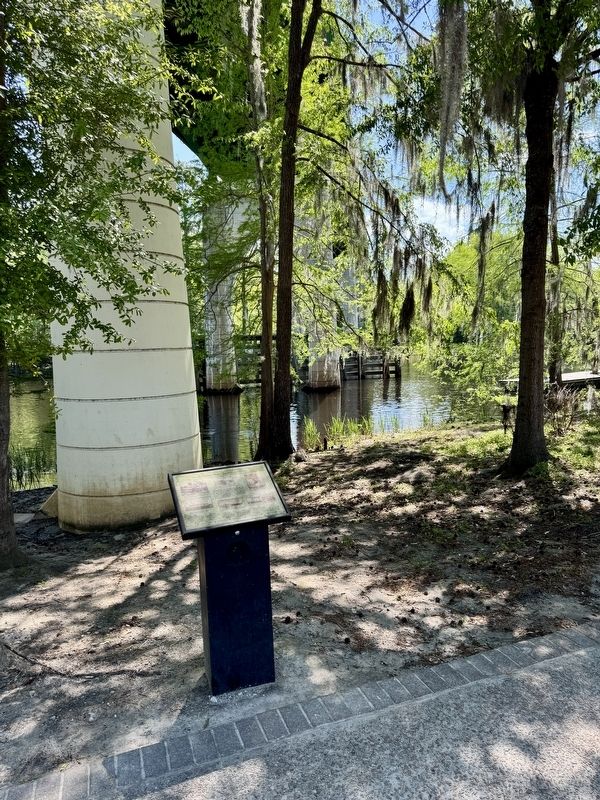
Location. 33° 49.969′ N, 79° 2.663′ W. Marker is in Conway, South Carolina, in Horry County. It is on Laurel Street 0.2 miles east of 2nd Avenue, on the left when traveling east. The marker is located behind the Peanut Warehouse along the Conway Riverwalk. Touch for map. Marker is at or near this postal address: 150 Laurel Street, Conway SC 29526, United States of America. Touch for directions.

Regionally, this marker is in South Carolina’s Pee Dee. It is also in the American South, specifically in the Deep South, and on the Eastern Seaboard. Globally, it is in the North Atlantic Region, North America, the Western Hemisphere, the Western World, and the Anglosphere. Historically, it finds itself in what was once the territory of the Mississippian Culture, one of the original Thirteen Colonies, one of the Confederate States of America, and the Antebellum South.
Other nearby markers. At least 8 other markers are within
Photographed by Brandon D Cross
2. The Steamboat Era on the Waccamaw River Marker
Another marker is no longer nearby. Kingston-Conway / Robert Conway (was approx. 0.2 miles away but has been confirmed missing).
Also see . . .
1. The last day of the S.S. Comanche. (Submitted on May 2, 2025, by Brandon D Cross of Flagler Beach, Florida.)
2. Conway Riverwalk. (Submitted on May 2, 2025, by Brandon D Cross of Flagler Beach, Florida.)
Credits. This page was last revised on May 2, 2025. It was originally submitted on May 2, 2025, by Brandon D Cross of Flagler Beach, Florida. This page has been viewed 280 times since then and 93 times this year. Photos: 1, 2. submitted on May 2, 2025, by Brandon D Cross of Flagler Beach, Florida. • Andrew Ruppenstein was the editor who published this page.
