Downers Grove in DuPage County, Illinois — The American Midwest (Great Lakes)
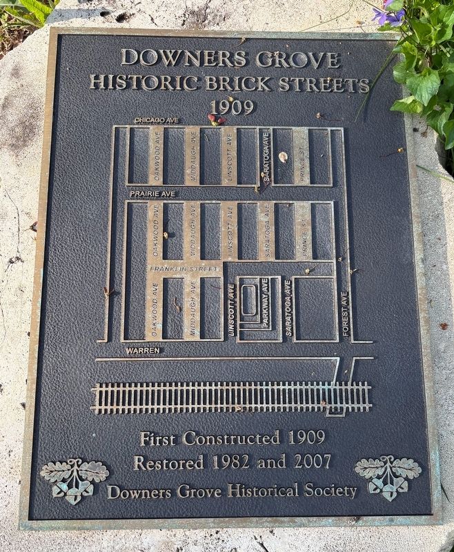
Downers Grove Historic Brick Streets
1909
Photographed by Sean P. Flynn, May 2, 2025
1. Downers Grove Historic Brick Streets Marker
First Constructed 1909
Restored 1982 and 2007
Erected 2007 by Downers Grove Historical Society.
Topics. This historical marker is listed in this topic list: Roads & Vehicles. A significant historical year for this entry is 1909.
Location. 41° 47.901′ N, 88° 0.948′ W. Marker is in Downers Grove, Illinois, in DuPage County. It is at the intersection of Franklin Street, on the right when traveling south on Franklin Street. The marker is on the south side of Franklin, close to its intersection with Linscott. Touch for map. Marker is at or near this postal address: Linscott Avenue, Downers Grove IL 60515, United States of America. Touch for directions.

Regionally, this marker is in Greater Chicago. It is also in the American Midwest. Globally, it is in North America, on the Great Lakes, in the Western Hemisphere, in the Western World, and in the Anglosphere. Historically, it finds itself in what was once the territory of the Mississippian Culture and also the Northwest Territory.
Other nearby markers. At
this page online
More about this marker. The marker includes a map of the brick-street area of Downers Grove, which includes about 12 blocks just north of the railroad tracks.
A separate marker erected in 1982 can be found across the street.
Also see . . . Downers Grove Historical Society: Historic Brick Streets.
Excerpt: "The brick streets were first laid in Downers Grove in the early 1900’s to replace dusty, dirt roads of the time. Main Street was the first(Submitted on May 3, 2025, by Sean P. Flynn of Oak Park, Illinois.)street bricked in 1906; Others followed later. In 1930’s, during the Great Depression, a crew of 71 men relaid all the brick streets as part of a WPA project. Today, the Village remains one of the few in the Chicago area that have retained and restored some of their brick streets."Photographed by Sean P. Flynn, May 2, 20252. Downers Grove Historic Brick Streets MarkerTwo historical markers about the brick streets are visible. The nearer was erected in 2007, while the one across the street is from about 1982.

Credits. This page was last revised on May 4, 2025. It was originally submitted on May 3, 2025, by Sean P. Flynn of Oak Park, Illinois. This page has been viewed 272 times since then and 71 times this year. Photos: 1, 2. submitted on May 3, 2025, by Sean P. Flynn of Oak Park, Illinois.
