Avalon in Cape May County, New Jersey — The American Northeast (Mid-Atlantic)
More than a Pile of Sand
Photographed by Pete Skillman, May 4, 2025
1. More than a Pile of Sand Marker
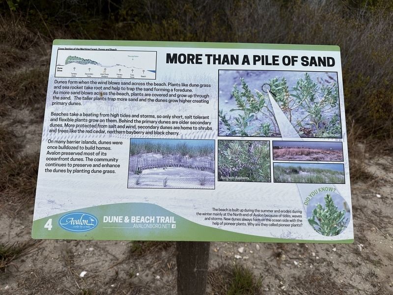
Beaches take a beating from high tides and storms, so only short, salt tolerant and flexible plants grow on them. Behind the primary dunes are older secondary dunes. More protected from salt and wind, secondary dunes are home to shrubs, and trees like the red cedar, northern bayberry and black cherry.
On many barrier islands, dunes were once bulldozed to build homes. Avalon preserved most of its oceanfront dunes. The community continues to preserve and enhance the dunes by planting dune grass.
The beach is built up during the summer and erodes during the winter mainly at the North end of Avalon because of tides, waves and storms. New dunes always form on the ocean side with the help of pioneer plants. Why are they called pioneer plants?
(Caption):
Cross section of the Maritime Forest, Dunes and Beach.
Erected by Avalon
this page online
Topics. This historical marker is listed in this topic list: Environment.
Location. 39° 4.965′ N, 74° 43.828′ W. Marker is in Avalon, New Jersey, in Cape May County. It can be reached from Dune Drive. Touch for map. Marker is at or near this postal address: 4818 Dune Dr, Avalon NJ 08202, United States of America. Touch for directions.

Regionally, this marker is on New Jersey’s Jersey Shore. It is also in the American Northeast, in the Mid-Atlantic, and on the Eastern Seaboard. Globally, it is in the North Atlantic Region, North America, the Western Hemisphere, the Western World, and the Anglosphere. Historically, it finds itself in what was once New Netherland and also one of the original Thirteen Colonies.
Other nearby markers. At least 8 other markers are within one mile of this marker, measured as the crow flies: Why All the Stumps? (about 500 feet away, measured in a direct line); The Disappearing Forest (about 600 feet away); Welcome to the Avalon Dune and Beach Trail (about 800 feet away); a different marker also named Welcome to the Avalon Dune and Beach Trail
Photographed by Pete Skillman, May 4, 2025
2. More than a Pile of Sand Marker - wide view
More about this marker. While this marker is primarily about nature, it qualifies as history because it discusses the effect of human development in bulldozing dunes to make way for houses.
Also see . . . Avalon Dune and Beach Trail Website. (Submitted on May 4, 2025, by Pete Skillman of Wilmington, Delaware.)
Credits. This page was last revised on May 4, 2025. It was originally submitted on May 4, 2025, by Pete Skillman of Wilmington, Delaware. This page has been viewed 92 times since then and 18 times this year. Photos: 1, 2. submitted on May 4, 2025, by Pete Skillman of Wilmington, Delaware.
