Richards Landing in Algoma District, Ontario — Central Canada (North America)
Sailor's Encampment
Photographed by Cosmos Mariner, June 10, 2024
1. Sailor's Encampment Marker
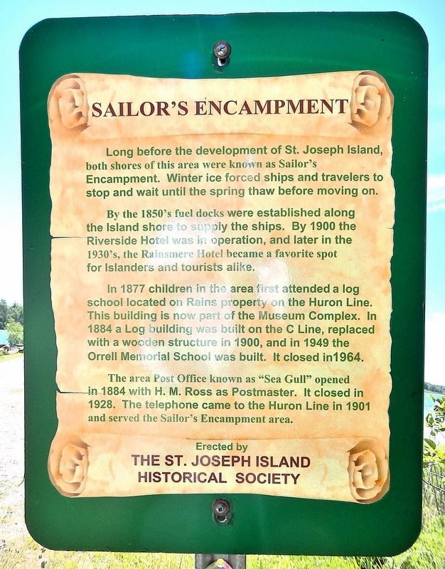
Long before the development of St. Joseph Island, both shores of this area were known as Sailor's Encampment. Winter ice forced ships and travelers to stop and wait until the spring thaw before moving on.
By the 1850's fuel docks were established along the Island shore to supply the ships. By 1900 the Riverside Hotel was in operation, and later in the 1930's, the Rainsmere Hotel became a favorite spot for Islanders and tourists alike.
In 1877 children in the area first attended a log school located on Rains property on the Huron Line. This building is now part of the Museum Complex. In 1884 a log building was built on the C Line, replaced with a wooden structure in 1900, and in 1949 the Orrell Memorial School was built. It closed in 1964.
The area Post Office known as “Sea Gull” opened in 1884 with H. M. Ross as Postmaster. It closed in 1928. The telephone came to the Huron Line in 1901 and served the Sailor's Encampment area.
Erected by St. Joseph Island Historical Society.
Topics. This historical marker is listed in these topic lists: Communications • Industry & Commerce • Settlements & Settlers
this page online
Location. 46° 15.883′ N, 84° 6.136′ W. Marker is in Richards Landing, Ontario, in Algoma District. It can be reached from the intersection of C Line Road (Provincial Highway 548) and Sailors Encampment Drive. The marker is located at the St. Mary's River wharf at the west end of C Line Road. Touch for map. Marker is in this post office area: Richards Landing ON P0R 1J0, Canada. Touch for directions.

Regionally, this marker is in the Sault Ste. Marie and Algoma Area and in Northern Ontario. It is also in Central Canada. Globally, it is in North America, in the Great North Woods, on the Great Lakes, on Lake Superior’s North Shore, in the Western Hemisphere, in the Western World, and in the Anglosphere. Historically, it finds itself in what was once a British colony, the Viceroyalty of New France, the Haudenosaunee (Iroquois) Confederacy, and Rupert’s Land.
Other nearby markers. At least 8 other markers are within 26 kilometers of this marker, measured as the crow flies: Site of John Richards' Homestead (approx. 6 kilometers away); St. Joseph World War Memorial
Photographed by Cosmos Mariner, June 10, 2024
2. Sailor's Encampment Marker
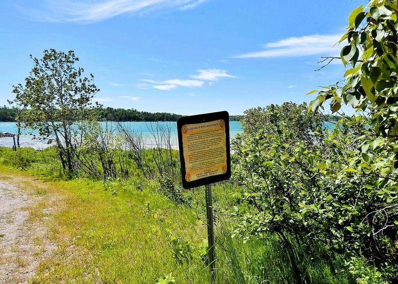
Looking southwest across the St. Mary’s River channel toward Rains Island, Barbeau, Michigan, USA.
Also see . . .
1. St. Joseph Island History.
Excerpt: One of the most prominent settlers at this site was John Marks. He came from Bruce Mines to establish a dock at the Sailors Encampment. In 1872, Marks decided to move again. In the area that was to become Hilton Beach, he opened a store and operated a wood dock. Six years later he opened the first post office under the name of Marksville, with himself as postmaster. In the year previous to that, 1877, a school had been established, and in 1881, St. John’s Anglican Church was erected.(Submitted on May 6, 2025, by Cosmos Mariner of Cape Canaveral, Florida.)
2. Sailors Encampment (facebook).
Excerpt: Sailors’ Encampment on St. Joseph Island is one of the narrowest points of the Great Lakes shipping system making it an outstanding spot for ship viewing.(Submitted on May 6, 2025, by Cosmos Mariner of Cape Canaveral, Florida.)
Credits. This page was last revised on May 6, 2025. It was originally submitted on May 5, 2025, by Cosmos Mariner of Cape Canaveral, Florida. This page has been viewed 674 times since then and 213 times this year. Photos: 1, 2. submitted on May 6, 2025, by Cosmos Mariner of Cape Canaveral, Florida.
