
Near McConnells in York County, South Carolina — The American South (South Atlantic)
Slave Cabin
Photographed by Mark Parker, May 3, 2025
1. Slave Cabin Marker
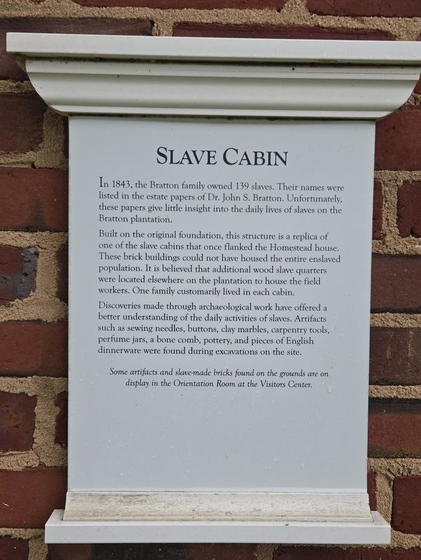
In 1843, the Bratton family owned 139 slaves. Their names were listed in the estate papers of Dr. John S. Bratton. Unfortunately, these papers give little insight into the daily lives of slaves on the Bratton plantation.
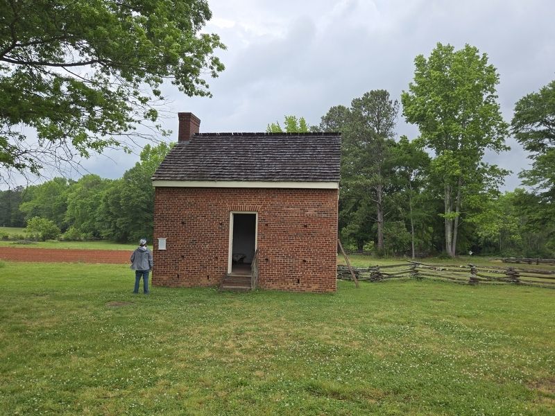
Built on the original foundation, this structure is a replica of one of the slave cabins that once flanked the Homestead house. These brick buildings could not have housed the entire enslaved population. It is believed that additional wood slave quarters were located elsewhere on the plantation to house the field workers. One family customarily lived in each cabin.
Discoveries made through archaeological work have offered a better understanding of the daily activities of slaves. Artifacts such as sewing needles, buttons, clay marbles, carpentry tools, perfume jars, a bone comb, pottery, and pieces of English dinnerware were found during excavations on the site.
Some artifacts and slave-made bricks found on the grounds are on display in the Orientation Room at the Visitors Center.
Topics. This historical marker is listed in these topic lists: African Americans • Agriculture • Settlements & Settlers. A significant historical year for this entry is 1843.
Location. 34° 51.922′ N,
this page online

Regionally, this marker is in the Midlands and in the Olde English District. It is also in the American South and specifically in the Deep South. Globally, it is in North America, the Western Hemisphere, the Western World, and the Anglosphere. Historically, it finds itself in what was once the original Cherokee Nation, the territory of the Mississippian Culture, one of the original Thirteen Colonies, one of the Confederate States of America, and the Antebellum South.
Other nearby markers. At least 8 other markers are within walking distance of this marker: Brick Kitchen (within shouting distance of this marker); William Bratton Plantation / Battle of Huck's Defeat
Photographed by Mark Parker, May 3, 2025
2. Slave Cabin. Marker is at the far left of the building.
Other markers no longer nearby. Brick Kitchen (was within shouting distance of this marker but has been replaced with another marker now near it); The Homestead (was within shouting distance of this marker but has been replaced with another marker now near it); a different marker also named The Battle of Huck’s Defeat (was within shouting distance of this marker but has been replaced with another marker now near it).
More about this marker. The Slave Cabin is part of Historic Brattonsville State Site.
Photographed by Mark Parker, May 3, 2025
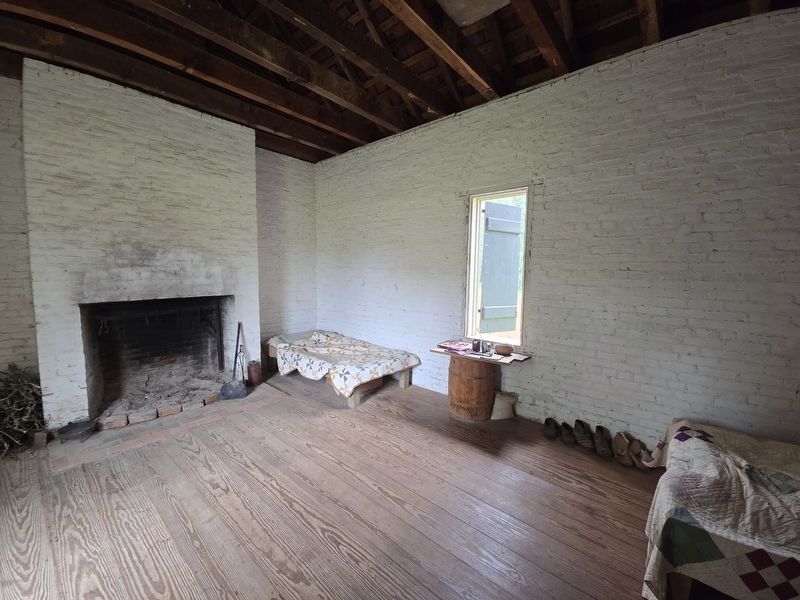
3. Slave Cabin interior
Photographed by Mark Parker, May 3, 2025
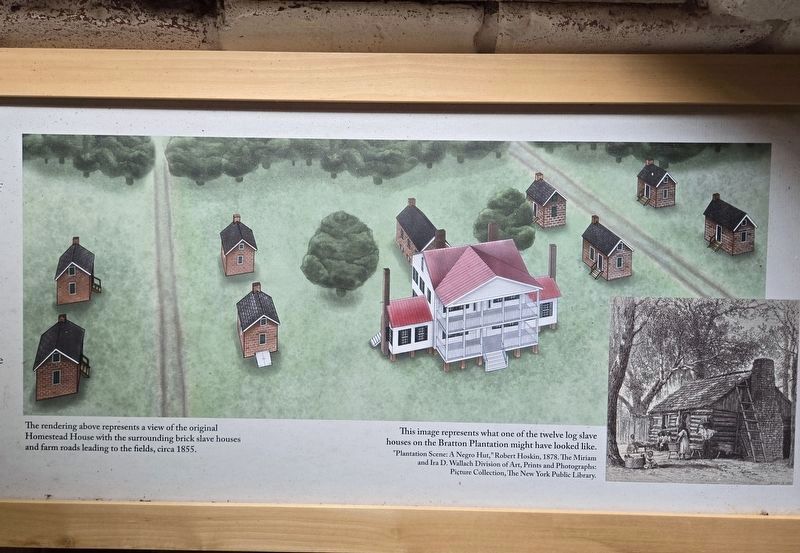
4. Layout of slave cabins surrounding The Homestead
This display is inside another cabin on the Brattonsville site
(Captions)
The rendering above represents a view of the originalbHomestead House with the surrounding brick slave houses and farm roads leading to the fields, circa 1855.
This image represents what one of the twelve log slave houses on the Bratton Plantation might have looked like. ("Plantation Scene: A Negro Hut,"' Robert Hoskin, 1878. The Miriam and Ira D. Wallach Division of Art, Prints and Photographs: Picture Collection, Ihe New York Public Library.)
(Captions)
The rendering above represents a view of the originalbHomestead House with the surrounding brick slave houses and farm roads leading to the fields, circa 1855.
This image represents what one of the twelve log slave houses on the Bratton Plantation might have looked like. ("Plantation Scene: A Negro Hut,"' Robert Hoskin, 1878. The Miriam and Ira D. Wallach Division of Art, Prints and Photographs: Picture Collection, Ihe New York Public Library.)
Photographed by Mark Parker, May 3, 2025
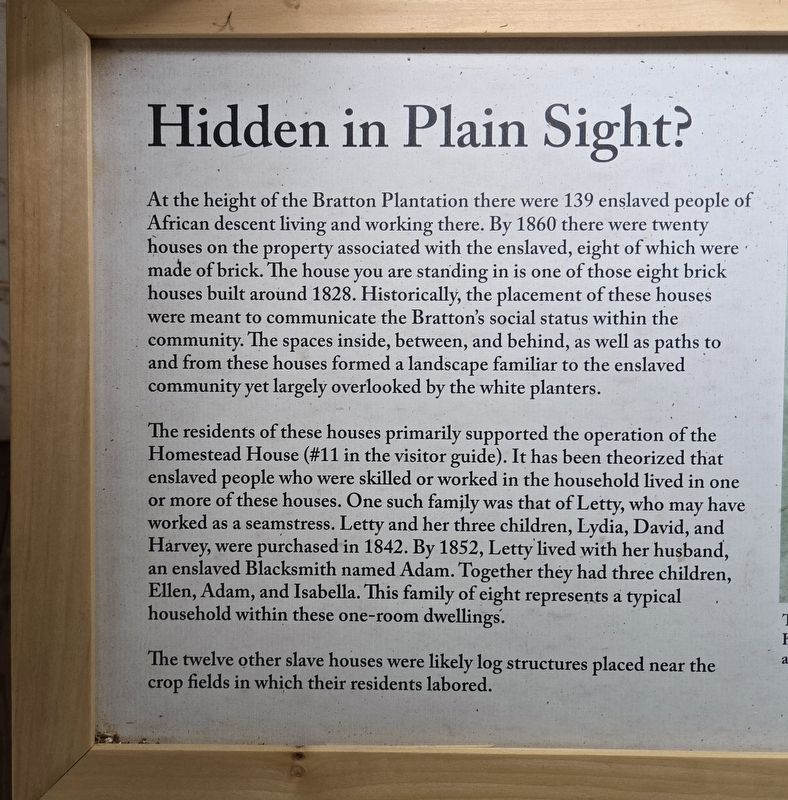
5. Hidden in Plain Sight?
Part of a display about slave life inside another cabin on the Brattonsville site
At the height of the Bratton Plantation there were 139 enslaved people of African descent living and working there. By 1860 there were twenty houses on the property associated with the enslaved, eight of which were made of brick. The house you are standing in is one of those eight brick houses built around 1828. Historically, the placement of these houses were meant to communicate the Bratton's social status within the community. The spaces inside, between, and behind, as well as paths to and from these houses formed a landscape familiar to the enslaved community yet largely overlooked by the white planters.
The residents of these houses primarily supported the operation of the Homestead House (#11 in the visitor guide). It has been theorized that enslaved people who were skilled or worked in the household lived in one or more of these houses. One such family was that of Letty, who may have worked as a seamstress. Letty and her three children, Lydia, David, and Harvey, were purchased in 1842. By 1852, Letty lived with her husband, an enslaved Blacksmith named Adam. Together they had three children, Ellen, Adam, and Isabella. This family of eight represents a typical household within these one-room dwellings.
The twelve other slave houses were likely log structures placed near the crop fields in which their residents labored.
At the height of the Bratton Plantation there were 139 enslaved people of African descent living and working there. By 1860 there were twenty houses on the property associated with the enslaved, eight of which were made of brick. The house you are standing in is one of those eight brick houses built around 1828. Historically, the placement of these houses were meant to communicate the Bratton's social status within the community. The spaces inside, between, and behind, as well as paths to and from these houses formed a landscape familiar to the enslaved community yet largely overlooked by the white planters.
The residents of these houses primarily supported the operation of the Homestead House (#11 in the visitor guide). It has been theorized that enslaved people who were skilled or worked in the household lived in one or more of these houses. One such family was that of Letty, who may have worked as a seamstress. Letty and her three children, Lydia, David, and Harvey, were purchased in 1842. By 1852, Letty lived with her husband, an enslaved Blacksmith named Adam. Together they had three children, Ellen, Adam, and Isabella. This family of eight represents a typical household within these one-room dwellings.
The twelve other slave houses were likely log structures placed near the crop fields in which their residents labored.
Credits. This page was last revised on May 7, 2025. It was originally submitted on May 5, 2025, by Mark Parker of Hickory, North Carolina. This page has been viewed 210 times since then and 33 times this year. Photos: 1, 2, 3, 4, 5. submitted on May 5, 2025, by Mark Parker of Hickory, North Carolina. • Devry Becker Jones was the editor who published this page.
