Fort Howard in Edgemere in Baltimore County, Maryland — The American Northeast (Mid-Atlantic)
Battery Key
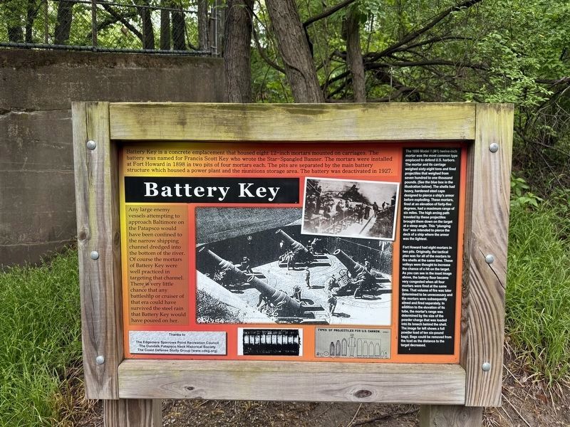
Battery Key is a concrete emplacement that housed eight 12-inch mortars mounted on carriages. The battery was named for Francis Scott Key who wrote the Star-Spangled Banner. The mortars were installed at Fort Howard in 1898 in two pits of four mortars each. The pits are separated by the main battery structure which housed a power plant and the munitions storage area. The battery was deactivated in 1927.
Any large enemy vessels attempting to approach Baltimore on the Patapsco would have been confined to the narrow shipping channel dredged into the bottom of the river. Of course the mortars of Battery Key were well practiced in targeting that channel. There is very little chance that any battleship or cruiser of that era could have survived the steel rain that Battery Key would have poured on her.
The 1890 Model 1 (M1) twelve-inch mortar was the most common type emplaced to defend U.S. harbors. The mortar and its carriage weighed sixty-eight tons and fired projectiles that weighed from seven hundred to one thousand pounds. (See the blue box in the illustration below). The shells had heavy, hardened steel caps designed to pierce a ship's armor before exploding. These mortars fired at an elevation of forty-five degrees, had a maximum range of six miles. The high arcing path traveled by these projectiles brought them down on the target at a steep angle. This "plunging fire" was intended to pierce the deck of a ship where the armor was the lightest.
Fort Howard had eight mortars in two pits. Originally, the tactical plan was for all of the mortars to fire shells at the same time. These volleys were thought to increase the chance of a hit on the target. As you can see in the inset image above, the battery floor became very congested when all four mortars were fired at the same time. That volume of fire was later determined to be unnecessary and the mortars were subsequently aimed and fired separately. In addition to the elevation of its tube, the mortar's range was determined by the size of the powder charge that was loaded into its breech behind the shell. The image far left shows a full powder load of ten six-pound bags. Bags could be removed from the load as the distance to the target decreased.
Erected by The
this page online
Topics. This historical marker is listed in these topic lists: Forts and Castles • Military • Waterways & Vessels. A significant historical year for this entry is 1898.
Location. 39° 11.873′ N, 76° 26.532′ W. Marker is in Edgemere, Maryland, in Baltimore County. It is in Fort Howard. It can be reached from the intersection of Patsco Street and Key Street, on the left when traveling east. Touch for map. Marker is at or near this postal address: 9500 North Point Rd, Fort Howard MD 21052, United States of America. Touch for directions.

Regionally, this marker is in the Baltimore Metro Region and in Central Maryland. It is also in the American Mid-Atlantic, in the Chesapeake Bay Region, and on the Eastern Seaboard. Globally, it is in the North Atlantic Region, North America, the Western Hemisphere, the Western World, and the Anglosphere. Historically, it finds itself in what was once one of the original Thirteen Colonies and also the Antebellum South.
Other nearby markers. At least 8 other markers
Photographed by Devry Becker Jones (CC0), May 4, 2025
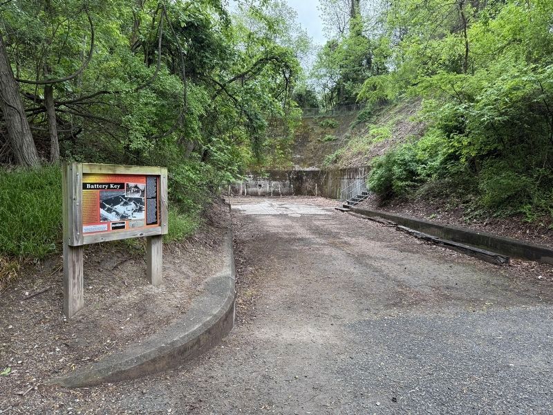
2. Battery Key Marker in front of the remnants
Another marker is no longer nearby. Fort Howard (was about 300 feet away, measured in a direct line but has been replaced with another marker now near it).
Photographed by Evan Dwyer, March 7, 2026
3. Battery Key
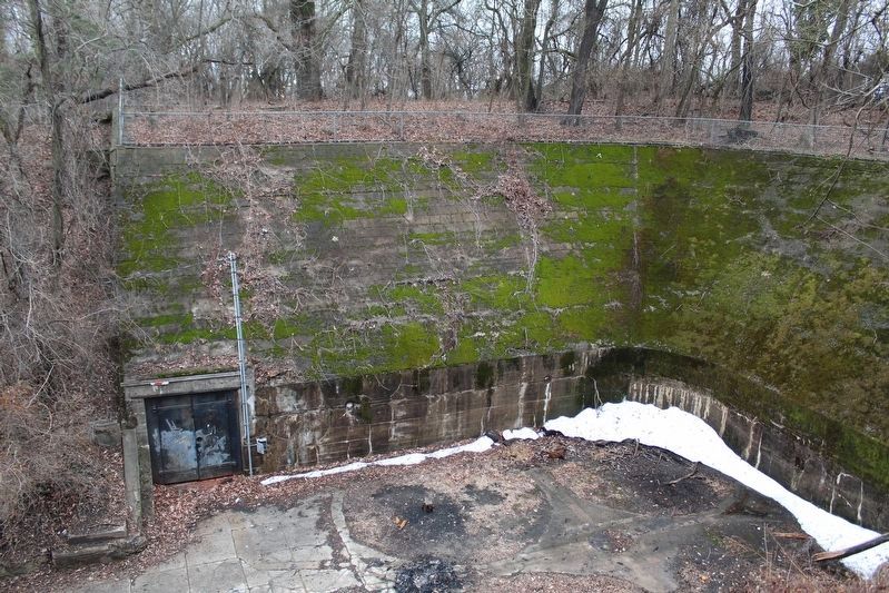
West Gun Pit. The circular foundations for the four mortars are evident on the concrete floor of the battery. The mortars delivered indirect fire at high arcs so would fire over the concrete walls towards the water. There are two gun pits like this.
Credits. This page was last revised on March 18, 2026. It was originally submitted on May 5, 2025, by Devry Becker Jones of Washington, District of Columbia. This page has been viewed 110 times since then and 27 times this year. Photos: 1, 2. submitted on May 5, 2025, by Devry Becker Jones of Washington, District of Columbia. 3. submitted on March 8, 2026, by Evan Dwyer of Richmond, Virginia.
