
Fort Howard in Edgemere in Baltimore County, Maryland — The American Northeast (Mid-Atlantic)
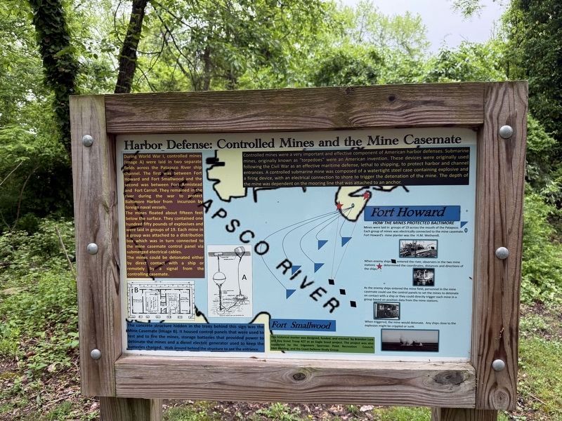
Harbor Defense: Controlled Mines and the Mine Casemate
Photographed by Devry Becker Jones (CC0), May 4, 2025
1. Harbor Defense: Controlled Mines and the Mine Casemate Marker
During World War I, controlled mines (Image A) were laid in two separate fields across the Patapsco River ship channel. The first was between Fort Howard and Fort Smallwood and the second was between Fort Armistead and Fort Carroll. They remained in the river during the war to protect Baltimore Harbor from incursion by foreign naval vessels.
The mines floated about fifteen feet below the surface. They contained one hundred fifty pounds of explosives and were laid in groups of 19. Each mine in a group was attached to a distribution box which was in turn connected to the mine casemate control panel via submerged electrical cables.
The mines could be detonated either by direct contact with a ship or remotely by a signal from the controlling casemate.
Controlled mines were a very important and effective component of American harbor defenses. Submarine mines, originally known as "torpedoes" were an American invention. These devices were originally used following the Civil War as an effective maritime defense, lethal to shipping, to protect harbor and channel entrances. A controlled submarine mine was composed of a
this page online
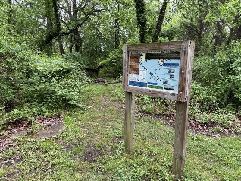
The concrete structure hidden in the trees behind this sign was the Mine Casemate (Image B). It housed control panels that were used to test and to fire the mines, storage batteries that provided power to detonate the mines and a diesel electric generator used to keep the batteries charged. Walk around behind the structure to see the entrance.
When enemy ships ◆ entered the river, observers in the two mine stations ★ determined the coordinates, distances and directions of the ships.
As the enemy ships entered the mine field, personnel in the mine casemate could use the control panels to set the mines to detonate on contact with a ship or they could directly trigger each mine in a group based on position data from the mine in a group based on position data from the mine stations.
When triggered, the mine would detonate. Any ships close to the explosion might be crippled or sunk.
Erected by Brandon
Photographed by Devry Becker Jones (CC0), May 4, 2025
2. Harbor Defense: Controlled Mines and the Mine Casemate Marker
Topics. This historical marker is listed in these topic lists: Forts and Castles • Military • Waterways & Vessels.
Location. 39° 11.883′ N, 76° 26.516′ W. Marker is in Edgemere, Maryland, in Baltimore County. It is in Fort Howard. It can be reached from Patsco Street east of Key Street, on the left when traveling east. Touch for map. Marker is at or near this postal address: 9500 North Point Rd, Fort Howard MD 21052, United States of America. Touch for directions.

Regionally, this marker is in Central Maryland. It is also in the American Mid-Atlantic, in the Chesapeake Bay Region, and on the Eastern Seaboard. Globally, it is in the North Atlantic Region, North America, the Western Hemisphere, the Western World, and the Anglosphere. Historically, it finds itself in what was once one of the original Thirteen Colonies and also the Antebellum South.
Other nearby markers. At least 8 other markers

Photographed by Evan Dwyer, March 7, 2026
3. Mine Casemate
The front of the mine casemate. The marker is around the corner to the left, by the main trail.
Another marker is no longer nearby. Fort Howard (was about 300 feet away but has been replaced with another marker now near it).

Photographed by Evan Dwyer, March 7, 2026
4. Mine Casemate
View from the marker, looking left if facing the text. The concrete is the casemate. Originally the earthen berm should have totally covered this angle so it would have appeared as a hill from this vantage point.

Photographed by Evan Dwyer, March 7, 2026
5. Mine Control Tower
One of the two observation stations used to monitor the mines and report on approaching ships to the mine casemate. This tower is on the grounds of the defunct VA hospital and is not accessible. This is a recreational drone view.
Credits. This page was last revised on March 20, 2026. It was originally submitted on May 5, 2025, by Devry Becker Jones of Washington, District of Columbia. This page has been viewed 162 times since then and 33 times this year. Photos: 1, 2. submitted on May 5, 2025, by Devry Becker Jones of Washington, District of Columbia. 3, 4, 5. submitted on March 8, 2026, by Evan Dwyer of Richmond, Virginia.
